 Old Cumbria Gazetteer
 |
 |
|
| Whitehaven Harbour, Whitehaven | ||
| Whitehaven Harbour | ||
| locality:- | Whitehaven | |
| civil parish:- | Whitehaven (formerly Cumberland) | |
| county:- | Cumbria | |
| locality type:- | harbour | |
| locality type:- | fishing boats | |
| locality type:- | fishing | |
| coordinates:- | NX97131841 (etc) | |
| 1Km square:- | NX9718 | |
| 10Km square:- | NX91 | |
|
|
||
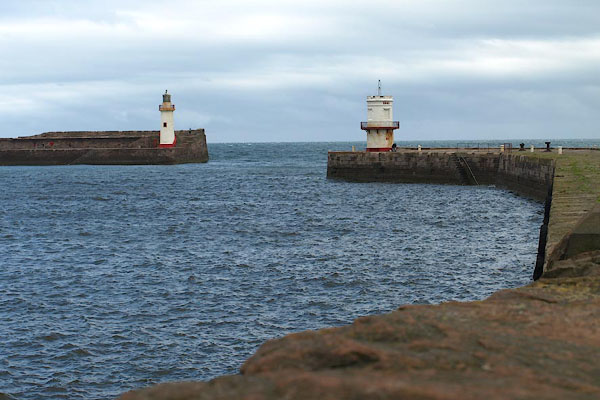 BPM03.jpg Harbour entrance (taken 15.7.2008) 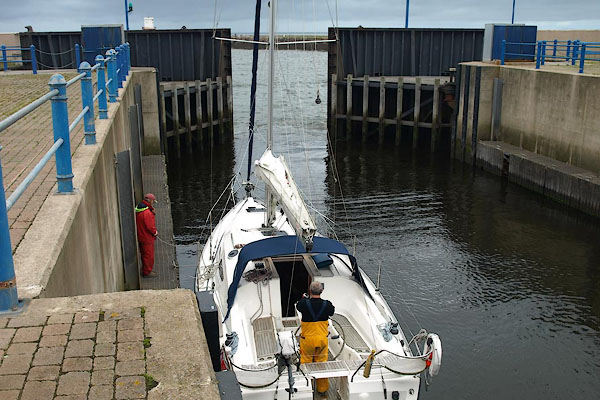 BPM07.jpg Sea lock, outer gate. (taken 15.7.2008) |
||
|
|
||
| evidence:- | old map:- OS County Series (Cmd 67 2) |
|
| source data:- | Maps, County Series maps of Great Britain, scales 6 and 25
inches to 1 mile, published by the Ordnance Survey, Southampton,
Hampshire, from about 1863 to 1948.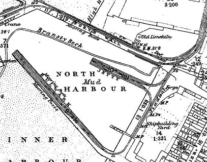 click to enlarge click to enlargeCSRY0067.jpg railways in North Harbour |
|
|
|
||
| evidence:- | descriptive text:- Collins 1693 (edn 1753) placename:- White Haven item:- coal |
|
| source data:- | Chart, of the Irish Sea, including the coast of Cumbria -
Lancashire and Cumberland, scale about 6.5 miles to 1 inch, by
Captain Greenvile Collins, published 1693; published up to 1753
at least. The text accompanying the chart, page 8 of the 1753 edn:- "White Haven / A little to the northward of St. Bees Head lieth White Haven, being a good dry Pier, where great Ships take in Sea-Coals, and carry them to Dublin in Ireland. This place belongeth to Sir John Lowther. / ..." |
|
|
|
||
| evidence:- | old map:- Bowen and Kitchin 1760 |
|
| source data:- | Map, hand coloured engraving, A New Map of the Counties of
Cumberland and Westmoreland Divided into their Respective Wards,
scale about 4 miles to 1 inch, by Emanuel Bowen and Thomas
Kitchin et al, published by T Bowles, Robert Sayer, and John
Bowles, London, 1760.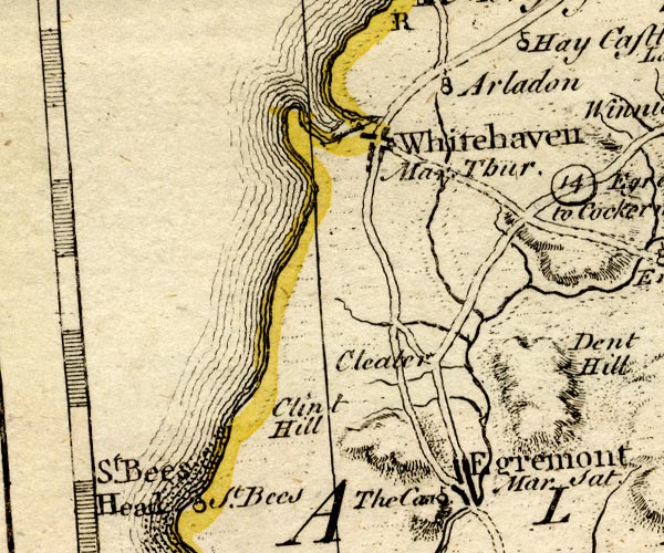 BO18NX91.jpg recognizable bay item:- Armitt Library : 2008.14.10 Image © see bottom of page |
|
|
|
||
| evidence:- | old text:- Gents Mag |
|
| source data:- | Magazine, The Gentleman's Magazine or Monthly Intelligencer or
Historical Chronicle, published by Edward Cave under the
pseudonym Sylvanus Urban, and by other publishers, London,
monthly from 1731 to 1922. goto source goto sourceGentleman's Magazine 1761 p.138 The Historical Chronicle for March 1761, Thursday 19 has the royal assent given to the bill for:- "..." "For enlarging the harbour of Whitehaven." |
|
|
|
||
| evidence:- | old map:- Donald 1774 (Cmd) |
|
| source data:- | Map, hand coloured engraving, 3x2 sheets, The County of Cumberland, scale about 1
inch to 1 mile, by Thomas Donald, engraved and published by Joseph Hodskinson, 29
Arundel Street, Strand, London, 1774.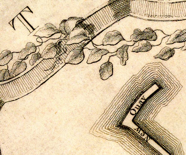 D49618S.jpg 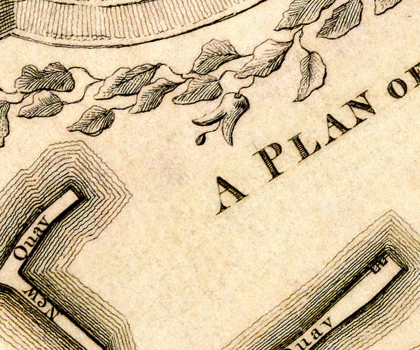 D49618X.jpg 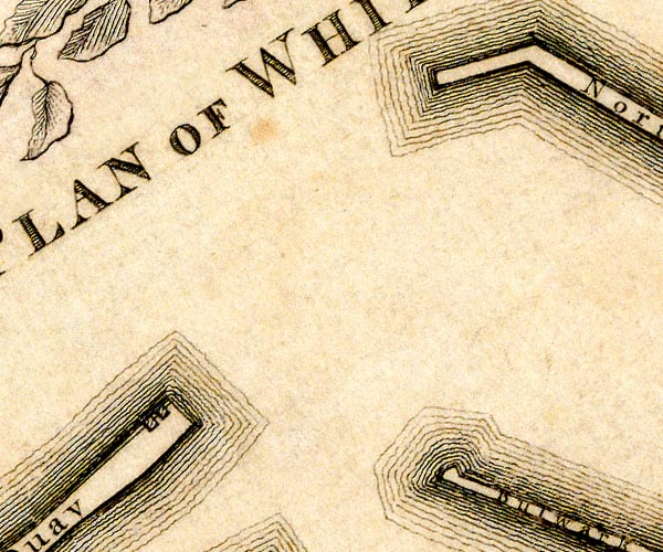 D49718C.jpg 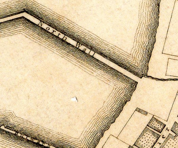 D49718H.jpg 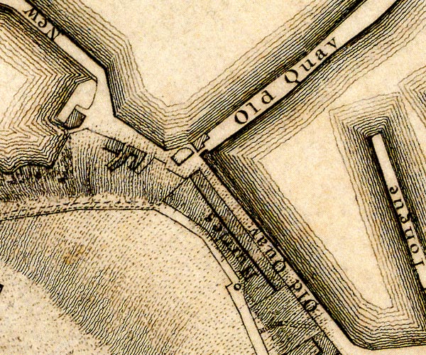 D49618W.jpg 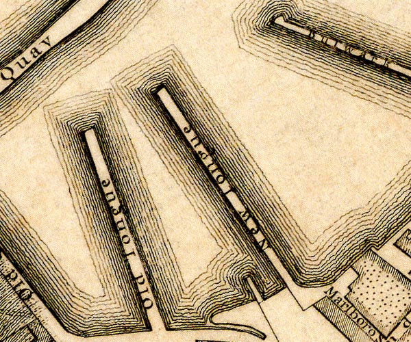 D49718B.jpg  D49718G.jpg harbour protected by quays item:- Carlisle Library : Map 2 Images © Carlisle Library |
|
|
|
||
| evidence:- | old map:- Donald 1774 (Cmd) |
|
| source data:- | Map, hand coloured engraving, 3x2 sheets, The County of Cumberland, scale about 1
inch to 1 mile, by Thomas Donald, engraved and published by Joseph Hodskinson, 29
Arundel Street, Strand, London, 1774. D4NX91NE.jpg several harbour moles item:- Carlisle Library : Map 2 Image © Carlisle Library |
|
|
|
||
| evidence:- | old text:- Mackenzie 1776 placename:- Whitehaven Harbour item:- harbour light |
|
| source data:- | Charts, and sailing directions, Nautical Descriptions of the
West Coast of Great Britain, Bristol Channel to Cape Wrath, by
Murdoch Mackenzie, published London, 1776. goto source Pages 23-24:- "... ..." "HARBOURS. / WHITEHAVEN Harbour." "On the English side of Solway Firth. / Whitehaven is a dry Harbour, divided into several basons, by strong kays that break off the sea, and shelter vessels within them: that within the second kay as you enter, is the best for large vessels that draw above ten feet water. In this bason there are seventeen or eighteen feet at high-water with spring-tide, and nine or ten at high-water with neap-tide. There is a light kept on St. Bee's Head to shew vessels into Solway Firth at night: and when there are eight feet of water in the Harbour of Whitehaven, colours are hoisted in the day on one of the pier-ends, and a lanthorn light at night." "High-water at eleven. / In this Harbour it is high-water on full and change days at eleven hours." "Rise of the Tide. / Spring-tide off the Harbour rises twenty feet perpendicular; neap-tide ten." |
|
|
|
||
| evidence:- | old text:- Capper 1808 item:- Corfe Rocks; shipping; storm |
|
| source data:- | Gazetteer, A Topographical Dictionary of the United Kingdom,
compiled by Benjamin Pitts Capper, published by Richard
Phillips, Bridge Street, Blackfriars, London, 1808; published
1808-29. goto source "[Workington] ..." "WHITEHAVEN, a sea port and market town ... owes its present thriving situation, to the improvements in its harbour, during the reign of queen Anne, when several strong and substantial moles and bulwarks were erected, which completely secured vessels from the Corfe rocks. ... On the old quay is erected a light house; and the entrance of the harbour is defended by a fort and half moon battery. This port has a Custom-house, with regular officers attached to it, and in the coal trade is reckoned the most eminent in England, next to Newcastle. In March 1793, this town suffered by a storm, when the tide rose 6 feet above its usual height. ..." |
|
|
|
||
| evidence:- | descriptive text:- Ford 1839 (3rd edn 1843) item:- coal |
|
| source data:- | Guide book, A Description of Scenery in the Lake District, by
Rev William Ford, published by Charles Thurnam, Carlisle, by W
Edwards, 12 Ave Maria Lane, Charles Tilt, Fleet Street, William
Smith, 113 Fleet Street, London, by Currie and Bowman,
Newcastle, by Bancks and Co, Manchester, by Oliver and Boyd,
Edinburgh, and by Sinclair, Dumfries, 1839. goto source Page 172:- "[Whitehaven] ... The harbour is large and safe, being protected by an extensive pier, built after a design by Sir John Rennie. Upwards of 140,000 chaldrons of coals are annually exported." |
|
|
|
||
| evidence:- | old map:- Walker 1842 |
|
| source data:- | Chart, Position of all the Lighthouses in the British Isles,
scale about 38 nautical miles to 1 inch, published by J and A
Walker, 72 South Castle Street, Liverpool, Lancashire, 1842. marked with a harbour light "Whitehaven - Two Lights - The Inner one steady, and shewn only whilst there is 9 feet water between the Pier-heads, the Outer one revolves, and is shewn throughout the night." |
|
|
|
||
| evidence:- | old text:- Admiralty 1933 placename:- item:- pilot, Whitehaven Harbour; navigation lights; coal; water; shipping; cranes; railways; fog signal |
|
| source data:- | goto source Page 387:- "..." "FIRTH OF SOLWAY. - ..." "Whitehaven, Workington, Maryport and Silloth, all on the English shore, are the chief trading ports in the firth." goto sourcePage 388:- "..." "Pilots. - There are Trinity House pilots for Whitehaven, Workington, and Maryport, the pilot cutter, which does not cruise, being stationed at Whitehaven; vessels requiring pilots for any of these places can obtain them off Whitehaven, or may proceed to a point off their destination." "The signal to be made during foggy weather by a vessel requiring a pilot is three long blasts; the reply is one long and two short blasts." |
|
|
|
||
| evidence:- | old text:- Admiralty 1933 |
|
| source data:- | goto source Page 389:- "..." "Anchorage. - Saltom bay affords a good anchorage with offshore winds. The depths of the approach to Whitehaven are regular," goto sourcePage 390:- "and anchorage may be taken up about 5 cables off, and abreast of the entrance, in depths of from 5 to 6 fathoms (9m1 to 11m0), sand." "..." "WHITEHAVEN. - Depths. - Whitehaven is an artificial, tidal harbour, 49 1/2 acres in extent, which affords excellent shelter, in all winds, to vessels that can lie aground; there is also a wet dock, named Queens dock, 4 3/4 acres in extent, in which vessels can lie afloat." "Outer harbour, with 2,000 feet (609m6) of quayage, is contained between West and North piers outside Old quay. It dries out to North Pier spit, a short distance northward of the entrance; within, it dries from 2 to 10 feet (0m6 to 3m0)." "Inner harbour, with 3,000m feet (914m4) of quayage, is contained within Old quay and Old North wall, a jetty which projects southward from North pier.It is divided into South harbour, contained within Old quay and Old Tongue; Custom House harbour, between Old Tongue and New Tongue; Inner harbour, between New Tongue and Bulwark pier; North harbour, contained within old North wall and the outer part of Bulwark pier; and Queens dock, with North harbour (Lat. 54~ 33' N., Long. 3~ 36' W.)." "There are depths of 20 feet (6m1) alongside the quays in Outer harbour at high water springs, and of 23 fee (7m0) in the dredged channel through it to Queens dock, though silting is liable to occur in the dredged channel after westerly or north-westerly gales. At high water springs, there are depths of 16 feet (4m9) alongside the quays in South harbour; of 15 feet (4m6) alongside those in Custom House harbour; of 13 feet (4m8) alongside those in Inner harbour; and of 18 feet (5m5) alongside those in North harbour." "Queens dock. - Queens dock is entered, from North harbour, through a gateway with depths of 22 feet (6m7) over the sill at high water springs; this gateway is 45 feet (13m7) wide at the top of the invert (i.e. 4 feet (1m2) above the lowest level of the sill) and 47 feet 10 inches (14m3) at the 20-foot (6m1) mark." "Depths of 14 feet (4m3) are normally maintained in the dock." "The gates are usually open from one hour before until one hour after high water; they are not opened when there are depths of less than 14 feet (4m3) over the sill." "The largest vessel that had entered the dock up to 1932 was one of 2,500 tons." "Lights. - Fog signals. - A light is exhibited, from 2 1/2 hours before until 1 1/2 hours after high water, at an elevation of 52 feet (15m8), from a white circular tower, 47 feet (14m3) in height, situated on the head of West pier. A fog signal is sounded from the lighthouse during the same period." "A light is exhibited, at an elevation of 28 feet (8m5), from a white circular tower, 20 feet (6m1) in height, situated on the head of North pier." "A light is exhibited, at an elevation of 25 feet (7m6), from a red mast, 18 feet (5m5) in height, situated on the head of Old quay." "A light is exhibited at an elevation of 25 feet (7m6), from a white post, 10 feet (3m0) in height, situated at the head of Old North wall (Lat. 54~ 33' N., Long. 3~ 35' W.)" "Signals. - A red flag is displayed from a flagstaff on the top" goto sourcePage 391:- "of a tower situated at the head of Old New quay (New quay), by day, or a red light is exhibited, at an elevation of 40 feet (12m2), from a white circular tower, 50 feet (15m2) in height, situated at the elbow of Old quay, at night, to denote the time of tidal attendance by officials, namely from 2 1/2 hours before until 1 1/2 hours after high water." "Two red flags displayed from a flagstaff on the top of the tower at the elbow of Old quay, by day, or two red lights, vertically disposed 7 feet (2m1) apart, exhibited from the same flagstaff, at night, signify that the harbour is blocked and that entrance is prohibited." "A red ball by day, or two red light, horizontally disposed, at night, are shown from the dredger when at work in Outer harbour, as a signal for vessels to keep clear and proceed with caution." "Pilotage. - Pilotage, and the use of the harbour boat, is compulsory for merchant vessels." "For information regarding pilots, see page 388." "Directions. - Caution. - A vessel may enter Whitehaven, even during a heavy gale, providing that there are sufficient depths. When entering, keep close to the West pierhead, as the flood stream sets eastward across the entrance, and, during westerly gales, a heavy sea is thrown across the entrance." "Port facilities. - There are coal mines, both northward and southward of the harbour, with direct rail services to the coal berths. Vessels can be loaded in Queens dock, by coal loader, at the rate of 300 tons an hour, or in North harbour at the rate of 100 tons an hour." "There is a gridiron, 112 feet (34m1) long and 22 1/2 feet (6m9) wide with depths of about 9 feet (2m7) over it at high water springs, situated on the western side on the Inner harbour, on which minor repairs can be effected." "The principal quays, which are connected to the mainline railway system and mines, are fitted with cranes capable of lifting from 2 to 10 tons, and are equipped with every requirement for the rapid working of cargoes." "Good water, which can be used in small tube boilers without filtering, is laid on to all the quays." "There are two sailors' homes and a port sanitary hospital." "Shipping. - Trade. - During 1932 the port was visited by 754 vessels with an aggregate tonnage of 101,020 tons." "Whitehaven is a parliamentary borough, and, in 1931, had a population of 13,112. Its chief trade consists in the export of coal, which is extensively worked in the immediate vicinity, coke, pig iron and all kinds of iron, leather and general goods. The chief imports are timber, grain, hides, cement, and general produce." "In the season, there is an extensive herring fishery." "Life-saving. A look-out is kept for life-saving purposes, and a rocket apparatus maintained." "Storm signals. - Storm signals are displayed at the watch tower on Old quay." |
|
|
|
||
 Act of Parliament Act of Parliament |
||
|
|
||
| evidence:- | old print:- |
|
| source data:- | Print, halftone photograph, The Harbour from Prospect Hill, Whitehaven, by Valentine
and Sons, published by Cumberland Motor Services, Tangier Street, Whitehaven, Cumberland,
about 1926. click to enlarge click to enlargeCS110.jpg On p.34 of Cumberland its Lakes and Mountains. lower right "WP" printed, bottom, left right "Valentine &Sons, Ltd. Photo. / The Harbour from Prospect Hill, WHITEHAVEN." item:- JandMN : 1022.10 Image © see bottom of page |
|
|
|
||
| old shipping directory |
||
|
|
||
| evidence:- | database:- Listed Buildings 2010 |
|
| source data:- | courtesy of English Heritage "NORTH WALL AND OLD NORTH WALL (ENCLOSING NORTH HARBOUR) / / / WHITEHAVEN / COPELAND / CUMBRIA / II / 75899 / NX9708018538" |
|
| source data:- | courtesy of English Heritage "C18 pier enclosing the inner harbour on the North, built of stone. Omit 1841 extension called North Pier." |
|
|
|
||
| evidence:- | old print:- Robertson 1911 |
|
| source data:- | Print, lithograph? Whitehaven Pier and St Bees Head, from Moresby, from a watercolour
by Arthur Tucker, published by Chatto and Windus, London, 1911.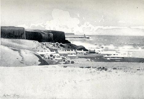 click to enlarge click to enlargeRSN111.jpg Tipped in opposite p.36 of Wordsworthshire by Eric Robertson. printed at bottom:- "WHITEHAVEN PIER AND ST. BEE'S HEAD, FROM MORESBY" signed at painting lower left:- "Arthur Tucker" item:- JandMN : 197.11 Image © see bottom of page |
|
|
|
||
| evidence:- | old painting:- placename:- South Harbour item:- boat; ship; fishing boat |
|
| source data:- | Painting, watercolour, The South Harbour, Whitehaven, Cumberland, by George Nelson
jnr, 1898.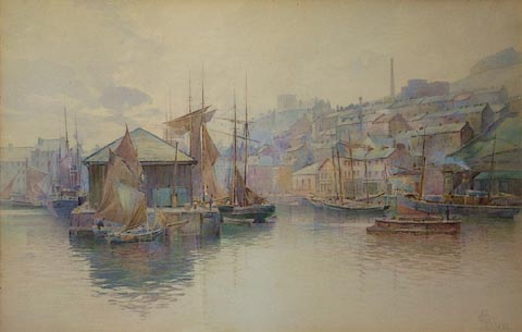 click to enlarge click to enlargePR0803.jpg Colourful view of Whitehaven harbour; ships and boats of varying sizes are moored in the calm waters beside the jetty or harbour walls. Beyond the harbour lies the town, rising up into the hillside. The tall chimney in the right of the composition is the site of William Pit. labelled at reverse, by Nelson:- "The South Harbour Whitehaven By G Nelson jnr" item:- Tullie House Museum : 1898.30 Image © Tullie House Museum |
|
|
|
||
| evidence:- | old print:- item:- lighthouse; ship |
|
| source data:- | Print, Whitehaven Harbour, Cumberland, by William Henry Bartlett, engraved by James
Charles Armytage, about 1840?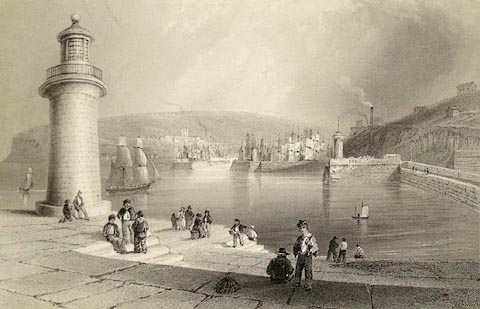 click to enlarge click to enlargePR1173.jpg View of Whitehaven harbour with the town across the water. Small groups of people stand or sit on the quayside to left of which stands a lighthouse. The sails of countless ships appear above the harbour wall. West Pier lighthouse in on the left, Old New Quay is on the far right and William Pit can be seen in the distance on the right. signed at bottom left on print:- "W.H. Bartlett." signed at bottom right on print:- "J.C. Armytage." item:- Tullie House Museum : 1976.169.2.1 Image © Tullie House Museum |
|
|
|
||
| evidence:- | old print:- |
|
| source data:- | Print, uncoloured engraving, Whitehaven, Cumberland, drawn by W H Bartlett, engraved
by J C Redaway, published 1840s.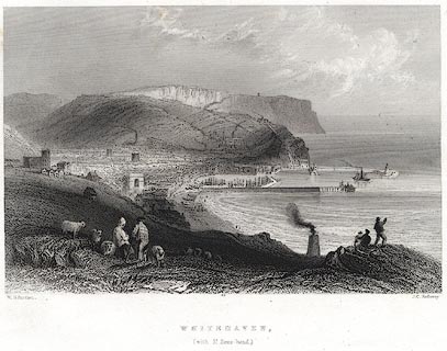 click to enlarge click to enlargePR0077.jpg Probably from Findens Views of the Ports, Harbours, Coast Scenery, and Watering Places of Great Britain, as continued by W H Bartlett. printed at bottom left, right, centre:- "W. H. Bartlett. / J. C. Redaway. / WHITEHAVEN, / (with St. Bees-head.)" item:- Dove Cottage : 2008.107.77 Image © see bottom of page |
|
|
|
||
| evidence:- | old print:- placename:- Whitehaven Harbour item:- lighthouse; sailing ship; ship; costume item:- sea |
|
| source data:- | Print, uncoloured engraving, Whitehaven Harbour, Whitehaven, Cumberland, drawn by
W H Bartlett, engraved by J C Arnytage, early 19th century?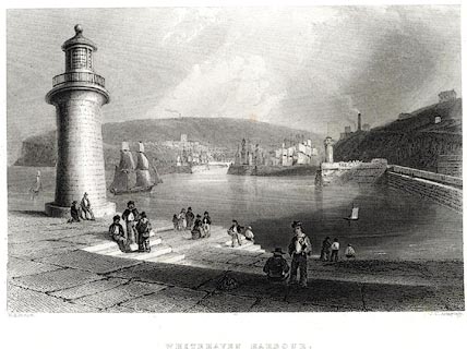 click to enlarge click to enlargePR0534.jpg printed at bottom left, right, centre:- "W. H. Bartlett. / J. C. Armytage. / WHITEHAVEN HARBOUR." item:- Dove Cottage : 2008.107.483 Image © see bottom of page |
|
|
|
||
| evidence:- | old painting:- item:- boat; ship; shipbuilding |
|
| source data:- | Painting, oil painting, Whitehaven Harbour, Cumberland, about 1794.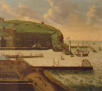 click to enlarge click to enlargePR0802.jpg Whitehaven harbour viewed from an elevated perspective with boatyard to left of composition, the harbour in the centre and a dock across the water. Jetties jut horizontally across composition. Above the houses of the town, which stand to left, horses graze in the fields on the steep hillside. The work is painted in a naive manner with discrepancies in scale and perspective. This view of Whitehaven harbour includes the Old Quay, lighthouse and boatyard. It is painted in a naive style. some of the features in the picture are the wrong scale and the perspective is not correct. item:- Tullie House Museum : 1897.29 Image © Tullie House Museum |
|
|
|
||
| evidence:- | old painting:- item:- ship; lighthouse; crane |
|
| source data:- | Painting, watercolour, Whitehaven Harbour, Cumberland, about 1780.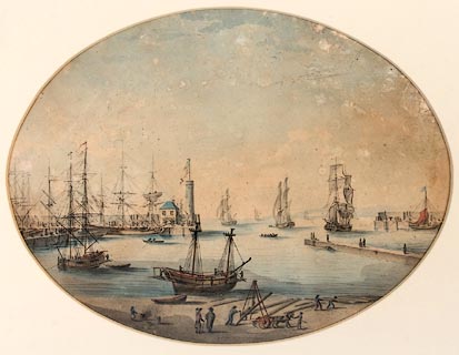 click to enlarge click to enlargePR1212.jpg View of Whitehaven harbour on a calm day, seen from a slightly elevated perspective. Tall ships are moored to left of composition with several others either leaving or entering the harbour in centre and to right. In the foreground timbers are being loaded with a small crane onto a cart and a man attends a smoking brazier. This is an early maritime picture of Whitehaven. It was probably painted by a visiting marine painter, attracted to this important port. Old New Quay an lighthouse are in the centre. The ships and activities in the harbour are painted in great detail. In the foreground timbers are being removed from a cart using a winch and a man attends a smoking brazier. item:- Tullie House Museum : 1978.108.69 Image © Tullie House Museum |
|
|
|
||
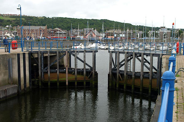 BPM06.jpg Sea lock, inner gate. (taken 15.7.2008) 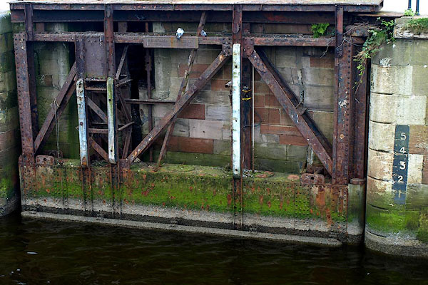 BPL95.jpg Lock gate to inner harbour? (taken 15.7.2008) 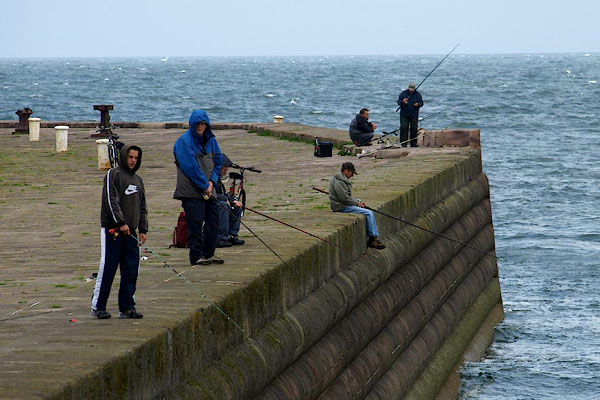 BPM04.jpg Fishing off the harbour wall. (taken 15.7.2008) 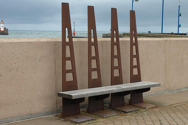 BPM08.jpg Seat. (taken 15.7.2008) |
||
|
|
||
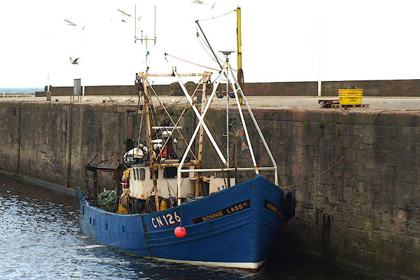 BPL96.jpg Fishing boat, Bonnie Lass. (taken 15.7.2008) 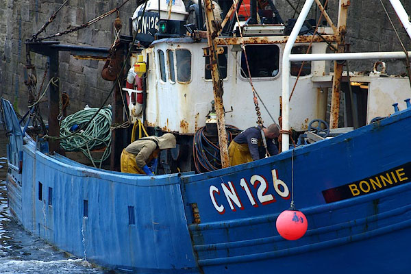 BPL97.jpg Fishing boat, Bonnie Lass. (taken 15.7.2008) 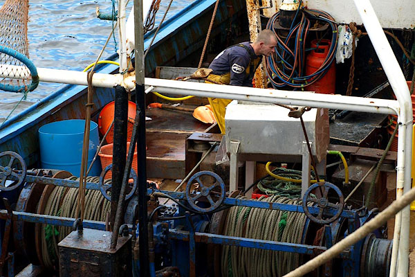 BPL98.jpg Fishing boat, Bonnie Lass. (taken 15.7.2008) 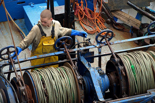 BPL99.jpg Fishing boat, Bonnie Lass. (taken 15.7.2008) 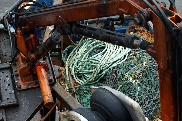 BPM01.jpg Fishing boat, Bonnie Lass. (taken 15.7.2008) 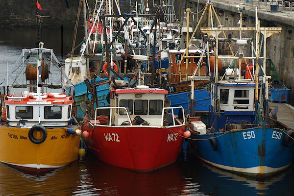 BPL94.jpg Fishing boats. (taken 15.7.2008) 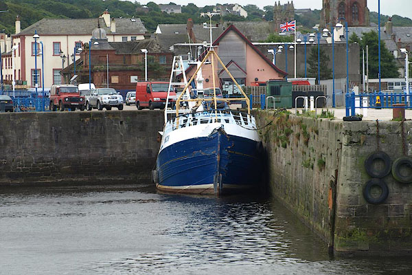 BPM05.jpg Fishing boat. (taken 15.7.2008) |
||
|
|
||
| hearsay:- |
The Old Quay was begun by Robert Storey, 1634. The lighthouse was built 1710. |
|
| In 1758 the harbour exported coal to Ireland. Daniel Defoe wrote that the port was:- |
||
| "the most eminent Port of England for shipping off coals, for they wholly supply the
City of Dublin, and all the Towns of Ireland on that coast." |
||
| The harbour imported tobacco from America for onward export to Europe. |
||
| The West Pier and North Pier were designed by James Rennie, 1823-33; Sir James Brunlees
was consultant engineer for the Queen's Dock , 1872-76. |
||
|
|
||
| copy photo:- |
The older names for the various quays and docks have been retained in the PlaceIdentity
data for the Old Cumbria gazetteer as they make good sense of the whole and relate
to other sources like Admiralty charts. In individual records the new name allocated
by Whitehaven Marina is given where known. |
|
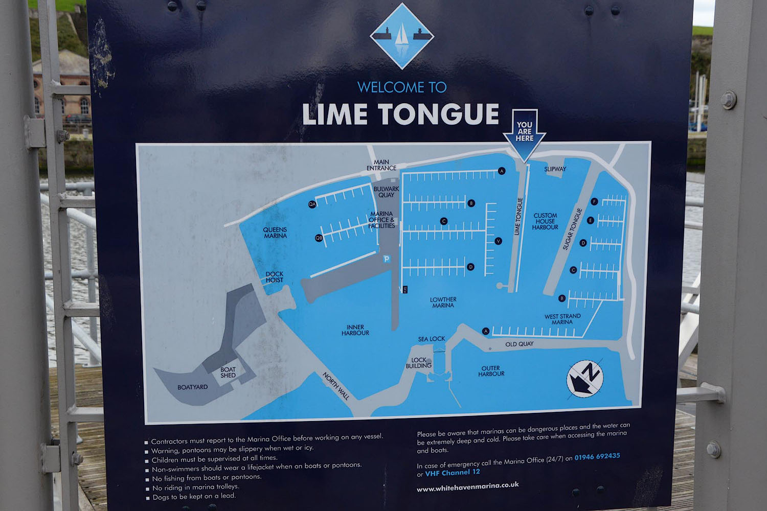 Click to enlarge CGN89.jpg (taken 15.9.2017) |
||
|
|
||
Lakes Guides menu.