 Old Cumbria Gazetteer
 |
 |
|
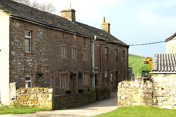
| Rakehead, Nateby | ||
| Rakehead | ||
| locality:- | Nateby | |
| civil parish:- | Nateby (formerly Westmorland) | |
| county:- | Cumbria | |
| locality type:- | buildings | |
| coordinates:- | NY77880671 | |
| 1Km square:- | NY7706 | |
| 10Km square:- | NY70 | |
| references:- | OS County Series |
|
|
|
||
 BVZ39.jpg (taken 2.3.2012) |
||
|
|
||
| evidence:- | old map:- OS County Series (Wmd 30 3) placename:- Rakehead |
|
| source data:- | Maps, County Series maps of Great Britain, scales 6 and 25
inches to 1 mile, published by the Ordnance Survey, Southampton,
Hampshire, from about 1863 to 1948. "Rakehead" |
|
|
|
||
| evidence:- | old map:- Ford 1839 map placename:- Raikhead |
|
| source data:- | Map, uncoloured engraving, Map of the Lake District of
Cumberland, Westmoreland and Lancashire, scale about 3.5 miles
to 1 inch, published by Charles Thurnam, Carlisle, and by R
Groombridge, 5 Paternoster Row, London, 3rd edn 1843.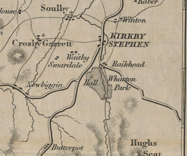 FD02NY70.jpg "Raikhead" item:- JandMN : 100.1 Image © see bottom of page |
|
|
|
||
| evidence:- | database:- Listed Buildings 2010 placename:- Rakehead Farm item:- date stone (1685) |
|
| source data:- | courtesy of English Heritage "RAKEHEAD FARMHOUSE AND ADJOINING COTTAGE / / B6270 / NATEBY / EDEN / CUMBRIA / II / 73376 / NY7759306782" |
|
|
|
||
 Lakes Guides menu.