 Old Cumbria Gazetteer
 |
 |
|
| Fairthwaite Park House, Lancashire | ||
| Fairthwaite Park House | ||
| site name:- | Fairthwaite Park (once?) | |
| locality:- | Leck | |
| county:- | Lancashire | |
| locality type:- | buildings | |
| locality type:- | park | |
| coordinates:- | SD638770 | |
| 1Km square:- | SD6377 | |
| 10Km square:- | SD67 | |
|
|
||
| evidence:- | old map:- Saxton 1579 |
|
| source data:- | Map, hand coloured engraving, Westmorlandiae et Cumberlandiae Comitatus ie Westmorland
and Cumberland, scale about 5 miles to 1 inch, by Christopher Saxton, London, engraved
by Augustinus Ryther, 1576, published 1579-1645.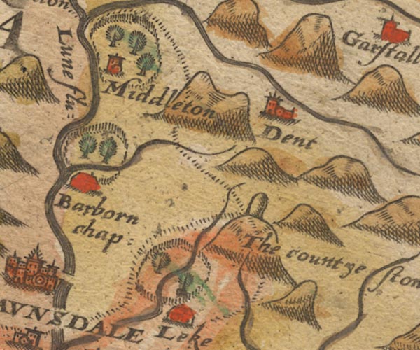 Sax9SD68.jpg At Leke; fence palings, trees, river through. item:- private collection : 2 Image © see bottom of page |
|
|
|
||
| evidence:- | old map:- Speed 1611 (Wmd) |
|
| source data:- | Map, hand coloured engraving, The Countie Westmorland and
Kendale the Cheif Towne, scale about 2.5 miles to 1 inch, by
John Speed, 1610, published by George Humble, Popes Head Alley,
London, 1611-12.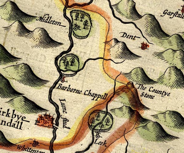 SP14SD68.jpg ring of fence palings, by Leck, Lancashire item:- Armitt Library : 2008.14.5 Image © see bottom of page |
|
|
|
||
| evidence:- | perhaps old map:- Jansson 1646 |
|
| source data:- | Map, hand coloured engraving, Cumbria and Westmoria, ie
Cumberland and Westmorland, scale about 3.5 miles to 1 inch, by
John Jansson, Amsterdam, Netherlands, 1646.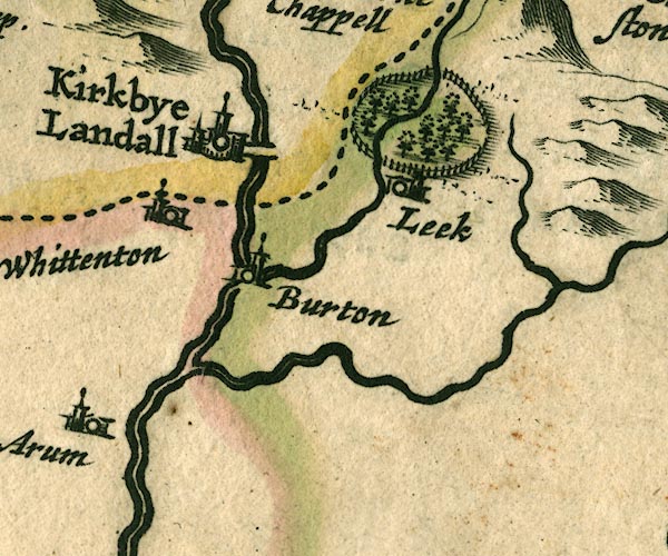 JAN3SD67.jpg Ring of fence palings with trees. item:- JandMN : 88 Image © see bottom of page |
|
|
|
||
| evidence:- | old map:- Morden 1695 (Wmd) placename:- Park House |
|
| source data:- | Map, hand coloured engraving, Westmorland, scale about 2.5 miles to 1 inch, by Robert
Morden, published by Abel Swale, the Unicorn, St Paul's Churchyard, Awnsham, and John
Churchill, the Black Swan, Paternoster Row, London, 1695.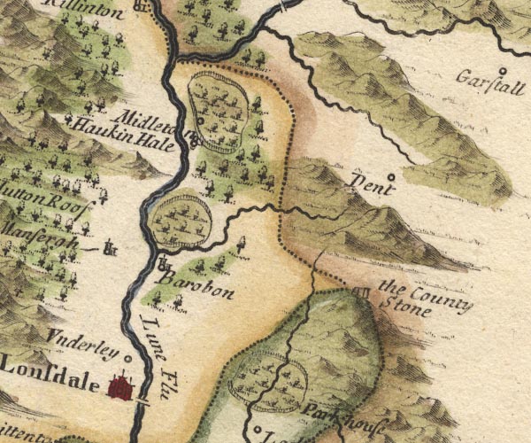 MD10SD68.jpg "Park house" Ring of fence palings, trees, and Park House. item:- JandMN : 24 Image © see bottom of page |
|
|
|
||
 Lakes Guides menu.