 Old Cumbria Gazetteer
 |
 |
|
| Cross Hall, Sedbergh | ||
| Cross Hall | ||
| civil parish:- | Sedbergh (formerly Yorkshire) | |
| county:- | Cumbria | |
| locality type:- | buildings | |
| coordinates:- | SD687938 | |
| 1Km square:- | SD6893 | |
| 10Km square:- | SD69 | |
|
|
||
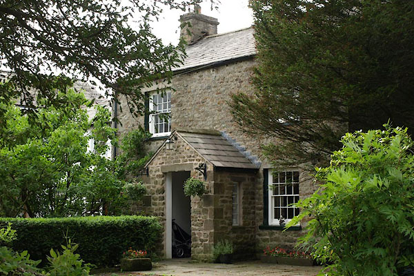 BYZ32.jpg (taken 6.8.2013) |
||
|
|
||
| evidence:- | old map:- OS County Series (Yrk 49 9) placename:- Cross Hall |
|
| source data:- | Maps, County Series maps of Great Britain, scales 6 and 25
inches to 1 mile, published by the Ordnance Survey, Southampton,
Hampshire, from about 1863 to 1948. |
|
|
|
||
| evidence:- | old map:- Jefferys 1770 (Wmd) placename:- Cross Hall |
|
| source data:- | Map, 4 sheets, The County of Westmoreland, scale 1 inch to 1
mile, surveyed 1768, and engraved and published by Thomas
Jefferys, London, 1770.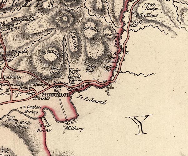 J5SD69SE.jpg "Cross Hall" circle, labelled in italic lowercase text; settlement, farm, house, or hamlet? item:- National Library of Scotland : EME.s.47 Image © National Library of Scotland |
|
|
|
||
| evidence:- | old map:- Cary 1789 (edn 1805) placename:- Cross Hall |
|
| source data:- | Map, uncoloured engraving, Westmoreland, scale about 2.5 miles
to 1 inch, by John Cary, London, 1789; edition 1805.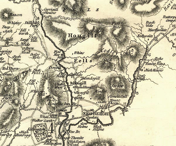 CY24SD69.jpg "Cross Hall" block/s, labelled in italic lowercase; house, or hamlet item:- JandMN : 129 Image © see bottom of page |
|
|
|
||
| evidence:- | old map:- Ford 1839 map placename:- Cross Hall |
|
| source data:- | Map, uncoloured engraving, Map of the Lake District of
Cumberland, Westmoreland and Lancashire, scale about 3.5 miles
to 1 inch, published by Charles Thurnam, Carlisle, and by R
Groombridge, 5 Paternoster Row, London, 3rd edn 1843.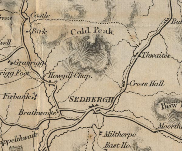 FD02SD69.jpg "Cross Hall" item:- JandMN : 100.1 Image © see bottom of page |
|
|
|
||
| evidence:- | database:- Listed Buildings 2010 placename:- Cross Hall Cottage |
|
| source data:- | courtesy of English Heritage "CROSS HALL COTTAGE / / CAUTLEY ROAD / SEDBERGH / SOUTH LAKELAND / CUMBRIA / II / 484527 / SD6877693921" |
|
|
|
||
 Lakes Guides menu.