 Old Cumbria Gazetteer
 |
 |
|
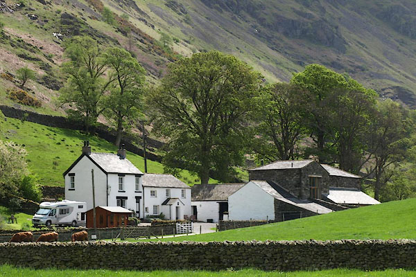
| Bram Cragg, St John's Castlerigg etc | ||
| Bram Cragg | ||
| Bramcrag | ||
| Bram Crag | ||
| locality:- | St John's in the Vale | |
| civil parish:- | St John's Castlerigg and Wythburn (formerly Cumberland) | |
| county:- | Cumbria | |
| locality type:- | buildings | |
| coordinates:- | NY31852140 | |
| 1Km square:- | NY3121 | |
| 10Km square:- | NY32 | |
|
|
||
 BYI55.jpg (taken 21.5.2103) 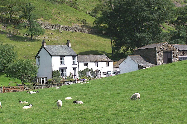 BMH48.jpg (taken 29.6.2006) |
||
|
|
||
| evidence:- | old map:- OS County Series (Cmd 64 12) placename:- Bramcrag |
|
| source data:- | Maps, County Series maps of Great Britain, scales 6 and 25
inches to 1 mile, published by the Ordnance Survey, Southampton,
Hampshire, from about 1863 to 1948. |
|
|
|
||
| evidence:- | old map:- Donald 1774 (Cmd) placename:- Braim Crag |
|
| source data:- | Map, hand coloured engraving, 3x2 sheets, The County of Cumberland, scale about 1
inch to 1 mile, by Thomas Donald, engraved and published by Joseph Hodskinson, 29
Arundel Street, Strand, London, 1774.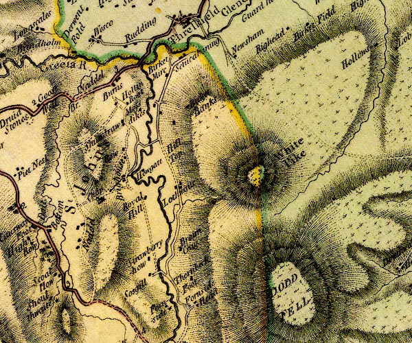 D4NY32SW.jpg "Braim Crag" block or blocks, labelled in lowercase; a hamlet or just a house item:- Carlisle Library : Map 2 Image © Carlisle Library |
|
|
|
||
| evidence:- | old map:- Ford 1839 map placename:- Braem Green |
|
| source data:- | Map, uncoloured engraving, Map of the Lake District of
Cumberland, Westmoreland and Lancashire, scale about 3.5 miles
to 1 inch, published by Charles Thurnam, Carlisle, and by R
Groombridge, 5 Paternoster Row, London, 3rd edn 1843.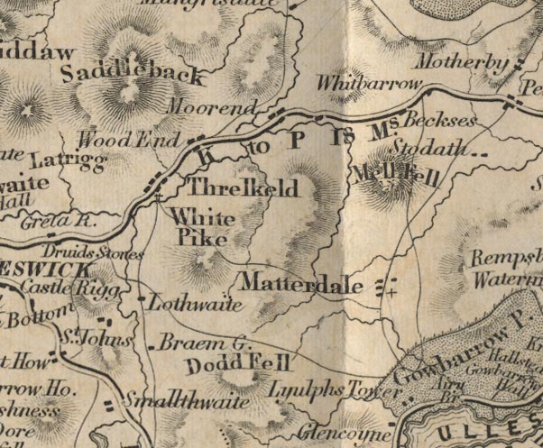 FD02NY32.jpg "Braem G." item:- JandMN : 100.1 Image © see bottom of page |
|
|
|
||
| evidence:- | database:- Listed Buildings 2010 placename:- Bram Crag |
|
| source data:- | courtesy of English Heritage "BRAM CRAG / / / ST JOHNS CASTLERIGG AND WYTHBURN / ALLERDALE / CUMBRIA / II / 72182 / NY3184821379" |
|
|
|
||
 Lakes Guides menu.