 Old Cumbria Gazetteer
 |
 |
|
| Ravenstonedale Park, Ravenstonedale | ||
| Ravenstonedale Park | ||
| civil parish:- | Ravenstonedale (formerly Westmorland) | |
| county:- | Cumbria | |
| locality type:- | park (ex) | |
| coordinates:- | NY72230533 (etc) | |
| 1Km square:- | NY7205 | |
| 10Km square:- | NY70 | |
|
|
||
| evidence:- | old map:- OS County Series (Wmd 29 8) placename:- Ravenstonedale Park |
|
| source data:- | Maps, County Series maps of Great Britain, scales 6 and 25
inches to 1 mile, published by the Ordnance Survey, Southampton,
Hampshire, from about 1863 to 1948. OS County Series (Wmd 30 5) |
|
|
|
||
| evidence:- | old map:- Morden 1695 (Wmd) |
|
| source data:- | Map, hand coloured engraving, Westmorland, scale about 2.5 miles to 1 inch, by Robert
Morden, published by Abel Swale, the Unicorn, St Paul's Churchyard, Awnsham, and John
Churchill, the Black Swan, Paternoster Row, London, 1695.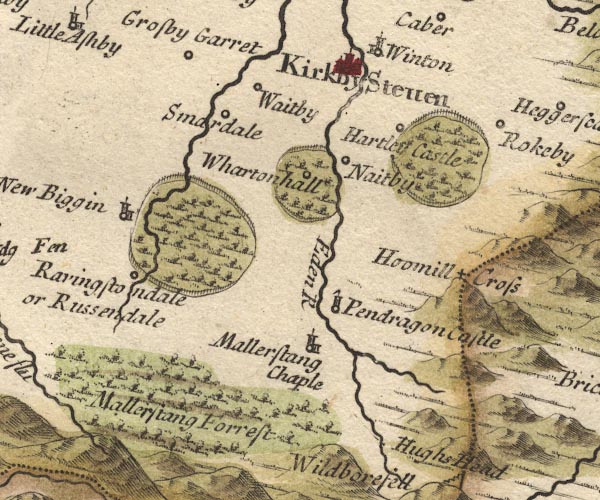 MD10NY70.jpg Ring of fence palings, trees. item:- JandMN : 24 Image © see bottom of page |
|
|
|
||
| evidence:- | possibly old map:- Simpson 1746 map (Wmd) |
|
| source data:- | Map, uncoloured engraving, Westmorland, scale about 8 miles to 1
inch, printed by R Walker, Fleet Lane, London, 1746.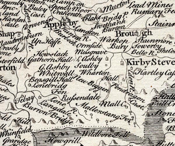 SMP2NYQ.jpg Outline with fence palings. item:- Dove Cottage : 2007.38.59 Image © see bottom of page |
|
|
|
||
| evidence:- | old map:- Bowen and Kitchin 1760 |
|
| source data:- | Map, hand coloured engraving, A New Map of the Counties of
Cumberland and Westmoreland Divided into their Respective Wards,
scale about 4 miles to 1 inch, by Emanuel Bowen and Thomas
Kitchin et al, published by T Bowles, Robert Sayer, and John
Bowles, London, 1760.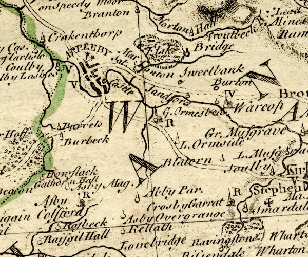 BO18NY61.jpg outline of fence palings item:- Armitt Library : 2008.14.10 Image © see bottom of page |
|
|
|
||
 Lakes Guides menu.