 Old Cumbria Gazetteer
 |
 |
|
| bridge, Blenkinsopp | ||
| site name:- | Tipalt Burn | |
| locality:- | Blenkinsopp | |
| county:- | Northumberland | |
| locality type:- | bridge | |
| coordinates:- | NY666646 | |
| 1Km square:- | NY6664 | |
| 10Km square:- | NY66 | |
|
|
||
| evidence:- | old map:- Morden 1695 (Cmd) |
|
| source data:- | Map, uncoloured engraving, Cumberland, scale about 4 miles to 1
inch, by Robert Morden, 1695, published by Abel Swale, the
Unicorn, St Paul's Churchyard, Awnsham, and John Churchill, the
Black Swan, Paternoster Row, London, 1695-1715.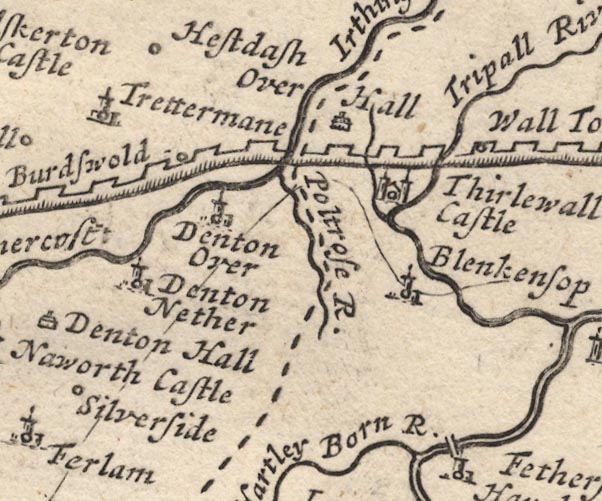 MD12NY66.jpg Single line over the Tripall River by Blenkensop. item:- JandMN : 90 Image © see bottom of page |
|
|
|
||
 Lakes Guides menu.