 Old Cumbria Gazetteer
 |
 |
|
| Annan Castle, Scotland | ||
| Annan Castle | ||
| locality:- | Annan | |
| country:- | Scotland | |
| locality type:- | castle | |
| coordinates:- | NY19216676 | |
| 1Km square:- | NY1966 | |
| 10Km square:- | NY16 | |
|
|
||
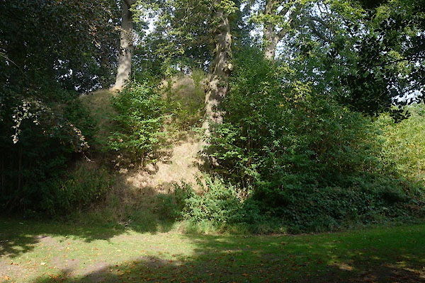 CBR31.jpg (taken 13.9.2014) |
||
|
|
||
| evidence:- | old map:- Saxton 1579 placename:- Anand Castle |
|
| source data:- | Map, hand coloured engraving, Westmorlandiae et Cumberlandiae Comitatus ie Westmorland
and Cumberland, scale about 5 miles to 1 inch, by Christopher Saxton, London, engraved
by Augustinus Ryther, 1576, published 1579-1645.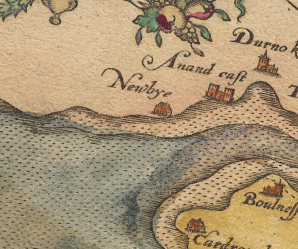 Sax9NY16.jpg Building with two towers, symbol for a castle. "Anand cast" item:- private collection : 2 Image © see bottom of page |
|
|
|
||
| evidence:- | old map:- Burghley 1590 (facsimile) placename:- Annand Castel |
|
| source data:- | Facsimile map, A Platt of the Opposete Border of Scotland to ye West Marches of England,
parts of Cumberland and Scotland including the Debateable Land, from a manuscript
drawn for William Cecil, Lord Burghley, about 1590, published by R B Armstrong, 1897. courtesy of the National Library of Scotland  M048NY27.jpg "Annand cast." walls, two towers item:- National Library of Scotland : MS6113 f.267 Image © National Library of Scotland |
|
|
|
||
| evidence:- | old map:- Speed 1611 (Cmd) placename:- Anand Castle |
|
| source data:- | Map, hand coloured engraving, Cumberland and the Ancient Citie
Carlile Described, scale about 4 miles to 1 inch, by John Speed,
1610, published by J Sudbury and George Humble, Popes Head
Alley, London, 1611-12.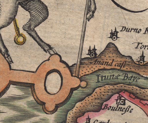 SP11NY16.jpg "Anand cast." circle, towers; Scotland item:- private collection : 16 Image © see bottom of page |
|
|
|
||
| evidence:- | old map:- Jansson 1646 placename:- Anand Castle |
|
| source data:- | Map, hand coloured engraving, Cumbria and Westmoria, ie
Cumberland and Westmorland, scale about 3.5 miles to 1 inch, by
John Jansson, Amsterdam, Netherlands, 1646.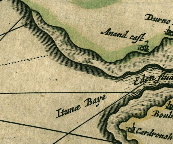 JAN3NY16.jpg "Anand cast" Buildings and tower with flag. item:- JandMN : 88 Image © see bottom of page |
|
|
|
||
| evidence:- | old map:- Morden 1695 (Cmd) placename:- Anand Castle |
|
| source data:- | Map, uncoloured engraving, Cumberland, scale about 4 miles to 1
inch, by Robert Morden, 1695, published by Abel Swale, the
Unicorn, St Paul's Churchyard, Awnsham, and John Churchill, the
Black Swan, Paternoster Row, London, 1695-1715.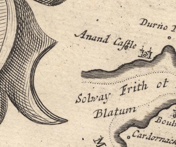 MD12NY16.jpg "Anand Castle" Circle, building with two towers. item:- JandMN : 90 Image © see bottom of page |
|
|
|
||
| evidence:- | old text:- Ayton and Daniell 1814-25 |
|
| source data:- | Tour, A Voyage Round Great Britain, undertaken in the summer of
the year 1813 ..., by Richard Ayton, illustrated by William
Daniell, published in 8 volumes, 1814, 1815, 1818, 1820, 1821,
1822, 1824, and 1825. "The great Robert the Bruce had a castle at Annan, and I was shown a high mount, partly artificial, in a gentleman's garden, which he was willing (and I heartily went along with him) to think the site of it ..." |
|
|
|
||
| hearsay:- |
David , King of Scots, granted the lands of Annandale to the Brus family in the 12th
century. The Bruces built a castle at Annan, about 1124. The site was fairly soon
abandoned because of flooding (the bailey is now partly washed away) and a new castle
was built at Lochmaben. Roberth The Bruce, 7th Lord of Annandale, seized the crown
during the War of Independence, 1306. |
|
|
|
||
| notes:- |
If the castle was abandoned probably in the 12th century it can hardly be the one
plotted by Saxton in the 16th century? |
|
| The map of Annandiae Praefectura, vulgo the Stewartrie of Annandail, drawn by Timothy
Pont, engraved by Johannes Bleau does not show a castle at Annan (ther is one at Newby). |
||
|
|
||
 Lakes Guides menu.