 Old Cumbria Gazetteer
 |
 |
|
| Rake, Martindale | ||
| locality:- | Howtown | |
| civil parish:- | Martindale (formerly Westmorland) | |
| county:- | Cumbria | |
| locality type:- | track | |
| locality type:- | pass | |
| coordinates:- | NY437193 (etc) | |
| 1Km square:- | NY4319 | |
| 10Km square:- | NY41 | |
|
|
||
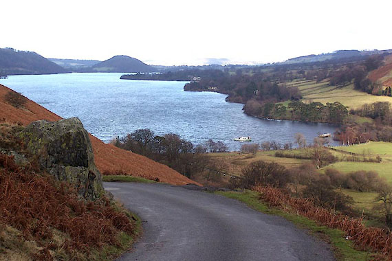 BLO88.jpg Howtown Wyke from The Rake. (taken 25.1.2006) |
||
|
|
||
| evidence:- | outline view:- Otley 1823 (5th edn 1834) placename:- Martindale Hause |
|
| source data:- | Print, woodcut outline view, Mountains of Ullswater, by
Jonathan Otley, Keswick, Cumberland, 1830.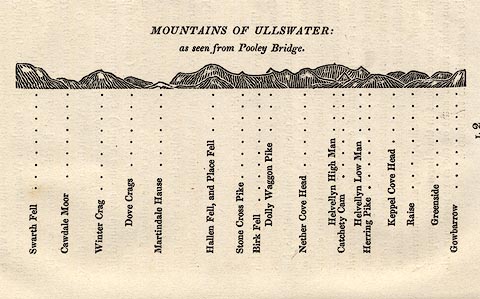 click to enlarge click to enlargeOT2E12.jpg Printed on p.113 of A Concise Description of the English Lakes, by Jonathan Otley, 5th edition, 1834. "MOUNTAINS OF ULLSWATER: as seen from Pooley Bridge." Mountains are listed:- "Swarth Fell / Cawdale Moor / Winter Crag / Dove Crags / Martindale Hause / Hallen Fell, and Place Fell / Stone Cross Pike / Birk Fell / Dolly Waggon Pike / Nether Cove Head / Helvellyn High Man / Catchety Cam / Helvellyn Low Man / Herring Pike / Keppel Cove Head / Raise / Greenside / Gowbarrow" item:- JandMN : 48.13 Image © see bottom of page |
|
|
|
||
 Lakes Guides menu.