 Old Cumbria Gazetteer
 |
 |
|
| Trumpet Beck | ||
| civil parish:- | Cleator Moor (formerly Cumberland) | |
| county:- | Cumbria | |
| locality type:- | river | |
| 1Km square:- | NY0214 | |
| 10Km square:- | NY01 | |
|
|
||
| evidence:- | possibly old map:- Ogilby 1675 (plate 96) |
|
| source data:- | Road strip map, hand coloured engraving, the Road from Kendal to
Cockermouth, and the Road from Egremond to Carlisle, scale about
1 inch to 1 mile, by John Ogilby, London, 1675.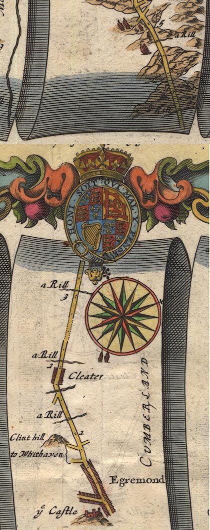 OG96Bm00.jpg In mile 2, Cumberland. "a Rill" drawn across the road. item:- JandMN : 22 Image © see bottom of page |
|
|
|
||
 Lakes Guides menu.