 Old Cumbria Gazetteer
 |
 |
|
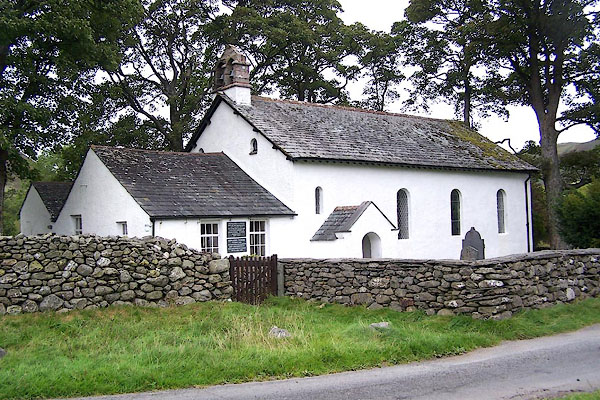
| Newlands Church, Above Derwent | ||
| Newlands Church | ||
| locality:- | Newlands | |
| civil parish:- | Above Derwent (formerly Cumberland) | |
| county:- | Cumbria | |
| locality type:- | church | |
| coordinates:- | NY22991937 | |
| 1Km square:- | NY2219 | |
| 10Km square:- | NY21 | |
|
|
||
 BMR75.jpg (taken 22.9.2006) 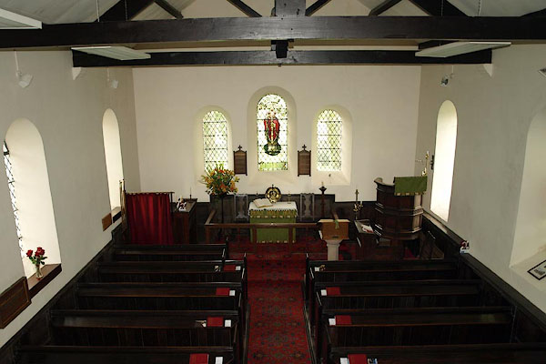 BRP40.jpg (taken 25.9.2009) |
||
|
|
||
| evidence:- | old map:- OS County Series (Cmd 64 13) |
|
| source data:- | Maps, County Series maps of Great Britain, scales 6 and 25
inches to 1 mile, published by the Ordnance Survey, Southampton,
Hampshire, from about 1863 to 1948. "Church (Per Curacy)" |
|
|
|
||
| evidence:- | presumably old map:- Mercator 1595 (edn?) placename:- Newland Chapel |
|
| source data:- | Map, hand coloured engraving, Northumbria, Cumberlandia, et
Dunelmensis Episcopatus, ie Northumberland, Cumberland and
Durham etc, scale about 6.5 miles to 1 inch, by Gerard Mercator,
Duisberg, Germany, about 1595. MER8CumE.jpg "Newland chap." circle item:- JandMN : 169 Image © see bottom of page |
|
|
|
||
| evidence:- | old map:- Speed 1611 (Cmd) placename:- Newland Chapel |
|
| source data:- | Map, hand coloured engraving, Cumberland and the Ancient Citie
Carlile Described, scale about 4 miles to 1 inch, by John Speed,
1610, published by J Sudbury and George Humble, Popes Head
Alley, London, 1611-12.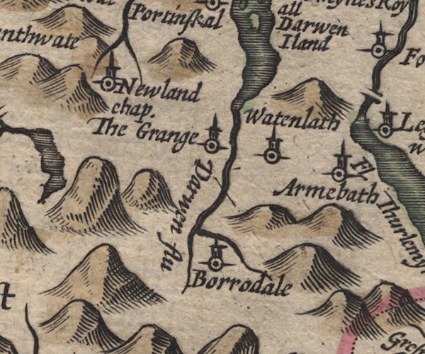 SP11NY21.jpg "Newland chap." circle, tower item:- private collection : 16 Image © see bottom of page |
|
|
|
||
| evidence:- | old map:- Jansson 1646 placename:- Newland Chappell |
|
| source data:- | Map, hand coloured engraving, Cumbria and Westmoria, ie
Cumberland and Westmorland, scale about 3.5 miles to 1 inch, by
John Jansson, Amsterdam, Netherlands, 1646.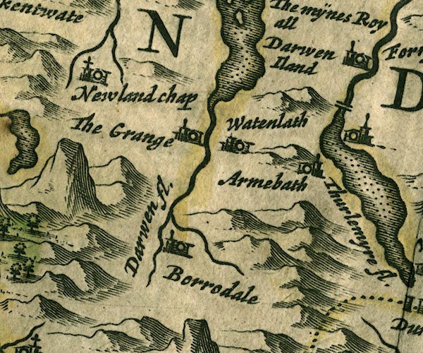 JAN3NY21.jpg "Newland Chap" Building and tower with cross. item:- JandMN : 88 Image © see bottom of page |
|
|
|
||
| evidence:- | old map:- Morden 1695 (Cmd) placename:- Newland Chapel |
|
| source data:- | Map, uncoloured engraving, Cumberland, scale about 4 miles to 1
inch, by Robert Morden, 1695, published by Abel Swale, the
Unicorn, St Paul's Churchyard, Awnsham, and John Churchill, the
Black Swan, Paternoster Row, London, 1695-1715.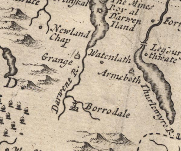 MD12NY21.jpg "Newland Chap" Circle. item:- JandMN : 90 Image © see bottom of page |
|
|
|
||
| evidence:- | old map:- Bowen and Kitchin 1760 placename:- Newland Chapel |
|
| source data:- | Map, hand coloured engraving, A New Map of the Counties of
Cumberland and Westmoreland Divided into their Respective Wards,
scale about 4 miles to 1 inch, by Emanuel Bowen and Thomas
Kitchin et al, published by T Bowles, Robert Sayer, and John
Bowles, London, 1760.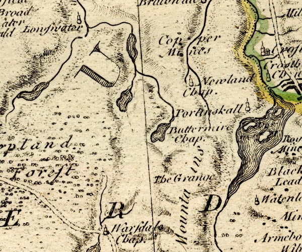 BO18NY11.jpg "Newland Chap." circle, tower item:- Armitt Library : 2008.14.10 Image © see bottom of page |
|
|
|
||
| evidence:- | old map:- Donald 1774 (Cmd) |
|
| source data:- | Map, hand coloured engraving, 3x2 sheets, The County of Cumberland, scale about 1
inch to 1 mile, by Thomas Donald, engraved and published by Joseph Hodskinson, 29
Arundel Street, Strand, London, 1774. D4NY21NW.jpg "Chap" church item:- Carlisle Library : Map 2 Image © Carlisle Library |
|
|
|
||
| evidence:- | old map:- Garnett 1850s-60s H placename:- Newlands |
|
| source data:- | Map of the English Lakes, in Cumberland, Westmorland and
Lancashire, scale about 3.5 miles to 1 inch, published by John
Garnett, Windermere, Westmorland, 1850s-60s. GAR2NY21.jpg "Newlands" cross, a church item:- JandMN : 82.1 Image © see bottom of page |
|
|
|
||
| evidence:- | old map:- Nurse 1918 |
|
| source data:- | Map, The Diocese of Carlisle, Cumberland, Westmorland, and
Lancashire North of the Sands, scale about 4 miles to 1 inch, by
Rev Euston J Nurse, published by Charles Thurnam and Sons, 11
English Street, Carlisle, Cumberland, 2nd edn 1939.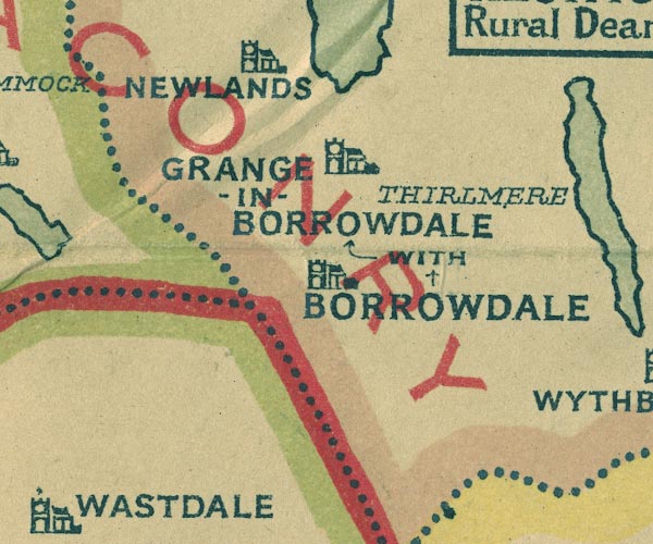 NUR1NY21.jpg "NEWLANDS" item:- JandMN : 27 Image © see bottom of page |
|
|
|
||
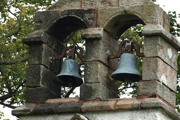 BRP42.jpg Bells. (taken 25.9.2009) 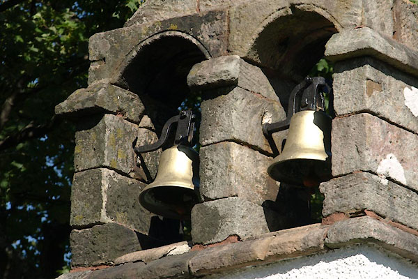 BZF78.jpg Bells. (taken 4.9.2013) |
||
|
|
||
 stained glass stained glass |
||
|
|
||
| some kneelers |
||
|
|
||
| evidence:- | database:- Listed Buildings 2010 placename:- Newlands Church |
|
| source data:- | courtesy of English Heritage "NEWLANDS CHURCH AND FORMER SCHOOL / / / ABOVE DERWENT / ALLERDALE / CUMBRIA / II / 72086 / NY2299019366" |
|
| source data:- | courtesy of English Heritage "Parish church and former school, now meeting room. Church rebuilt in 1843 on earlier site; school dated 1877. Painted roughcast walls under graduated greenslate roof. 3-bay nave/chancel with south stone porch and west twin bellcote. Single-storey 2-bay former school adjoins west end. Nave has gabled porch and tall round-headed windows. School has casement windows in plain reveals. Rear extension has casement windows with glazing bars and rounded bars in heads. School has wall plaque inscribed NEWLANDS SCHOOL BUILT BY THE PARISHIONERS 1877, CLOSED 1967 THIS STONE WAS PLACED HERE IN GRATEFUL MEMORY OF DOROTHEA POTTS HEADMISTRESS 1943-1963." "INTERIOR of church has gallery over vestibule and vestry, giving access to both school and church. Royal Arms of George II dated 1737. C17 pulpit and lecturn. Wainscoating is of reused C17 panelling. Stained glass window as First World War memorial. Late C19 furnishings and fittings." |
|
|
|
||
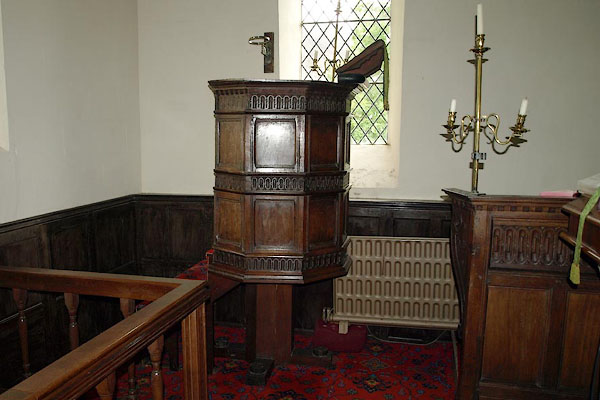 BRP41.jpg Pulpit. (taken 25.9.2009) 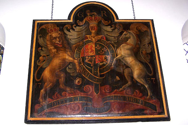 BMR77.jpg Coat of Arms, George ? (taken 22.9.2006) 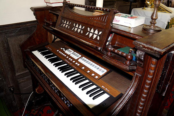 CBA84.jpg Harmonium, old and new. (taken 9.7.2014) 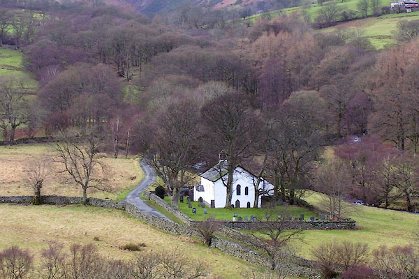 BOK68.jpg (taken 19.1.2008) 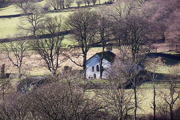 BNE18.jpg (taken 14.2.2007) |
||
|
|
||
| notes:- |
Christopher Saxton's map, 1576, shows a chapel here. The first reader record is Anthony
Bragg, 1610. The chapel was restored from a delapidated state in 1843. |
|
| : : church leaflet |
||
|
|
||
 Lakes Guides menu.