Old Cumbria Gazetteer
 |
 |
|
||
| Carling Gill | ||||
| runs into:- |  Irthing, River Irthing, River |
|||
|
|
||||
| civil parish:- | Nether Denton (formerly Cumberland) | |||
| county:- | Cumbria | |||
| locality type:- | river | |||
| 1Km square:- | NY6062 (etc) | |||
| 10Km square:- | NY66 | |||
|
|
||||
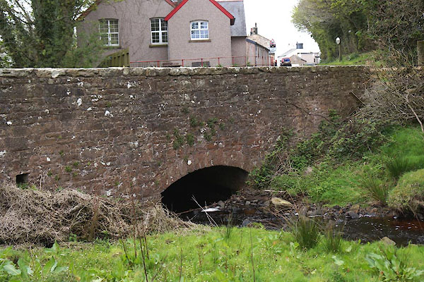
 CCZ44.jpg At Low Row, (taken 8.5.2015) |
||||
|
|
||||
| evidence:- | old map:- OS County Series (Cmd 12 14) placename:- Carling Gill |
|||
| source data:- | Maps, County Series maps of Great Britain, scales 6 and 25
inches to 1 mile, published by the Ordnance Survey, Southampton,
Hampshire, from about 1863 to 1948. "Carling Gill" |
|||
| source data:- | Maps, County Series maps of Great Britain, scales 6 and 25
inches to 1 mile, published by the Ordnance Survey, Southampton,
Hampshire, from about 1863 to 1948. "[ ] Gill" |
|||
| source data:- | Maps, County Series maps of Great Britain, scales 6 and 25
inches to 1 mile, published by the Ordnance Survey, Southampton,
Hampshire, from about 1863 to 1948. "Carling Gill" |
|||
|
|
||||
| evidence:- | possibly old map:- Ogilby 1675 (plate 86) |
|||
| source data:- | Road strip map, uncoloured engraving, the Road from Tinmouth ...
to Carlisle, scale about 1 inch to 1 mile, by John Ogilby,
London, 1675.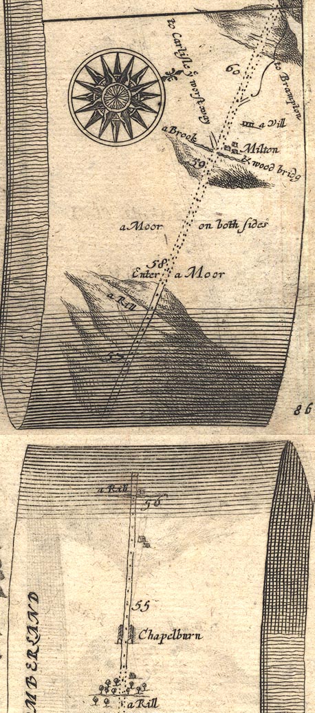 OG86m055.jpg In mile 56, Cumberland. "a Rill" crossing under the road. item:- JandMN : 73 Image © see bottom of page |
|||
|
|
||||
| places:- |
|
|||
|
||||
Lakes Guides menu.