 Old Cumbria Gazetteer
 |
 |
|
| Yewbarrow, Nether Wasdale | ||
| Yewbarrow | ||
| locality:- | Wasdale | |
| civil parish:- | Nether Wasdale (formerly Cumberland) | |
| county:- | Cumbria | |
| locality type:- | hill | |
| coordinates:- | NY173085 | |
| 1Km square:- | NY1708 | |
| 10Km square:- | NY10 | |
| altitude:- | 2057 feet | |
| altitude:- | 627m | |
|
|
||
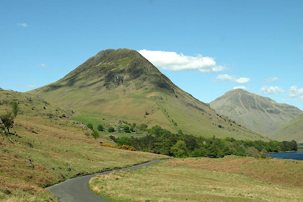 BQN98.jpg (taken 11.5.2009) 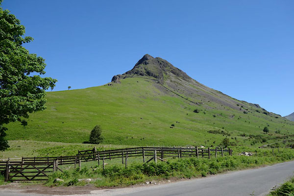 BYO45.jpg (taken 18.6.2013) |
||
|
|
||
| evidence:- | old map:- OS County Series (Cmd 74 10) placename:- Yewbarrow |
|
| source data:- | Maps, County Series maps of Great Britain, scales 6 and 25
inches to 1 mile, published by the Ordnance Survey, Southampton,
Hampshire, from about 1863 to 1948. |
|
|
|
||
| evidence:- | old painting:- Green 1790s-1820s item:- cattle; clouds |
|
| source data:- | Painting, watercolour, Overbeck Bridge and Yewbarrow, Wasdale, Nether Wasdale, Cumberland,
by William Green, Ambleside, Westmorland, 1800s-10s?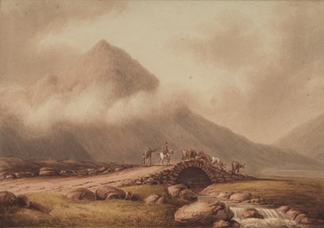 click to enlarge click to enlargePR1749.jpg item:- Dove Cottage : 2005.27.26 Image © see bottom of page |
|
|
|
||
| evidence:- | old print:- Green 1804 (plate 24) |
|
| source data:- | Print, uncoloured aquatint, Wast Water, Nether Wasdale, Cumberland, by William Green,
Ambleside, Westmorland, 1804.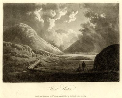 click to enlarge click to enlargeGN1624.jpg Plate 24 from a series. printed at bottom:- "Wast Water. / Drawn and Engraved by Wm. Green, and Published at Ambleside, June 24, 1804." printed at top right:- "24" at :- "W ELGAR / 1802" item:- Armitt Library : 2014.173 Image © see bottom of page |
|
|
|
||
| evidence:- | old text:- Green 1810 placename:- Yewbarrow |
|
| source data:- | Set of prints, soft ground etchings, Sixty Studies from Nature,
by William Green, Ambleside, Westmorland, drawn 1808-10,
published 1810. goto source goto sourcepage 92:- "... Yew-barrow, if not like the camelion in colour, assumes a decidedly different form from every part of the valley." |
|
|
|
||
| evidence:- | old print:- Green 1810 (plate 46) |
|
| source data:- | Print, soft ground etching, Over Beck Bridge in Wasdale, Nether Wasdale, Cumberland,
by William Green, Ambleside, Westmorland, 1808.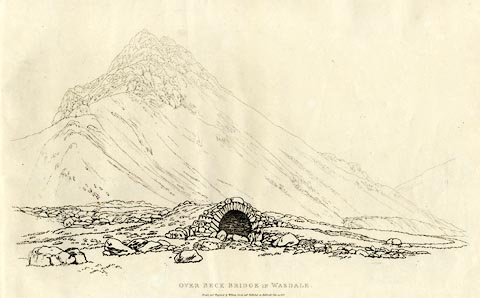 click to enlarge click to enlargeGN1246.jpg Yewbarrow behind. Plate 46 in Sixty Studies from Nature, 1810. printed at top right:- "46" printed at bottom:- "OVER BECK BRIDGE IN WASDALE. / Drawn and Engraved by William Green, and Published at Ambleside, June 24, 1808." watermark:- "J WHATMAN / 1813" item:- Armitt Library : A6641.46 Image © see bottom of page |
|
|
|
||
| evidence:- | old print:- Green 1814 (plate 44) |
|
| source data:- | Print, uncoloured soft ground etching, Wast Water from the Road, Nether Wasdale, Cumberland,
by William Green, Ambleside, Westmorland, 1814.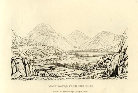 click to enlarge click to enlargeGN0944.jpg Plate 44 in Sixty Small Prints. printed at top right:- "44" printed at bottom:- "WAST WATER FROM THE ROAD. / Published at Ambleside Augst. 1, 1814, by Wm. Green." item:- Armitt Library : A6656.44 Image © see bottom of page |
|
|
|
||
| evidence:- | old print:- Green 1814 (plate 44) |
|
| source data:- | Print, tinted soft ground etching, Wast Water from the Road, Nether Wasdale, Cumberland,
by William Green, Ambleside, Westmorland, 1814.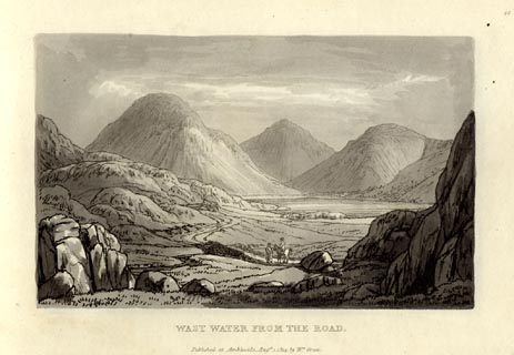 click to enlarge click to enlargeGN1044.jpg Plate 44 in Sixty Small Prints. printed at top right:- "44" printed at bottom:- "WAST WATER FROM THE ROAD. / Published at Ambleside Augst. 1, 1814, by Wm. Green." item:- Armitt Library : A6653.44 Image © see bottom of page |
|
|
|
||
| evidence:- | old print:- Green 1815 placename:- Yewbarrow item:- clouds |
|
| source data:- | Print, coloured aquatint, Yewbarrow from Bowderdale, Nether Wasdale, Cumberland, by
William Green, Ambleside, Westmorland, 1815.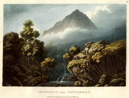 click to enlarge click to enlargeGN0555.jpg Plate 59 in Lake Scenery. printed at upper right:- "59" printed at bottom:- "YEWBARROW from BOWDERDALE. / Published at Ambleside, June 1, 1815, by Wm. Green." item:- Armitt Library : A6646.55 Image © see bottom of page |
|
|
|
||
| evidence:- | old map:- Otley 1818 placename:- Yewbarrow |
|
| source data:- | Map, uncoloured engraving, The District of the Lakes,
Cumberland, Westmorland, and Lancashire, scale about 4 miles to
1 inch, by Jonathan Otley, 1818, engraved by J and G Menzies,
Edinburgh, Scotland, published by Jonathan Otley, Keswick,
Cumberland, et al, 1833. OT02NY10.jpg item:- JandMN : 48.1 Image © see bottom of page |
|
|
|
||
| evidence:- | outline view:- Otley 1823 (4th edn 1830) placename:- Yewbarrow |
|
| source data:- | Print, engraving, outline view, Mountains round Wastwater as seen from the Strands
in Nether Wasdale, published by Jonathan Otley, Keswick, Cumberland et al, 1830.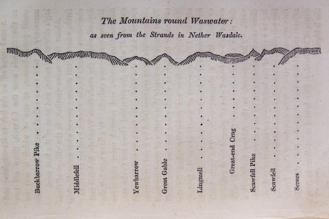 click to enlarge click to enlargeO75E08.jpg p.129 in A Concise Description of the English Lakes, by Jonathan Otley, 4th edition, 1830. "The Mountains round Wastwater: / as seen from the Strands in Nether Wasdale." "Buckbarrow Pike / Middlefell / Yewbarrow / Great Gable / Lingmell / Great-end Crag / Scawfell Pike / Scawfell / Screes" item:- Armitt Library : A1175.8 Image © see bottom of page |
|
|
|
||
| evidence:- | outline view:- Otley 1823 (8th edn 1849) placename:- Yewbarrow |
|
| source data:- | Engraving, outline view of mountains, Mountains of Wast Water as seen from Nether
Wasdale, drawn by T Binns, engraved by O Jewitt, opposite p.22 of A Descriptive Guide
of the English Lakes, by Jonathan Otley, 8th edition, 1849.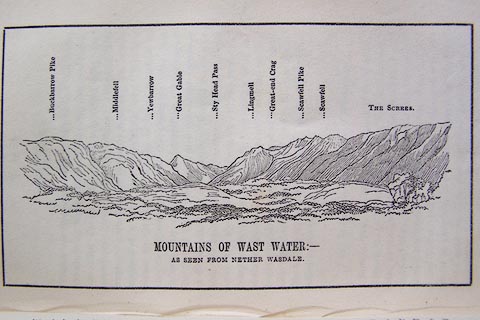 click to enlarge click to enlargeO80E13.jpg item:- Armitt Library : A1180.14 Image © see bottom of page |
|
|
|
||
| evidence:- | outline view:- Otley 1823 (8th edn 1849) placename:- Yewbarrow |
|
| source data:- | Engraving, outline view of mountains, A Group of Mountains seen from Helvellyn, looking
towards the South West, drawn by T Binns, engraved by O Jewitt, opposite p.50 of A
Descriptive Guide of the English Lakes, by Jonathan Otley, 8th edition, 1849.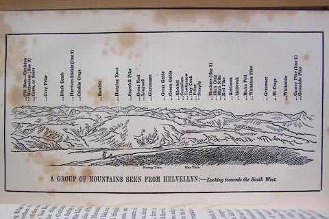 click to enlarge click to enlargeO80E17.jpg item:- Armitt Library : A1180.18 Image © see bottom of page |
|
|
|
||
| evidence:- | outline view:- Otley 1823 (5th edn 1834) |
|
| source data:- | Print, woodcut outline view, Mountains of Wast Water, by
Jonathan Otley, Keswick, Cumberland, 1830.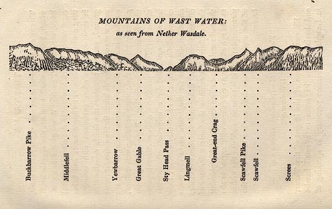 click to enlarge click to enlargeOT2E07.jpg Printed on p.31 of A Concise Description of the English Lakes, by Jonathan Otley, 5th edition, 1834. "THE MOUNTAINS OF WAST WATER: as seen from Nether Wasdale." "Buckbarrow Pike / Middlefell / Yewbarrow / Great Gable / Sty Head Pass / Lingmell / Great-end Crag / Scawfell Pike / Scawfell / Screes" item:- JandMN : 48.8 Image © see bottom of page |
|
|
|
||
| evidence:- | old map:- Garnett 1850s-60s H placename:- Yewbarrow |
|
| source data:- | Map of the English Lakes, in Cumberland, Westmorland and
Lancashire, scale about 3.5 miles to 1 inch, published by John
Garnett, Windermere, Westmorland, 1850s-60s.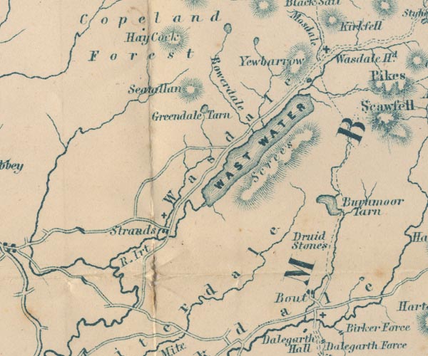 GAR2NY10.jpg "Yewbarrow" hill hachuring item:- JandMN : 82.1 Image © see bottom of page |
|
|
|
||
| evidence:- | old print:- Pyne 1853 |
|
| source data:- | Print, tinted lithograph, Wast Water, Nether Wasdale, Cumberland, by James Baker Pyne,
engraved by W Gauci, published by Thomas Agnew and Sons, Manchester, Lancashire, 1853.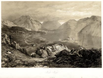 click to enlarge click to enlargePYN225.jpg "PAINTED BY J. B. PYNE. / W. GAUCI LITH. / MANCHESTER, PUBLISHED BY THOMAS AGNEW & SONS, 1853. / Wast Water / M.& N. HANHART, IMPT." item:- Armitt Library : A6678.26 Image © see bottom of page |
|
|
|
||
| evidence:- | old print:- Pyne 1853 |
|
| source data:- | Print, coloured lithograph, Wast Water, Nether Wasdale, Cumberland, by James Baker
Pyne, engraved by W Gauci, published by Thomas Agnew and Sons, Manchester, Lancashire,
1853.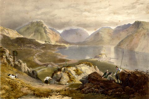 click to enlarge click to enlargePYN425.jpg item:- Armitt Library : A6677.26 Image © see bottom of page |
|
|
|
||
| evidence:- | old photograph:- Bell 1880s-1940s |
|
| source data:- | Photograph, black and white, Yewbarrow from Black Sail Pass, Nether Wasdale, Cumberland,
by Herbert Bell, photographer, Ambleside, Westmorland, 1890s.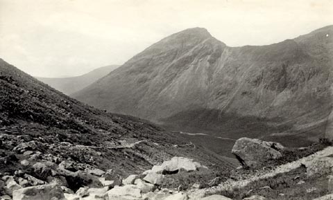 click to enlarge click to enlargeHB0779.jpg internegative at lower right:- "H. Bell" item:- Armitt Library : ALPS442 Image © see bottom of page |
|
|
|
||
| evidence:- | outline view:- Seascale 1920s-30s placename:- Yewbarrow |
|
| source data:- | Print, uncoloured engraving, outline view, mountains from Seascale, published by Edward
Burrow and Son, Cheltenham, Gloucestershire, 1920s-30s.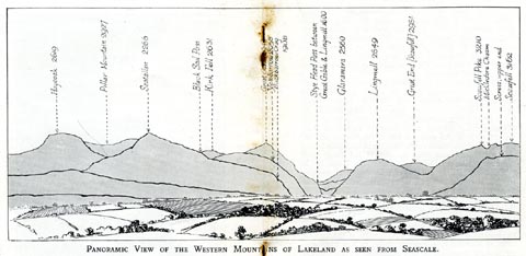 click to enlarge click to enlargeSES113.jpg "PANORAMIC VIEW OF THE WESTERN MOUNTAINS OF LAKELAND AS SEEN FROM SEASCALE." "... Yewbarrow 2058 ..." item:- JandMN : 1079.13 Image © see bottom of page |
|
|
|
||
| evidence:- | old postcard:- |
|
| source data:- | Postcard, colour photograph, Wast Water and Great Gable, Nether Wasdale, Cumberland,
published by Sanderson and Dixon, Ambleside, Westmorland, about 1959.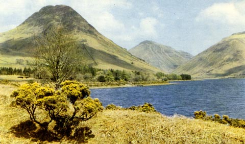 click to enlarge click to enlargePH0112.jpg The prominent mountain is Yewbarrow not Great Gable. printed at bottom:- "WASTWATER AND GREAT GABLE" item:- JandMN : 976.4 Image © see bottom of page |
|
|
|
||
| evidence:- | old print:- Rowbotham 1875 |
|
| source data:- | Print, colour lithograph? Wast Water, Cumberland, by T L Rowbotham, published by Marcus
Ward and Co, London? 1875?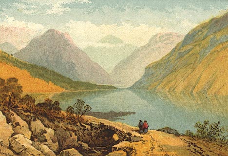 click to enlarge click to enlargePR0128.jpg Included in the set of prints, Views in the English Lake District. printed at lower left, right:- "Rowbotham / MARCUS WARD &CO" item:- Dove Cottage : 2008.107.128 Image © see bottom of page |
|
|
|
||
| evidence:- | outline view:- Matthew 1866 placename:- Yewbarrow |
|
| source data:- | Print, engraving, outline view, Mountains as seen from the Road to Wastwater near
Murthwaiteside, Cumberland, published by J Richardson, Highgate, Kendal, Westmorland,
1866.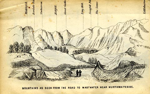 click to enlarge click to enlargeMW1E03.jpg Tipped in before p.1 of The English Lakes, Peaks and Passes, from Kendal to Keswick, by George King Matthew. printed at bottom:- "MOUNTAINS AS SEEN FROM THE ROAD TO WASTWATER NEAR MURTHWAITESIDE." printed at caption to mountains:- "... Yewbarrow. ..." item:- Armitt Library : A1168.3 Image © see bottom of page |
|
|
|
||
| evidence:- | outline view:- Black 1856 (23rd edn 1900) placename:- Yewbarrow |
|
| source data:- | Print, lithograph, Outline Views, Haws and Wastwater - Mountains as seen from Burn-Banks
near the Foot of Hawes Water, and Mountains as seen near Nether Wastdale at the First
Bridge on the road to Wast-Water, by J Flintoft, Keswick, Cumberland, engraved by
R Mason, Edinburgh, Lothian, about 1900.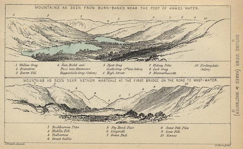 click to enlarge click to enlargeBC08E6.jpg "... 3 Yewbarrow ..." item:- JandMN : 37.21 Image © see bottom of page |
|
|
|
||
| evidence:- | old print:- Pyne 1853 |
|
| source data:- | Drawn by James Barker Pyne, 1848-1853, lithographed by T Picken, 1859.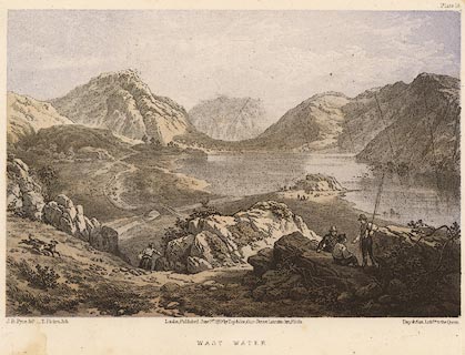 click to enlarge click to enlargePY14.jpg "Wast Water" item:- JandMN : 97.13 Image © see bottom of page |
|
|
|
||
| evidence:- | outline view:- Linton 1852 placename:- Yewbarrow |
|
| source data:- | Print, engraving, outline views, Mountains as Seen from the Esk Viaduct, the Eskmeals
Viaduct, and Mountains as Seen from the Viaduct near Drigg, the Irt Viaduct, Whitehaven
and Furness Junction Railway, Cumberland, engraved by W H Lizars, Edinburgh, published
by Whittaker and Co, London, and by R Gibson and Son and by Callander and Dixon, Whitehaven,
Cumberland, 1852.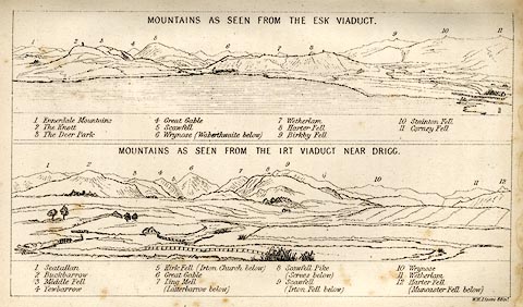 click to enlarge click to enlargeLN1E13.jpg Tipped in opposite p.86 of A Handbook of the Whitehaven and Furness Railway, by John Linton. printed at upper scene, top:- "MOUNTAINS AS SEEN FROM THE ESK VIADUCT." item:- Armitt Library : A1158.11 Image © see bottom of page |
|
|
|
||
| evidence:- | outline view:- Black 1841 (3rd edn 1846) placename:- Yewbarrow |
|
| source data:- | Print, engraving, outline view, Mountains as seen from Burn Banks near the Foot of
Hawes Water, and Mountains as seen near Strands in Wastdale at the First bridge on
the Road to Wast Water, by J Flintoft, Keswick, Cumberland, engraved by R Mason, Edinburgh,
Lothian, about 1846.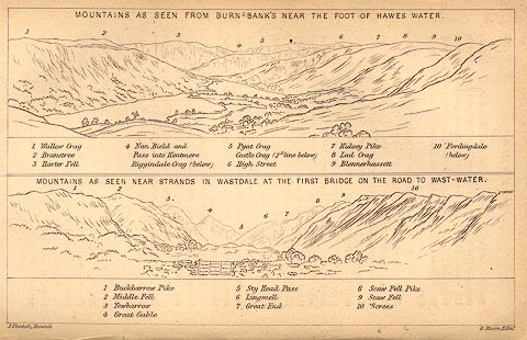 click to enlarge click to enlargeBC02E8.jpg "... 3 Yewbarrow ..." item:- JandMN : 32.12 Image © see bottom of page |
|
|
|
||
| evidence:- | old print:- Green 1819 |
|
| source data:- | Print, aquatint, Over Beck Bridge on Wast Water, Nether Wasdale, Cumberland, by William
Green, 1819, published by R Lough and Co, Chronicle Office, Finkle Street, Kendal,
and others, 1820.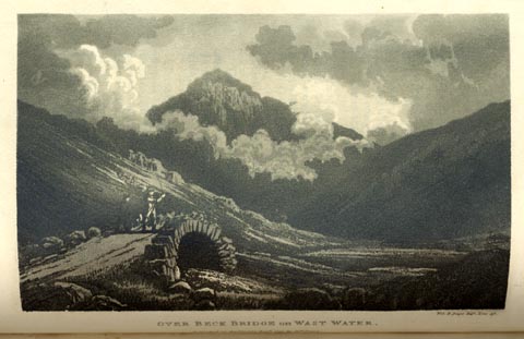 click to enlarge click to enlargeGN0127.jpg Tipped in opposite vol.2 p.247 of The Tourist's New Guide, by William Green. printed at bottom right, centre:- "Vol.2, page 247, line 19. / OVER BECK BRIDGE on WAST WATER. / Published at Ambleside, Augt. 1. 1819, by Wm. Green." item:- Armitt Library : A1141.28 Image © see bottom of page |
|
|
|
||
| evidence:- | old print with text:- Farington 1816 (plate 25) |
|
| source data:- | Print, uncoloured engraving, Wastdale Village, drawn by Joseph Farington, engraved
by J Landseer, published by T Cadell and W Davies, Strand, London, 1815.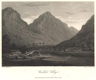 click to enlarge click to enlargeBNV37.jpg Plate 25 in The Lakes of Lancashire, Westmorland and Cumberland ... with text by Thomas Hartwell Horne:- "... Excepting the opening towards the Lake the valley is closely surrounded by mountains. That which is most conspicuous in our view rises in the form of a cone, to a stupendous height, and presents a precipitous front; which, under varying effects of light and shade, exhibits alternately the aweful, the beautiful, and the sublime. ..." item:- private collection : 76 Image © see bottom of page |
|
|
|
||
| evidence:- | old print:- Green 1809 placename:- Yewbarrow item:- footbridge |
|
| source data:- | Print, soft ground etching, Bridge at Bowderdale, Nether Wasdale, Cumberland, by William
Green, published by William Green, Ambleside, Westmorland, and Longman, Hurst, Rees
and Orme, Paternoster Row, London, 1809.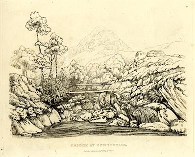 click to enlarge click to enlargeGN0346.jpg Plate 46 in Seventy Eight Studies from Nature. printed in introductory pages to set of prints:- "Number 46. Bowderdale is a solitary house, ... the conical mountain is Yewbarrow." printed at bottom:- "BRIDGE AT BOWDERDALE. / Published Ambleside, Augst. 1st. 1809, by W. Green." item:- Armitt Library : A6637.46 Image © see bottom of page |
|
|
|
||
| evidence:- | old print:- |
|
| source data:- | Print, uncoloured engraving, Head of Wastwater, drawn by IW, engraved by R Scott,
about 1800?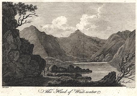 click to enlarge click to enlargePR0400.jpg printed at bottom left, right, centre:- "I.W. delint. / R. Scott sculpt. / The Head of Wastwater" item:- Dove Cottage : 2008.107.393 Image © see bottom of page |
|
|
|
||
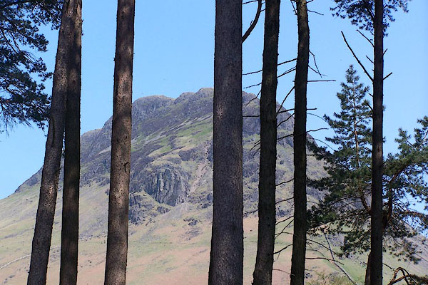 BMB64.jpg (taken 11.5.2006) 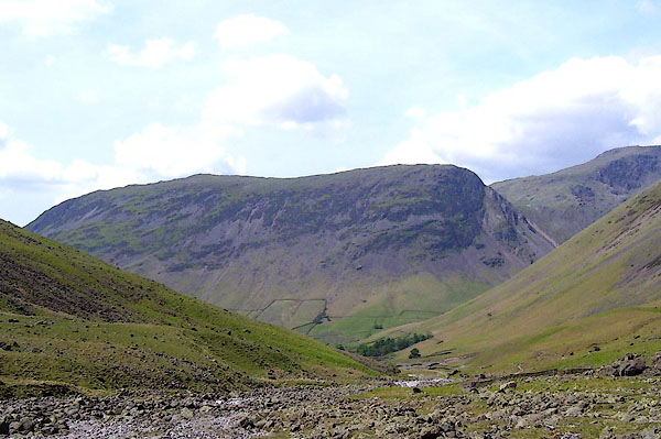 BPF38.jpg From the East. (taken 20.5.2008) 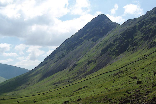 BUR28.jpg (taken 3.6.2011) 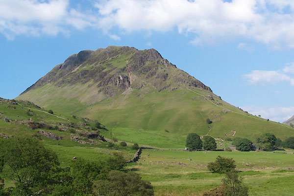 BUR29.jpg (taken 3.6.2011) 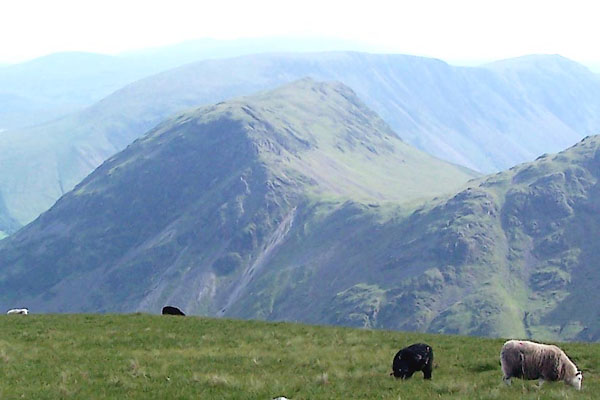 BQX35.jpg From Pillar. (taken 25.6.2009) 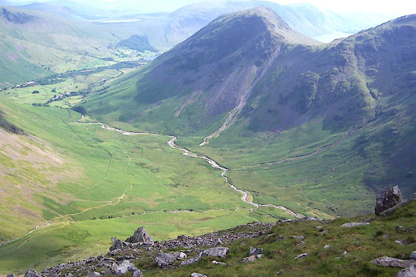 BQX39.jpg Mosedale and Yewbarrow. (taken 25.6.2009) 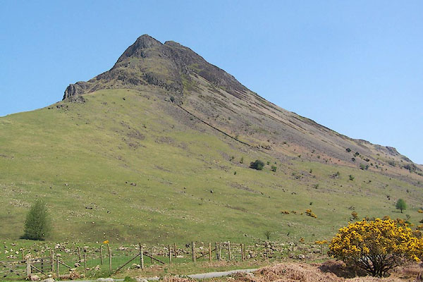 BMB39.jpg (taken 11.5.2006) 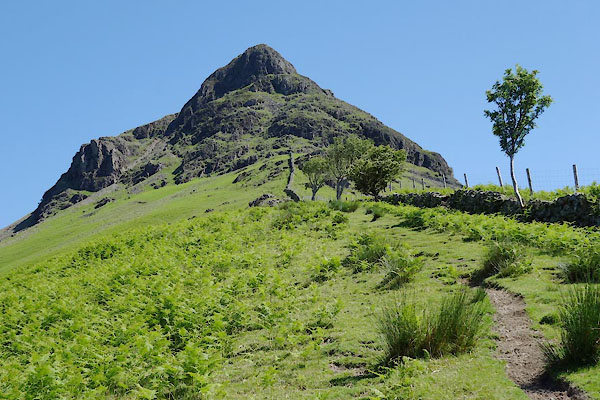 BYO46.jpg (taken 18.6.2013) 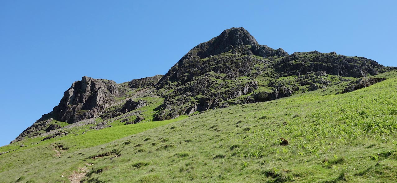 Click to enlarge BYO47.jpg and Dropping Crag. (taken 18.6.2013) 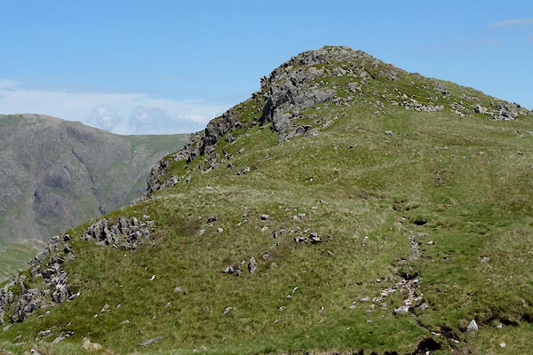 BYO48.jpg Summit. (taken 18.6.2013) 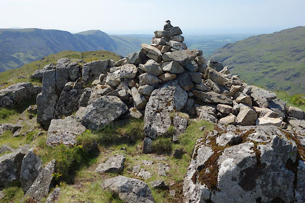 BYO49.jpg Cairn on summit. (taken 18.6.2013) 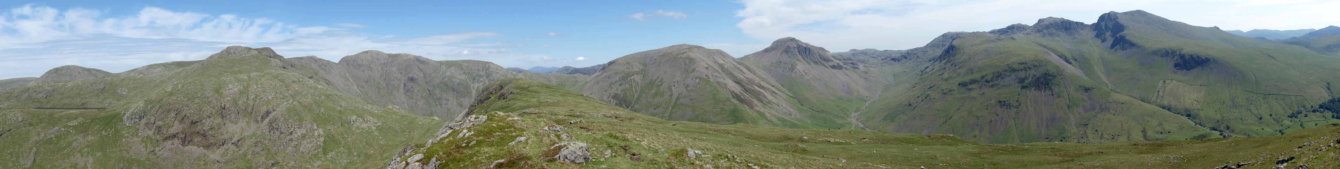 Click to enlarge BYO61.jpg Panorama - Haycock, Red Pike, Pillar, Kirk Fell, Great Gable, Sca Fell. (taken 18.6.2013) |
||
|
|
||
Lakes Guides menu.