 Old Cumbria Gazetteer
 |
 |
|
| Whithaugh Tower, Scotland | ||
| Whithaugh Tower | ||
| country:- | Scotland | |
| locality type:- | tower | |
| 1Km square:- | NY4988 | |
| 10Km square:- | NY48 | |
|
|
||
| evidence:- | old map:- Saxton 1579 placename:- Whithaugh Toure |
|
| source data:- | Map, hand coloured engraving, Westmorlandiae et Cumberlandiae Comitatus ie Westmorland
and Cumberland, scale about 5 miles to 1 inch, by Christopher Saxton, London, engraved
by Augustinus Ryther, 1576, published 1579-1645.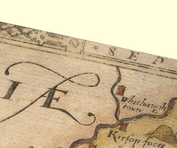 Sax9NY48.jpg Tower, symbol for a house, hall, tower, etc. "Whithaugh toure" item:- private collection : 2 Image © see bottom of page |
|
|
|
||
| evidence:- | old map:- Speed 1611 (Cmd) placename:- Whithaugh Toure |
|
| source data:- | Map, hand coloured engraving, Cumberland and the Ancient Citie
Carlile Described, scale about 4 miles to 1 inch, by John Speed,
1610, published by J Sudbury and George Humble, Popes Head
Alley, London, 1611-12.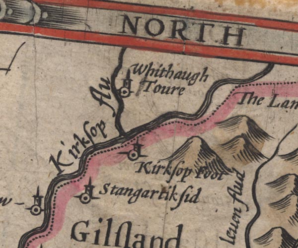 SP11NY48.jpg "Whithaugh Toure" circle, tower; Scotland item:- private collection : 16 Image © see bottom of page |
|
|
|
||
| evidence:- | old map:- Jansson 1646 placename:- Whithaugh Toure |
|
| source data:- | Map, hand coloured engraving, Cumbria and Westmoria, ie
Cumberland and Westmorland, scale about 3.5 miles to 1 inch, by
John Jansson, Amsterdam, Netherlands, 1646.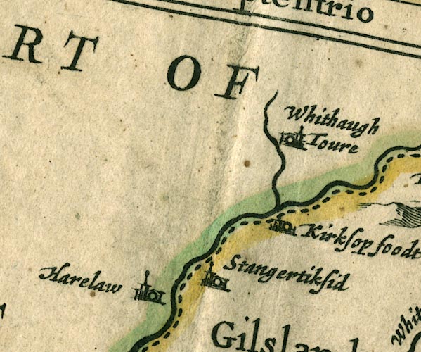 JAN3NY48.jpg "Whithaugh Toure" Buildings and tower. item:- JandMN : 88 Image © see bottom of page |
|
|
|
||
 Lakes Guides menu.