 Old Cumbria Gazetteer
 |
 |
|
| Whitestock Hall, Colton | ||
| Whitestock Hall | ||
| civil parish:- | Colton (formerly Lancashire) | |
| county:- | Cumbria | |
| locality type:- | buildings | |
| coordinates:- | SD32838896 | |
| 1Km square:- | SD3288 | |
| 10Km square:- | SD38 | |
|
|
||
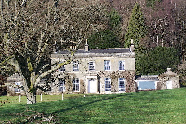 BND12.jpg (taken 2.2.2007) |
||
|
|
||
| evidence:- | old map:- OS County Series (Lan 8 5) placename:- Whitestock Hall |
|
| source data:- | Maps, County Series maps of Great Britain, scales 6 and 25
inches to 1 mile, published by the Ordnance Survey, Southampton,
Hampshire, from about 1863 to 1948. |
|
|
|
||
| evidence:- | old map:- Garnett 1850s-60s H placename:- Whitestock Hall |
|
| source data:- | Map of the English Lakes, in Cumberland, Westmorland and
Lancashire, scale about 3.5 miles to 1 inch, published by John
Garnett, Windermere, Westmorland, 1850s-60s.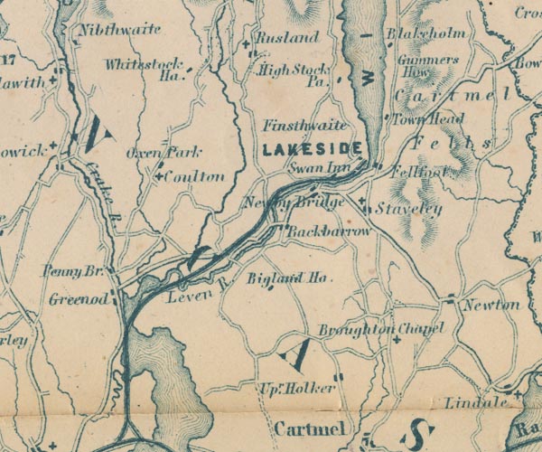 GAR2SD38.jpg "Whitestock Ha." block, building item:- JandMN : 82.1 Image © see bottom of page |
|
|
|
||
| evidence:- | database:- Listed Buildings 2010 placename:- Whitestock Hall |
|
| source data:- | courtesy of English Heritage "WHITESTOCK HALL / / / COLTON / SOUTH LAKELAND / CUMBRIA / II / 421774 / SD3283088960" |
|
|
|
||
| person:- | artist : Romney, George |
|
| place:- | home | |
|
|
||
 Lakes Guides menu.