 Old Cumbria Gazetteer
 |
 |
|
| Whinnah, Lamplugh | ||
| Whinnah | ||
| civil parish:- | Lamplugh (formerly Cumberland) | |
| county:- | Cumbria | |
| locality type:- | buildings | |
| locality type:- | inn (ex) | |
| coordinates:- | NY07662049 | |
| 1Km square:- | NY0720 | |
| 10Km square:- | NY02 | |
| references:- | Listed Buildings 2010 |
|
|
|
||
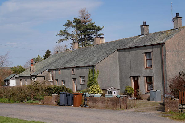 CCU24.jpg (taken 10.4.2015) 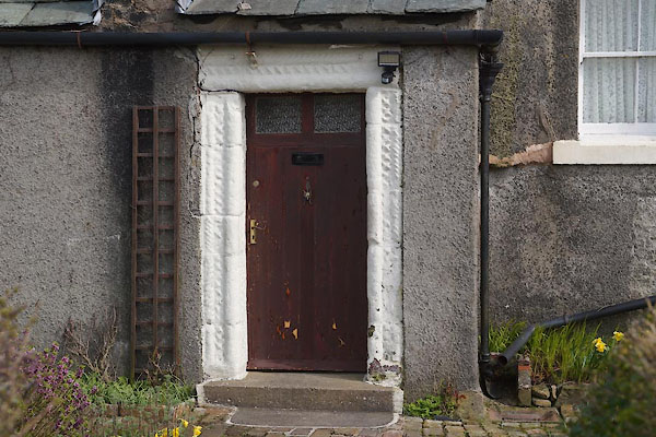 CCU25.jpg Door. (taken 10.4.2015) |
||
|
|
||
| evidence:- | old map:- OS County Series (Cmd 62 14) placename:- Whinnah |
|
| source data:- | Maps, County Series maps of Great Britain, scales 6 and 25
inches to 1 mile, published by the Ordnance Survey, Southampton,
Hampshire, from about 1863 to 1948. |
|
|
|
||
| evidence:- | old map:- Ogilby 1675 (plate 96) placename:- Winnick |
|
| source data:- | Road strip map, hand coloured engraving, the Road from Kendal to
Cockermouth, and the Road from Egremond to Carlisle, scale about
1 inch to 1 mile, by John Ogilby, London, 1675.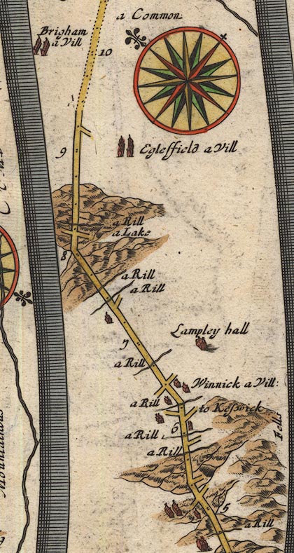 OG96Bm05.jpg In mile 6, Cumberland. "Winnick a Vill:" a house on each side of the road. item:- JandMN : 22 Image © see bottom of page |
|
|
|
||
| evidence:- | old map:- Morden 1695 (Cmd) placename:- Winnick |
|
| source data:- | Map, uncoloured engraving, Cumberland, scale about 4 miles to 1
inch, by Robert Morden, 1695, published by Abel Swale, the
Unicorn, St Paul's Churchyard, Awnsham, and John Churchill, the
Black Swan, Paternoster Row, London, 1695-1715.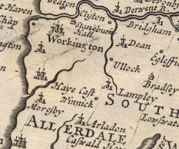 MD12NY02.jpg "Winnick" Circle. item:- JandMN : 90 Image © see bottom of page |
|
|
|
||
| evidence:- | old map:- Bowen 1720 (plate 261) placename:- Winnick |
|
| source data:- | Road strip map, uncoloured engraving, pl.261, the end of the
road from Kendal to Cockermouth and the road from Egremont to
Carlisle, scale about 2 miles to 1 inch, published by Emanuel
Bowen, St Katherines, London, 1720.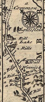 B261m05.jpg At mile 6-7 from Egremont. item:- Dove Cottage : Lowther.36 Image © see bottom of page |
|
|
|
||
| evidence:- | old map:- Bowen and Kitchin 1760 placename:- Winnick |
|
| source data:- | Map, hand coloured engraving, A New Map of the Counties of
Cumberland and Westmoreland Divided into their Respective Wards,
scale about 4 miles to 1 inch, by Emanuel Bowen and Thomas
Kitchin et al, published by T Bowles, Robert Sayer, and John
Bowles, London, 1760.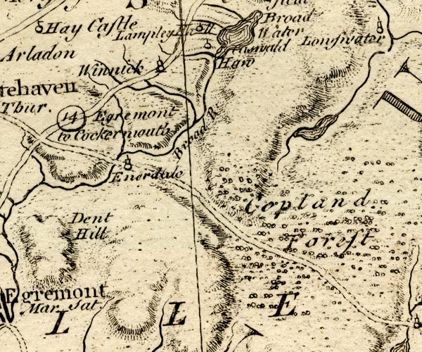 BO18NY01.jpg "Winnick" circle, tower item:- Armitt Library : 2008.14.10 Image © see bottom of page |
|
|
|
||
| evidence:- | old map:- Donald 1774 (Cmd) placename:- Whinah |
|
| source data:- | Map, hand coloured engraving, 3x2 sheets, The County of Cumberland, scale about 1
inch to 1 mile, by Thomas Donald, engraved and published by Joseph Hodskinson, 29
Arundel Street, Strand, London, 1774.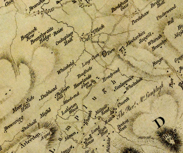 D4NY02SE.jpg "Whinah" block or blocks, labelled in lowercase; a hamlet or just a house item:- Carlisle Library : Map 2 Image © Carlisle Library |
|
|
|
||
| evidence:- | database:- Listed Buildings 2010 placename:- Whinnah Cottages item:- date stone (1700) |
|
| source data:- | courtesy of English Heritage "WHINNAH COTTAGES AND ADJOINING STORE / 2 AND 3 / A5086 / LAMPLUGH / COPELAND / CUMBRIA / II / 76261 / NY0765620495" |
|
|
|
||
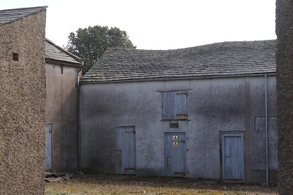 CCU26.jpg (taken 10.4.2015) 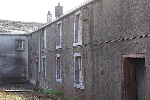 CCU27.jpg (taken 10.4.2015) 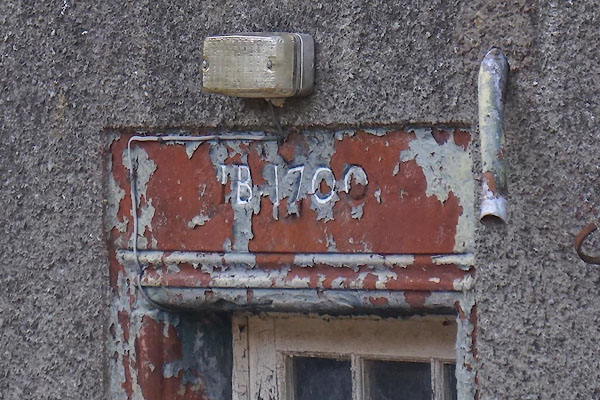 CCU28.jpg Date stone:- "IB 1700" (taken 10.4.2015) |
||
|
|
||
 Lakes Guides menu.