 Old Cumbria Gazetteer
 |
 |
|
| Well Heads, Hincaster | ||
| Well Heads | ||
| civil parish:- | Hincaster (formerly Westmorland) | |
| county:- | Cumbria | |
| locality type:- | buildings | |
| coordinates:- | SD51468605 | |
| 1Km square:- | SD5186 | |
| 10Km square:- | SD58 | |
|
|
||
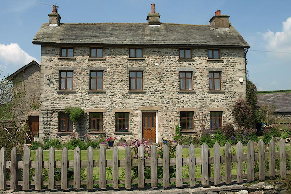 BYM64.jpg (taken 7.6.2013) |
||
|
|
||
| evidence:- | old map:- OS County Series (Wmd 42 8) placename:- Well Heads |
|
| source data:- | Maps, County Series maps of Great Britain, scales 6 and 25
inches to 1 mile, published by the Ordnance Survey, Southampton,
Hampshire, from about 1863 to 1948. |
|
|
|
||
| evidence:- | hearth tax returns:- Hearth Tax 1675 placename:- Well-head-raines |
|
| source data:- | Records, hearth tax survey returns, Westmorland, 1674/75. "Well-head-raines" in "Sigswick" |
|
|
|
||
| evidence:- | old map:- Jefferys 1770 (Wmd) placename:- Well Head |
|
| source data:- | Map, 4 sheets, The County of Westmoreland, scale 1 inch to 1
mile, surveyed 1768, and engraved and published by Thomas
Jefferys, London, 1770.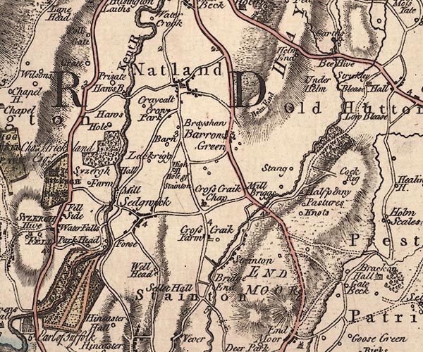 J5SD58NW.jpg "Well Head" circle, labelled in italic lowercase text; settlement, farm, house, or hamlet? item:- National Library of Scotland : EME.s.47 Image © National Library of Scotland |
|
|
|
||
| evidence:- | database:- Listed Buildings 2010 placename:- Well Heads Farm |
|
| source data:- | courtesy of English Heritage "WELL HEADS FARMHOUSE / / WELL HEADS LANE / HINCASTER / SOUTH LAKELAND / CUMBRIA / II / 76446 / SD5146586059" |
|
|
|
||
 Lakes Guides menu.