 Old Cumbria Gazetteer
 |
 |
|
| Tyne Head | ||
| site name:- | South Tyne, River | |
| civil parish:- | Alston Moor (formerly Cumberland) | |
| county:- | Cumbria | |
| locality type:- | locality | |
| coordinates:- | NY753378 (etc) | |
| 1Km square:- | NY7537 | |
| 10Km square:- | NY73 | |
|
|
||
| evidence:- | old map:- Saxton 1579 placename:- South Tyne Flu. |
|
| source data:- | Map, hand coloured engraving, Westmorlandiae et Cumberlandiae Comitatus ie Westmorland
and Cumberland, scale about 5 miles to 1 inch, by Christopher Saxton, London, engraved
by Augustinus Ryther, 1576, published 1579-1645.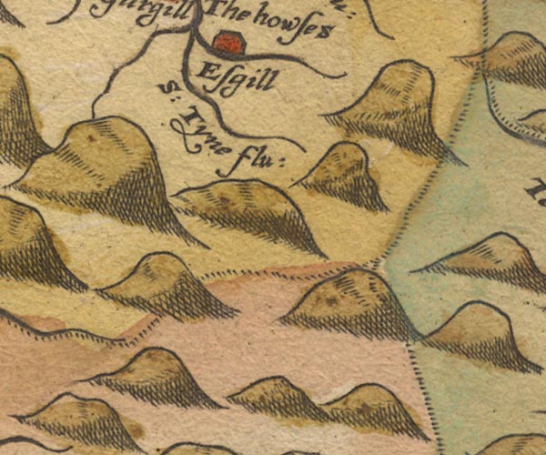 SAX9NY73.jpg "S: Tyne flu:" item:- private collection : 2 Image © see bottom of page |
|
|
|
||
| evidence:- | old map:- Morden 1695 (Cmd) placename:- South Tyne River |
|
| source data:- | Map, uncoloured engraving, Cumberland, scale about 4 miles to 1
inch, by Robert Morden, 1695, published by Abel Swale, the
Unicorn, St Paul's Churchyard, Awnsham, and John Churchill, the
Black Swan, Paternoster Row, London, 1695-1715.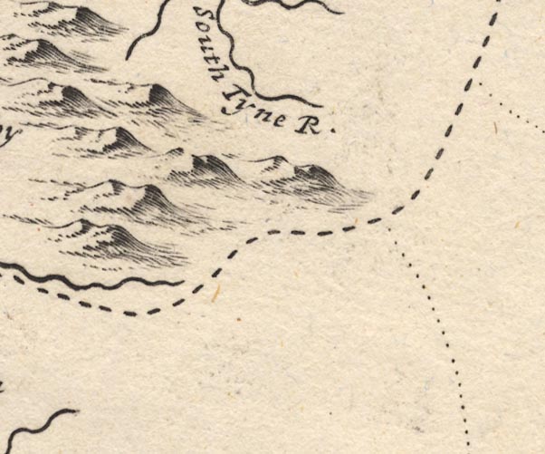 MD12NY73.jpg "South Tyne R." item:- JandMN : 90 Image © see bottom of page |
|
|
|
||
 Lakes Guides menu.