 Old Cumbria Gazetteer
 |
 |
|
| Thackthwaite Hall, Boltons | ||
| Thackthwaite Hall | ||
| civil parish:- | Boltons (formerly Cumberland) | |
| county:- | Cumbria | |
| locality type:- | buildings | |
| coordinates:- | NY26434352 | |
| 1Km square:- | NY2643 | |
| 10Km square:- | NY24 | |
|
|
||
| evidence:- | old map:- OS County Series (Cmd 37 2) placename:- Thackthwaite |
|
| source data:- | Maps, County Series maps of Great Britain, scales 6 and 25
inches to 1 mile, published by the Ordnance Survey, Southampton,
Hampshire, from about 1863 to 1948. |
|
|
|
||
| evidence:- | old map:- Donald 1774 (Cmd) placename:- Thackthwaite |
|
| source data:- | Map, hand coloured engraving, 3x2 sheets, The County of Cumberland, scale about 1
inch to 1 mile, by Thomas Donald, engraved and published by Joseph Hodskinson, 29
Arundel Street, Strand, London, 1774.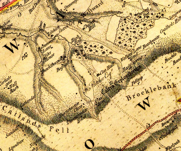 D4NY24SE.jpg "Thackthwaite" no symbol? except trees item:- Carlisle Library : Map 2 Image © Carlisle Library |
|
|
|
||
| evidence:- | old map:- Ford 1839 map placename:- Thackthwaite Hall |
|
| source data:- | Map, uncoloured engraving, Map of the Lake District of
Cumberland, Westmoreland and Lancashire, scale about 3.5 miles
to 1 inch, published by Charles Thurnam, Carlisle, and by R
Groombridge, 5 Paternoster Row, London, 3rd edn 1843.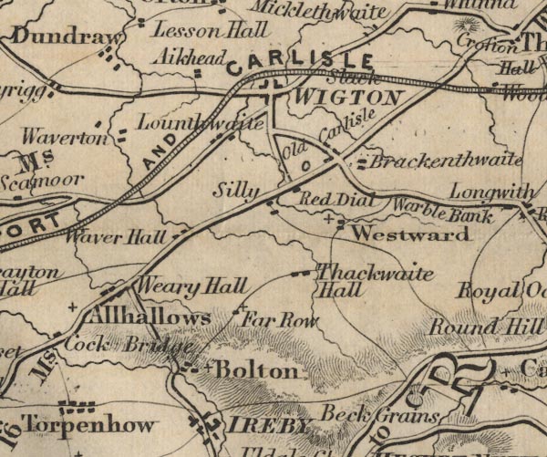 FD02NY24.jpg "Thackthwaite Hall" item:- JandMN : 100.1 Image © see bottom of page |
|
|
|
||
| evidence:- | database:- Listed Buildings 2010 placename:- Thackthwaite Hall item:- date stone (1700) |
|
| source data:- | courtesy of English Heritage "THACKTHWAITE HALL AND ADJOINING BYRE / / / BOLTONS / ALLERDALE / CUMBRIA / II / 72328 / NY2643243520" |
|
|
|
||
 Lakes Guides menu.