 Old Cumbria Gazetteer
 |
 |
|
||||||||||||||||||||||||||||
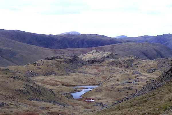
| Sprinkling Tarn, Borrowdale | ||||||||||||||||||||||||||||||
| Sprinkling Tarn | ||||||||||||||||||||||||||||||
| civil parish:- | Borrowdale (formerly Cumberland) | |||||||||||||||||||||||||||||
| county:- | Cumbria | |||||||||||||||||||||||||||||
| locality type:- | tarn | |||||||||||||||||||||||||||||
| coordinates:- | NY22800912 (etc) | |||||||||||||||||||||||||||||
| 1Km square:- | NY2209 | |||||||||||||||||||||||||||||
| 10Km square:- | NY20 | |||||||||||||||||||||||||||||
|
|
||||||||||||||||||||||||||||||
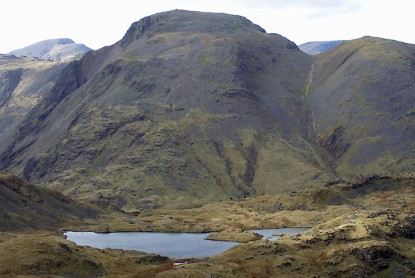 BNG84.jpg and Great Gable. (taken 26.2.2007) 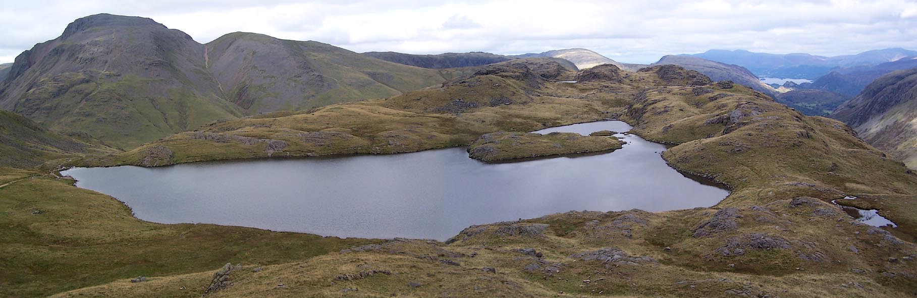 Click to enlarge BRM71.jpg (taken 14.9.2009) |
||||||||||||||||||||||||||||||
|
|
||||||||||||||||||||||||||||||
| evidence:- | old map:- OS County Series (Cmd 75 9) placename:- Sprinkling Tarn |
|||||||||||||||||||||||||||||
| source data:- | Maps, County Series maps of Great Britain, scales 6 and 25
inches to 1 mile, published by the Ordnance Survey, Southampton,
Hampshire, from about 1863 to 1948. |
|||||||||||||||||||||||||||||
|
|
||||||||||||||||||||||||||||||
| evidence:- | old drawing:- Green 1790s-1820s item:- fishing |
|||||||||||||||||||||||||||||
| source data:- | Drawing, pen and ink, fishing, Sprinkling Tarn, Borrowdale, Cumberland, by William
Green, Ambleside, Westmorland, 1800s-10s?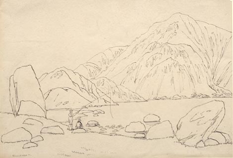 click to enlarge click to enlargePR1741.jpg item:- Dove Cottage : 1994.118.7 Image © see bottom of page |
|||||||||||||||||||||||||||||
|
|
||||||||||||||||||||||||||||||
| evidence:- | old print:- Green 1815 placename:- Sprinkling Tarn item:- sheep |
|||||||||||||||||||||||||||||
| source data:- | Print, coloured aquatint, Sprinkling Tarn, Borrowdale, Cumberland, by William Green,
Ambleside, Westmorland, 1815.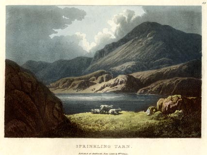 click to enlarge click to enlargeGN0545.jpg Plate 49 in Lake Scenery. printed at upper right:- "49" printed at bottom:- "SPRINKLING TARN. / Published at Ambleside, June 1, 1815, by Wm. Green." item:- Armitt Library : A6646.45 Image © see bottom of page |
|||||||||||||||||||||||||||||
|
|
||||||||||||||||||||||||||||||
| evidence:- | old map:- Otley 1818 |
|||||||||||||||||||||||||||||
| source data:- | Map, uncoloured engraving, The District of the Lakes,
Cumberland, Westmorland, and Lancashire, scale about 4 miles to
1 inch, by Jonathan Otley, 1818, engraved by J and G Menzies,
Edinburgh, Scotland, published by Jonathan Otley, Keswick,
Cumberland, et al, 1833.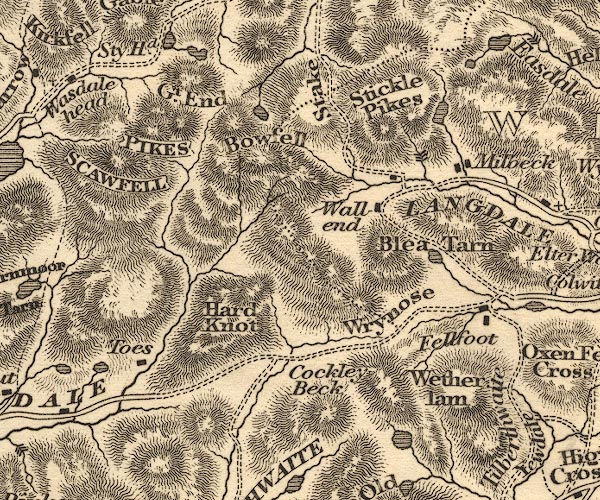 OT02NY20.jpg item:- JandMN : 48.1 Image © see bottom of page |
|||||||||||||||||||||||||||||
|
|
||||||||||||||||||||||||||||||
| evidence:- | descriptive text:- Otley 1823 (5th edn 1834) item:- fishing; trout |
|||||||||||||||||||||||||||||
| source data:- | Guide book, A Concise Description of the English Lakes, the
mountains in their vicinity, and the roads by which they may be
visited, with remarks on the mineralogy and geology of the
district, by Jonathan Otley, published by the author, Keswick,
Cumberland now Cumbria, by J Richardson, London, and by Arthur
Foster, Kirkby Lonsdale, Cumbria, 1823; published 1823-49,
latterly as the Descriptive Guide to the English Lakes. goto source goto sourcePage 37:- "... Sprinkling Tarn, of irregular shape, reposes under Great End Crag: it abounds with excellent trout; but they are too well fed, or too wary, to be easily tempted by the bait of the angler. ..." |
|||||||||||||||||||||||||||||
|
|
||||||||||||||||||||||||||||||
| evidence:- | descriptive text:- Ford 1839 (3rd edn 1843) placename:- Sprinkling Tarn |
|||||||||||||||||||||||||||||
| source data:- | Guide book, A Description of Scenery in the Lake District, by
Rev William Ford, published by Charles Thurnam, Carlisle, by W
Edwards, 12 Ave Maria Lane, Charles Tilt, Fleet Street, William
Smith, 113 Fleet Street, London, by Currie and Bowman,
Newcastle, by Bancks and Co, Manchester, by Oliver and Boyd,
Edinburgh, and by Sinclair, Dumfries, 1839. goto source Page 70:- "..." "... [Stye Head etc] ... The tarn under Great End Crag is a fine subject for the pencil. ... Sprinkling Tarn, noted by all anglers for its trout. ..." |
|||||||||||||||||||||||||||||
|
|
||||||||||||||||||||||||||||||
| evidence:- | old text:- Miller 1847 placename:- Sparkling Tarn item:- rain gauge; rainfall |
|||||||||||||||||||||||||||||
| source data:- | Book, Report on the Fall of Rain in the Lake Districts of
Cumberland and Westmoreland in 1846, by John Fletcher Miller,
printed by G Irwin, Lowther Street, Whitehaven, Cumberland, 1847. goto source Page 4:- "Note. The Lake district Gauges are five inches in diameter; they are all of the same construction, and are elevated about eighteen inches above the surface. The funnel rims are of stout sheet brass, so that the apertures cannot readily lose their circular form. The Metres were all made by Bate of the Poultry, London. - The Rain is read off daily at 9 A.M." "..." goto sourcePage 8:- 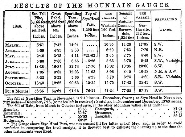 MI02Tab3.jpg goto sourcePage 9:- "REMARKS ON MOUNTAIN GAUGES." "The Mountain Gauges are on pretty much the same construction as those in the vallies, but the receivers are much more capacious, being calculated to hold nearly 80 inches of Rain." "..." "The Gauge ... [at] Sparkling Tarn is about 600 feet above the top of Stye Head Pass, ..." ".."
|
|||||||||||||||||||||||||||||
|
|
||||||||||||||||||||||||||||||
| evidence:- | old map:- Garnett 1850s-60s H placename:- Sprinkling Tarn |
|||||||||||||||||||||||||||||
| source data:- | Map of the English Lakes, in Cumberland, Westmorland and
Lancashire, scale about 3.5 miles to 1 inch, published by John
Garnett, Windermere, Westmorland, 1850s-60s.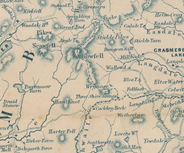 GAR2NY20.jpg "Sprinkling Tarn" outline with shore form lines, lake or tarn item:- JandMN : 82.1 Image © see bottom of page |
|||||||||||||||||||||||||||||
|
|
||||||||||||||||||||||||||||||
| evidence:- | old photograph:- Bell 1880s-1940s |
|||||||||||||||||||||||||||||
| source data:- | Photograph, sepia, camping at Sprinkling Tarn, Borrowdale, Cumberland, by Herbert
Bell, Strawberry Bank, Ambleside, Westmorland, about 1890s-1900s.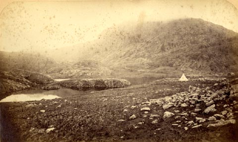 click to enlarge click to enlargeHB1000.jpg internegative at lower left:- "H. Bell." item:- Armitt Library : 1958.3186.1 Image © see bottom of page |
|||||||||||||||||||||||||||||
|
|
||||||||||||||||||||||||||||||
| evidence:- | old photograph:- Bell 1880s-1940s |
|||||||||||||||||||||||||||||
| source data:- | Photograph, black and white, Sprinkling Tarn and Great Gable from Esk Hause, Cumberland,
by Herbert Bell, photographer, Ambleside, Westmorland, 1890s.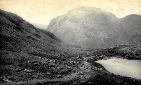 click to enlarge click to enlargeHB0578.jpg internegative at lower left:- "H. Bell" item:- Armitt Library : ALPS238 Image © see bottom of page |
|||||||||||||||||||||||||||||
|
|
||||||||||||||||||||||||||||||
| evidence:- | old print:- MacBride 1922 placename:- Sprinkling Tarn |
|||||||||||||||||||||||||||||
| source data:- | Print, colour, Sprinkling Tarn and Great Gable, by Alfred Heaton Cooper, published
by Adam and Charles Black, 4-6 Soho Square, London, 2nd edn 1928.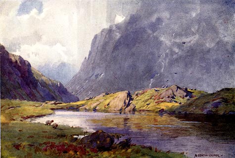 click to enlarge click to enlargeMB0104.jpg Tipped in opposite p.17 in Wild Lakeland by MacKenzie MacBride. printed at bottom:- "SPRINKLING TARN AND GREAT GABLE" signed at lower right:- "A. HEATON COOPER" item:- JandMN : 195.6 Image © see bottom of page |
|||||||||||||||||||||||||||||
|
|
||||||||||||||||||||||||||||||
 BNG85.jpg (taken 26.2.2007) 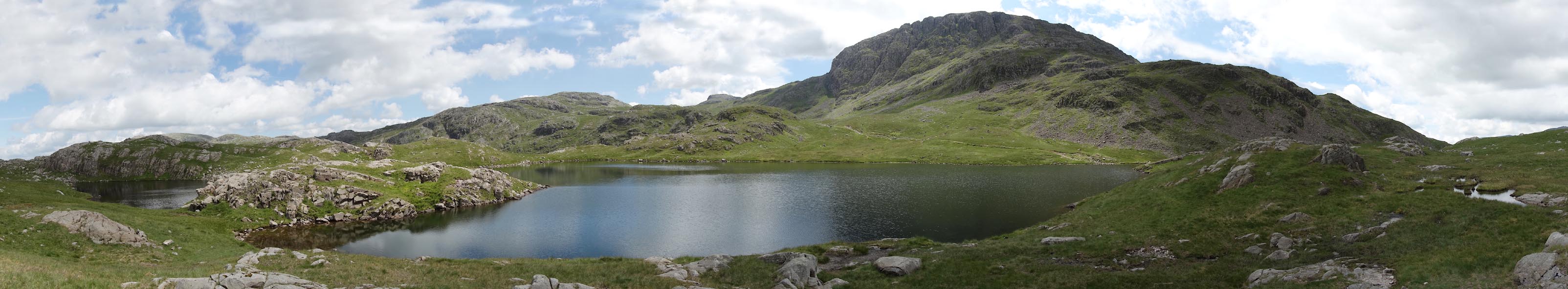 Click to enlarge CAY94.jpg (taken 23.6.2014) |
||||||||||||||||||||||||||||||
|
|
||||||||||||||||||||||||||||||
| hearsay:- |
Rainfall of more than 200 inches in a year has been recorded here. |
|||||||||||||||||||||||||||||
|
|
||||||||||||||||||||||||||||||
Lakes Guides menu.