 Old Cumbria Gazetteer
 |
 |
|
| South End Haws, Walney Island | ||
| South End Haws | ||
| locality:- | Walney Island | |
| civil parish:- | Barrow-in-Furness (formerly Lancashire) | |
| county:- | Cumbria | |
| coordinates:- | SD21646193 (etc) | |
| 1Km square:- | SD2161 | |
| 10Km square:- | SD26 | |
|
|
||
| evidence:- | possibly old map:- Mercator 1595 (edn?) placename:- South End placename:- End, South |
|
| source data:- | Map, hand coloured engraving, Westmorlandia, Lancastria, Cestria
etc, ie Westmorland, Lancashire, Cheshire etc, scale about 10.5
miles to 1 inch, by Gerard Mercator, Duisberg, Germany, 1595,
edition 1613-16.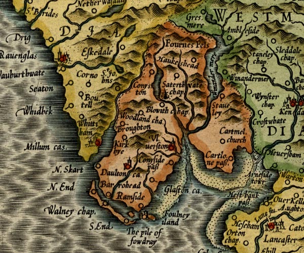 MER5LanA.jpg "S. End" circle item:- Armitt Library : 2008.14.3 Image © see bottom of page |
|
|
|
||
| evidence:- | old map:- West 1784 map placename:- South End Haws |
|
| source data:- | Map, hand coloured engraving, A Map of the Lakes in Cumberland,
Westmorland and Lancashire, scale about 3.5 miles to 1 inch,
engraved by Paas, 53 Holborn, London, about 1784.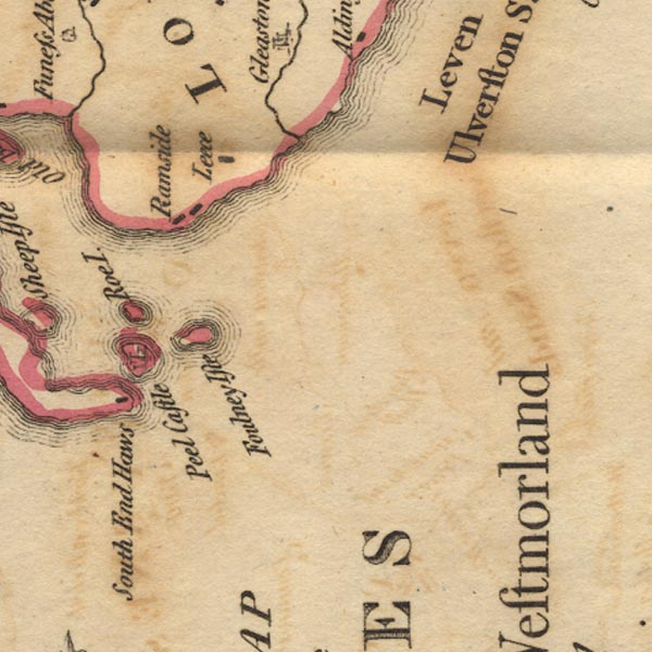 Ws02SD26.jpg item:- Armitt Library : A1221.1 Image © see bottom of page |
|
|
|
||
 Lakes Guides menu.