 Old Cumbria Gazetteer
 |
 |
|
| Shaking Bridge, Bolton Low Houses | ||
| Shaking Bridge | ||
| site name:- | Waver, River | |
| locality:- | Bolton Low Houses | |
| civil parish:- | Boltons (formerly Cumberland) | |
| civil parish:- | Wigton (formerly Cumberland) | |
| county:- | Cumbria | |
| locality type:- | bridge | |
| coordinates:- | NY23924452 | |
| 1Km square:- | NY2344 | |
| 10Km square:- | NY24 | |
|
|
||
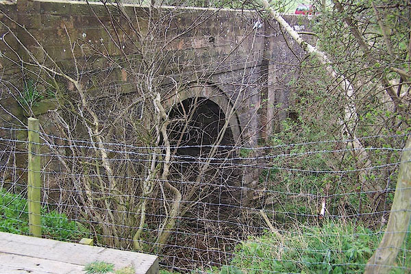 BNO35.jpg (taken 11.4.2007) 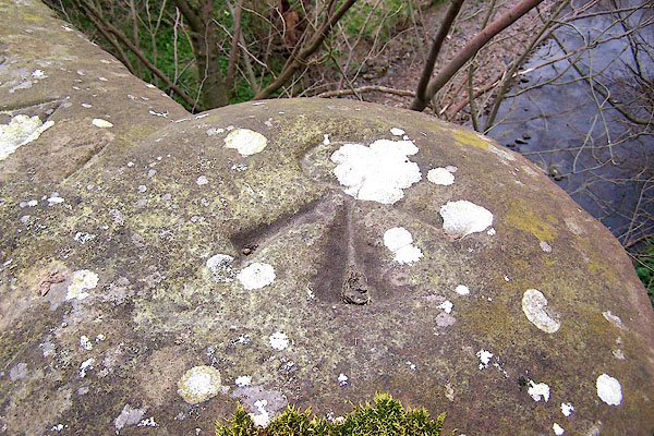 BNO36.jpg Bench mark, pivot? on the top of the parapet. (taken 11.4.2007) |
||
|
|
||
| evidence:- | old map:- OS County Series (Cmd 37 1) placename:- Shaking Bridge |
|
| source data:- | Maps, County Series maps of Great Britain, scales 6 and 25
inches to 1 mile, published by the Ordnance Survey, Southampton,
Hampshire, from about 1863 to 1948. |
|
|
|
||
| evidence:- | old map:- Ogilby 1675 (plate 96) |
|
| source data:- | Road strip map, hand coloured engraving, the Road from Kendal to
Cockermouth, and the Road from Egremond to Carlisle, scale about
1 inch to 1 mile, by John Ogilby, London, 1675.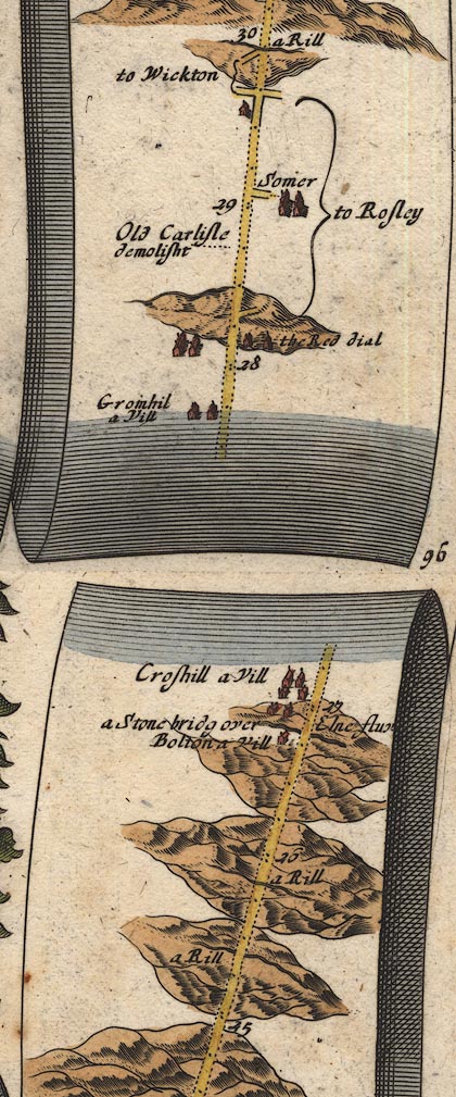 OG96Bm25.jpg In mile 26, Cumberland. Road crosses the river by:- "a Stone bridg over Elne fluv" no bridge is drawn. item:- JandMN : 22 Image © see bottom of page |
|
|
|
||
| evidence:- | old map:- Bowen 1720 (plate 261) |
|
| source data:- | Road strip map, uncoloured engraving, pl.261, the end of the
road from Kendal to Cockermouth and the road from Egremont to
Carlisle, scale about 2 miles to 1 inch, published by Emanuel
Bowen, St Katherines, London, 1720.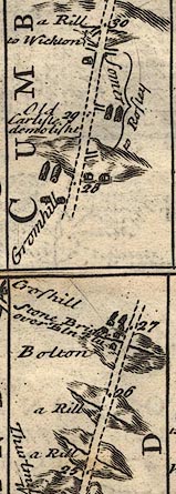 B261m25.jpg "Stone Bridge over Eln Flu" About mile 27 from Egremont. item:- Dove Cottage : Lowther.36 Image © see bottom of page |
|
|
|
||
| evidence:- | old map:- Donald 1774 (Cmd) placename:- Shaken Bridge |
|
| source data:- | Map, hand coloured engraving, 3x2 sheets, The County of Cumberland, scale about 1
inch to 1 mile, by Thomas Donald, engraved and published by Joseph Hodskinson, 29
Arundel Street, Strand, London, 1774.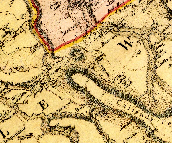 D4NY24SW.jpg "Shaken Bridge" block or blocks, labelled in lowercase; a hamlet or just a house and road/river crossing item:- Carlisle Library : Map 2 Image © Carlisle Library |
|
|
|
||
| evidence:- | old map:- Bell 1892 placename:- Shaking Bridge |
|
| source data:- | Map, colour lithograph, Road Map of Cumberland, by George Joseph
Bell, scale about 2.5 miles to 1 inch, printed by Charles
Thurnam and Sons, Carlisle, Cumberland, 1892.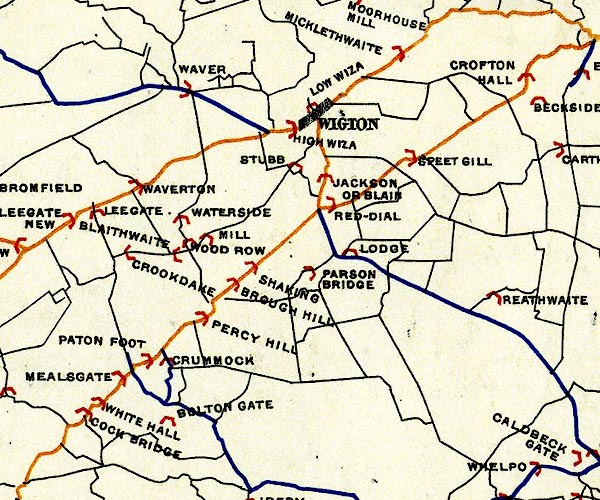 BEL9NY24.jpg "SHAKING" bridge symbol Road map of Cumberland showing County Bridges item:- Carlisle Library : Map 38 Image © Carlisle Library |
|
|
|
||
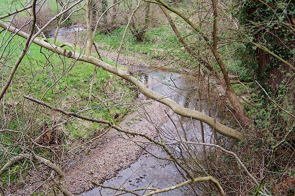 BNO37.jpg View of river. (taken 11.4.2007) |
||
|
|
||
 Lakes Guides menu.