 Old Cumbria Gazetteer
 |
 |
|
| salt pans, Crosscanonby | ||
| Saltpans | ||
| Crosscanonby Salt Pans | ||
| civil parish:- | Crosscanonby (formerly Cumberland) | |
| county:- | Cumbria | |
| locality type:- | salt pans | |
| locality type:- | buildings | |
| coordinates:- | NY06684013 (etc) | |
| 1Km square:- | NY0640 | |
| 10Km square:- | NY04 | |
|
|
||
 BPH78.jpg Salt pan. the structure on the beach is visible in the background. (taken 14.6.2008) 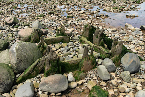 BPH79.jpg Remains of water tank scaffold on the beach. (taken 14.6.2008) |
||
|
|
||
| evidence:- | old map:- Donald 1774 (Cmd) |
|
| source data:- | Map, hand coloured engraving, 3x2 sheets, The County of Cumberland, scale about 1
inch to 1 mile, by Thomas Donald, engraved and published by Joseph Hodskinson, 29
Arundel Street, Strand, London, 1774.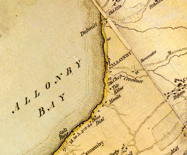 D4NY04SE.jpg "Salt Pans" block or blocks, labelled in lowercase; a hamlet or just a house; or salt pans on the foreshore? item:- Carlisle Library : Map 2 Image © Carlisle Library |
|
|
|
||
| evidence:- | old map:- Ford 1839 map |
|
| source data:- | Map, uncoloured engraving, Map of the Lake District of
Cumberland, Westmoreland and Lancashire, scale about 3.5 miles
to 1 inch, published by Charles Thurnam, Carlisle, and by R
Groombridge, 5 Paternoster Row, London, 3rd edn 1843.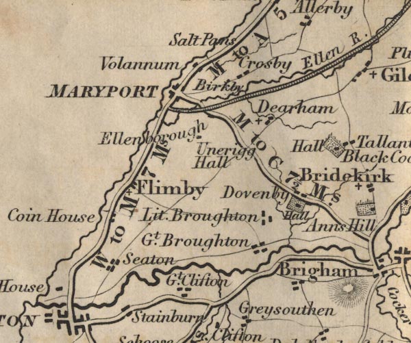 FD02NY03.jpg "Salt Pans" item:- JandMN : 100.1 Image © see bottom of page |
|
|
|
||
| hearsay:- |
Crosscanonby Salt Pans were leased to Richard Barwise in 1634, they were probably
began about 1630. A land survey of 1699 calls them Mr Lamplugh's salt pans; and shows
another set of salt pans south of Crosscanonby which belonged to the Senhouse Family
of Netherhall, the Netherhall Salt Pans. The saltern probably ceased working in the
1760s. |
|
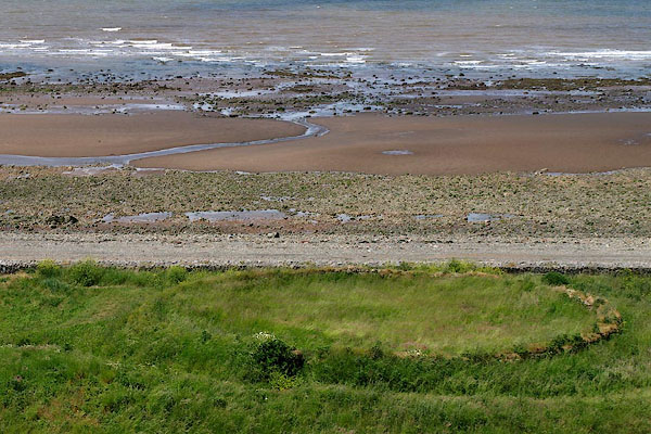
| On the beach was a water tank on a wooden scaffold, whose footings remain, from which
sea water ran onto the sleech in the kinch. Sleech is salt laden sand from the beach;
the kinch, where it was piled up is the large round pond, sealed by puddled clay,
that can be seen clearly on the site. The strong brine from the kinch trickled down
to the brine pit just to the south. The brine was then boiled in iron pans to produce
salt, which crystalized out of the brine. Coal for the saltern came from Crosshow,
near Dearham. |
||
| From 1698 a salt tax was levied. One salt officer was John Smith, d.1730, whose tombstone
is at Crosscanonby church, with a carving of him at his desk. |
||
| The new coast road was built 1824 and went through the site; the kinch and the salters'
cottages were all that was obviously visible. One of the cottages was a pub, possibly
called The Solway Inn, for a time. |
||
|
|
||
| :- |
18th century washing and settling tanks on the shore. |
|
|
|
||
 Lakes Guides menu.