 Old Cumbria Gazetteer
 |
 |
|
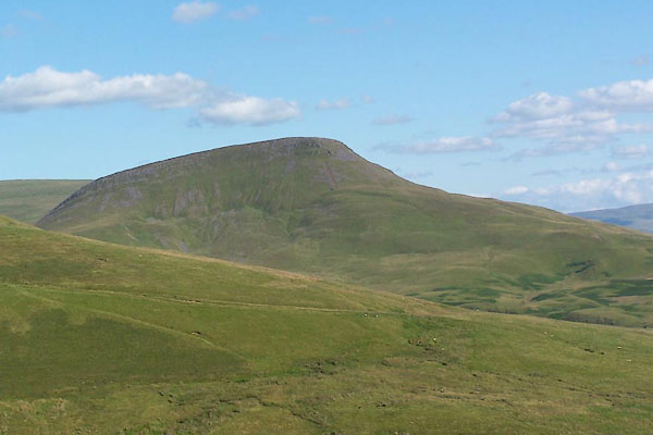
| Roman Fell, Warcop | ||
| Roman Fell | ||
| civil parish:- | Warcop (formerly Westmorland) | |
| civil parish:- | Murton (formerly Westmorland) | |
| county:- | Cumbria | |
| locality type:- | hill | |
| locality type:- | fell | |
| coordinates:- | NY75432036 (etc) | |
| 1Km square:- | NY7520 | |
| 10Km square:- | NY72 | |
| altitude:- | 1946 feet | |
| altitude:- | 593m | |
|
|
||
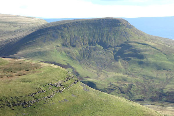 CGR58.jpg (taken 5.10.2017) 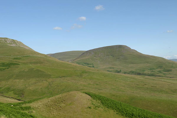 BVB31.jpg (taken 24.7.2011) |
||
|
|
||
| evidence:- | old map:- OS County Series (Wmd 16 2) placename:- Roman Fell |
|
| source data:- | Maps, County Series maps of Great Britain, scales 6 and 25
inches to 1 mile, published by the Ordnance Survey, Southampton,
Hampshire, from about 1863 to 1948. |
|
|
|
||
| evidence:- | old map:- Morden 1695 (Wmd) placename:- Romanfell placename:- Rumary Fell |
|
| source data:- | Map, hand coloured engraving, Westmorland, scale about 2.5 miles to 1 inch, by Robert
Morden, published by Abel Swale, the Unicorn, St Paul's Churchyard, Awnsham, and John
Churchill, the Black Swan, Paternoster Row, London, 1695.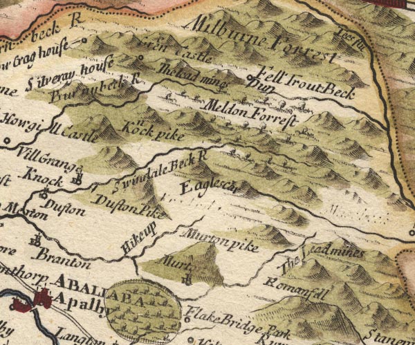 MD10NY72.jpg "Romanfell"  MD10NY71.jpg "Rumary Fell" Hillocks. Morden might have plotted the fell twice, perhaps copying from different sources. item:- JandMN : 24 Image © see bottom of page |
|
|
|
||
| evidence:- | old map:- Badeslade 1742 placename:- Rumary Fells |
|
| source data:- | Map, uncoloured engraving, A Map of Westmorland North from
London, scale about 10 miles to 1 inch, with descriptive text,
by Thomas Badeslade, London, engraved and published by William
Henry Toms, Union Court, Holborn, London, 1742. click to enlarge click to enlargeBD12.jpg "Rumary Fell[s]" hillocks item:- Dove Cottage : 2007.38.62 Image © see bottom of page |
|
|
|
||
| evidence:- | old map:- Simpson 1746 map (Wmd) placename:- Rumary Fell |
|
| source data:- | Map, uncoloured engraving, Westmorland, scale about 8 miles to 1
inch, printed by R Walker, Fleet Lane, London, 1746.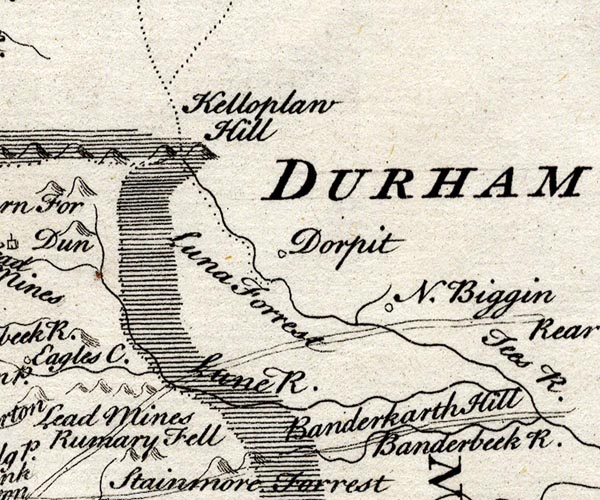 SMP2NYW.jpg "Rumary Fell" Hillock. item:- Dove Cottage : 2007.38.59 Image © see bottom of page |
|
|
|
||
| evidence:- | old map:- Bowen and Kitchin 1760 placename:- Rumary Fell |
|
| source data:- | Map, hand coloured engraving, A New Map of the Counties of
Cumberland and Westmoreland Divided into their Respective Wards,
scale about 4 miles to 1 inch, by Emanuel Bowen and Thomas
Kitchin et al, published by T Bowles, Robert Sayer, and John
Bowles, London, 1760.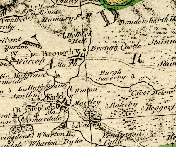 BO18NY71.jpg "Rumary Fell" hill hachuring item:- Armitt Library : 2008.14.10 Image © see bottom of page |
|
|
|
||
| evidence:- | old map:- Jefferys 1770 (Wmd) placename:- Roman Fell |
|
| source data:- | Map, 4 sheets, The County of Westmoreland, scale 1 inch to 1
mile, surveyed 1768, and engraved and published by Thomas
Jefferys, London, 1770.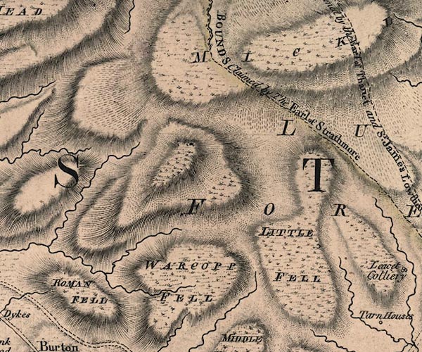 J5NY72SE.jpg "ROMAN FELL" hill hachuring; hill or mountain item:- National Library of Scotland : EME.s.47 Image © National Library of Scotland |
|
|
|
||
 BVB90.jpg (taken 24.7.2011) 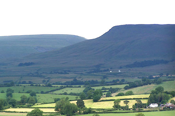 BMI05.jpg (taken 7.7.2006) |
||
|
|
||
 Lakes Guides menu.