 Old Cumbria Gazetteer
 |
 |
|
| Rathmoss, Pennington | ||
| Rathmoss | ||
| civil parish:- | Pennington (formerly Lancashire) | |
| county:- | Cumbria | |
| locality type:- | buildings | |
| coordinates:- | SD25388049 | |
| 1Km square:- | SD2580 | |
| 10Km square:- | SD28 | |
|
|
||
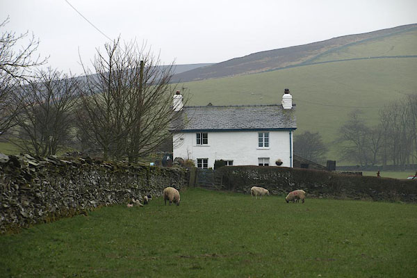 BOW71.jpg (taken 26.3.2008) |
||
|
|
||
| evidence:- | old map:- Yates 1786 placename:- Road Moss |
|
| source data:- | Map, engraving, The County Palatine of Lancaster, scale about 1
inch to 1 mile, by William Yates, published, London, 1786. "Road Moss" |
|
|
|
||
| evidence:- | old map:- Otley 1818 placename:- Road Moss |
|
| source data:- | Map, uncoloured engraving, The District of the Lakes,
Cumberland, Westmorland, and Lancashire, scale about 4 miles to
1 inch, by Jonathan Otley, 1818, engraved by J and G Menzies,
Edinburgh, Scotland, published by Jonathan Otley, Keswick,
Cumberland, et al, 1833.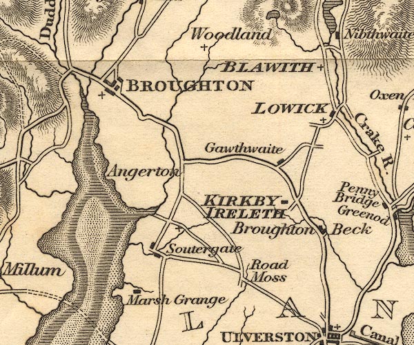 OT02SD28.jpg item:- JandMN : 48.1 Image © see bottom of page |
|
|
|
||
| evidence:- | old map:- Greenwood 1824 placename:- Rad Moss |
|
| source data:- | Maps, Map of the County of Westmorland, scale about 1 inch to 1
mile, and Map of the County of Cumberland, scale about 1 inch to
1 mile, etc, by C and J Greenwood, published by George Pringle
jnr, 70 Queen Street, Cheapside, London, 1823 and 1824
respectively. "Rad Moss" |
|
|
|
||
| evidence:- | old map:- Ford 1839 map placename:- Road Moss |
|
| source data:- | Map, uncoloured engraving, Map of the Lake District of
Cumberland, Westmoreland and Lancashire, scale about 3.5 miles
to 1 inch, published by Charles Thurnam, Carlisle, and by R
Groombridge, 5 Paternoster Row, London, 3rd edn 1843.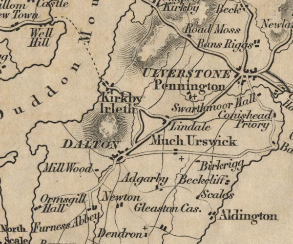 FD02SD27.jpg "Road Moss" item:- JandMN : 100.1 Image © see bottom of page |
|
|
|
||
 Lakes Guides menu.