 Old Cumbria Gazetteer
 |
 |
|
| Rannerdale Knotts, Buttermere | ||
| Rannerdale Knotts | ||
| civil parish:- | Buttermere (formerly Cumberland) | |
| county:- | Cumbria | |
| locality type:- | hill | |
| locality type:- | rocks | |
| coordinates:- | NY166183 | |
| 1Km square:- | NY1618 | |
| 10Km square:- | NY11 | |
| altitude:- | 1165 feet | |
| altitude:- | 355m | |
|
|
||
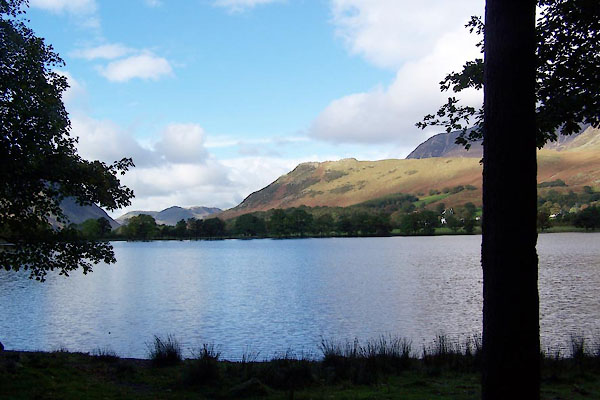
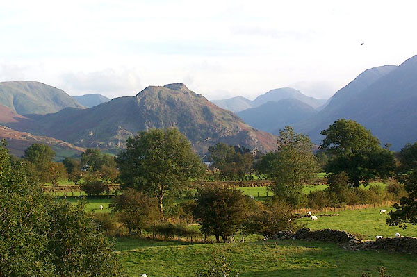 BJY18.jpg From the north. (taken 14.10.2005) 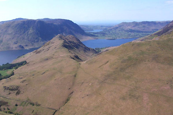 BUM98.jpg (taken 3.5.2011) |
||
|
|
||
| MN photo:- |
A rock atop the knotts. |
|
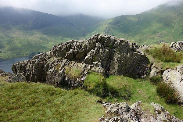 CAY12.jpg (taken 11.6.2014) 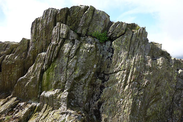 CAY13.jpg (taken 11.6.2014) 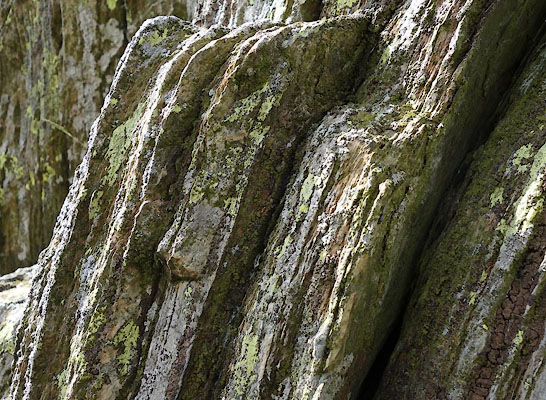 CAY14.jpg (taken 11.6.2014) |
||
|
|
||
| evidence:- | old map:- Crosthwaite 1783-94 (But/Cru/Low) placename:- Rannerdale Knot |
|
| source data:- | Map, uncoloured engraving, An Accurate Map of Buttermere,
Crummock and Loweswater Lakes, scale about 3 inches to 1 mile,
by Peter Crosthwaite, Keswick, Cumberland, 1794, version
published 1800. CT08Vgn2.jpg "Rannerdale Knot as it appears from the Author's 1st. Station" item:- Armitt Library : 1959.191.2 Image © see bottom of page |
|
|
|
||
| evidence:- | old painting:- Green 1790s-1820s item:- clouds |
|
| source data:- | Painting, watercolour, Crummock Water looking towards Rannerdale Knotts, Buttermere,
Cumberland, by William Green, Ambleside, Westmorland, 1800s-10s?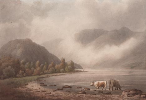 click to enlarge click to enlargePR1753.jpg item:- Dove Cottage : 2010.57.2 Image © see bottom of page |
|
|
|
||
| evidence:- | old print:- Green 1814 (plate 40) item:- cattle |
|
| source data:- | Print, uncoloured soft ground etching, Crummock Water, Buttermere, Cumberland, by
William Green, Ambleside, Westmorland, 1814. click to enlarge click to enlargeGN0940.jpg Plate 40 in Sixty Small Prints. printed at top right:- "40" printed at bottom:- "CRUMMOCK WATER. / Published at Ambleside Augst. 1, 1814, by Wm. Green." item:- Armitt Library : A6656.40 Image © see bottom of page |
|
|
|
||
| evidence:- | old print:- Green 1814 (plate 40) item:- cattle |
|
| source data:- | Print, tinted soft ground etching, Crummock Water, Buttermere, Cumberland, by William
Green, Ambleside, Westmorland, 1814.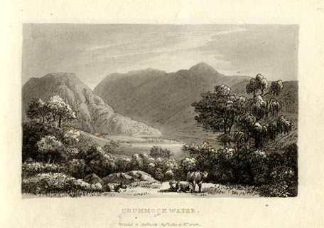 click to enlarge click to enlargeGN1040.jpg Plate 40 in Sixty Small Prints. printed at top right:- "40" printed at bottom:- "CRUMMOCK WATER. / Published at Ambleside Augst. 1, 1814, by Wm. Green." item:- Armitt Library : A6653.40 Image © see bottom of page |
|
|
|
||
| evidence:- | outline view:- Otley 1823 (4th edn 1830) placename:- Rannerdale Knot |
|
| source data:- | Print, engraving, outline view, The Mountains of Crummock and Buttermere as seen on
the Road between Scale-Hill and Loweswater, published by Jonathan Otley, Keswick,
Cumberland et al, 1830.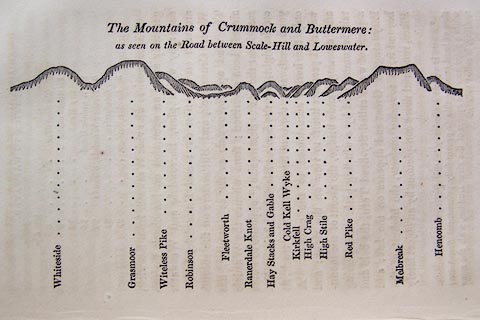 click to enlarge click to enlargeO75E07.jpg p.125 in A Concise Description of the English Lakes, by Jonathan Otley, 4th edition, 1830. "The Mountains of Crummock and Buttermere: / as seen on the Road between Scale-Hill and Loweswater." "Whiteside / Grasmoor / Witeless Pike / Robinson / Fleetworth / Rannerdale Knot / Hay Stacks and Gable / Cold Kell Wyke / Kirkfell / High Crag / High Stile / Red Pike / Melbreak / Hencomb" item:- Armitt Library : A1175.7 Image © see bottom of page |
|
|
|
||
| evidence:- | outline view:- Otley 1823 (8th edn 1849) placename:- Rannerdale Knot |
|
| source data:- | Engraving, outline view of mountains, Crummock and Buttermere from the Road near Loweswater
Church, drawn by T Binns, engraved by O Jewitt, opposite p.18 of A Descriptive Guide
of the English Lakes, by Jonathan Otley, 8th edition, 1849.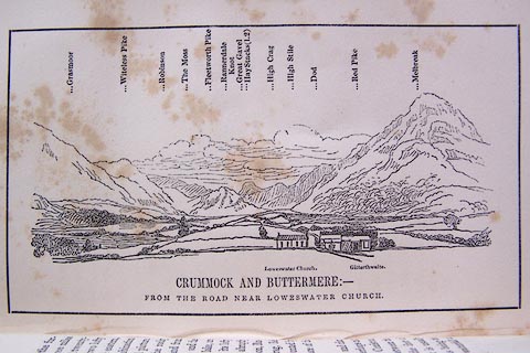 click to enlarge click to enlargeO80E10.jpg item:- Armitt Library : A1180.11 Image © see bottom of page |
|
|
|
||
| evidence:- | outline view:- Otley 1823 (5th edn 1834) placename:- Rannerdale Knot |
|
| source data:- | Print, woodcut outline view, The Mountains of Crummock and
Buttermere, by Jonathan Otley, Keswick, Cumberland, 1830.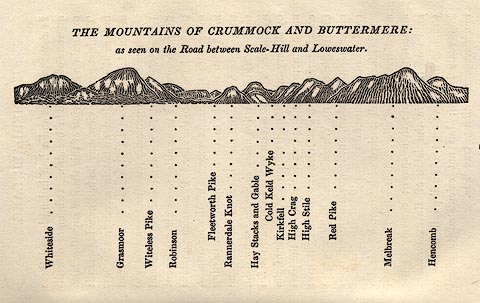 click to enlarge click to enlargeOT2E05.jpg Printed on p.25 of A Concise Description of the English Lakes, by Jonathan Otley, 5th edition, 1834. "THE MOUNTAINS OF CRUMMOCK AND BUTTERMERE: as seen on the Road between Scale-Hill and Loweswater." "Whiteside / Grasmoor / Witeless Pike / Robinson / Fleetworth Pike / Rannerdale Knot / Hay Stacks and Gable / Cold Keld Wyke / Kirkfell / High Crag / High Stile / Red Pike / Melbreak / Hencomb" item:- JandMN : 48.6 Image © see bottom of page |
|
|
|
||
| evidence:- | outline view:- Martineau 1855 placename:- Rannerdale Knott |
|
| source data:- | Print, engraving, outline view, Mountains seen from Lanthwaite Wood Crummock Water,
drawn by L Aspland, engraved by W Banks, Edinburgh, published by John Garnett, Windermere,
Westmorland, and by Whittaker and Co, London, 1855.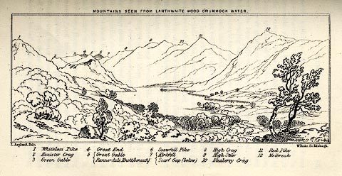 click to enlarge click to enlargeMNU113.jpg Opposite p.84 in A Complete Guide to the English Lakes, by Harriet Martineau. The view is captioned, numbers referring to mountains in the image:- "1 Whiteless Pike, 2 Honister Crag, 3 Green Gable, 4 Great End, 5 Great Gable / Rannerdale Knott (beneath), 6 Scawfell Pike, 7 Kirkfell / Scarf Gap (below), 8 High Crag, 9 High Stile, 10 Bleaberry Crag, 11 Red Pike, 12 Melbreak." "MOUNTAINS SEEN FROM LANTHWAITE WOOD CRUMMOCK WATER." "L Aspland Delt. / W Banks Sc Edinr." item:- Armitt Library : A1159.13 Image © see bottom of page |
|
|
|
||
| evidence:- | outline view:- Black 1856 placename:- Rannerdale Knot |
|
| source data:- | Print, lithograph, Outline Views, Buttermere - Mountains as seen from the Knots near
the Hotel at Buttermere, and Mountains as seen at the Seat in Lanthwaite Wood, Scale
Hill, by J Flintoft, Keswick, Cumberland, engraved by R Mason, Edinburgh, Lothian,
about 1900. click to enlarge click to enlargeBC08E5.jpg "... 17 Rannerdale Knot ... 6 Rannerdale Knot ..." item:- JandMN : 37.19 Image © see bottom of page |
|
|
|
||
| evidence:- | outline view:- Black 1841 (3rd edn 1846) placename:- Rannerdale Knot |
|
| source data:- | Print, engraving, outline view, Mountains as seen from The Knots near the Victoria
at Buttermere, and Mountains as seen at the Seat in Lanthwaite Wood, Scale Hill, by
J Flintoft, Keswick, Cumberland, engraved by R Mason, Edinburgh, Lothian, about 1846.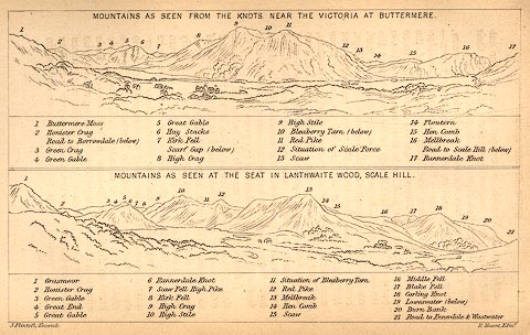 click to enlarge click to enlargeBC02E7.jpg "... 17 Rannerdale Knot ... 6 Rannerdale Knot ..." item:- JandMN : 32.11 Image © see bottom of page |
|
|
|
||
| evidence:- | perhaps old print:- Rose 1832-35 (vol.1 no.52) |
|
| source data:- | Print, uncoloured engraving, Crummock Water, Cumberland, drawn by Thomas Allom, engraved
by W le Petit, published by Fisher, Son and Co, London, 1833.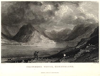 click to enlarge click to enlargePR0020.jpg vol.1 pl.52 in the set of prints, Westmorland, Cumberland, Durham and Northumberland Illustrated. printed at bottom left, right, centre:- "T. Allom. / W. Le Petit. / CRUMMOCK WATER, CUMBERLAND. / FISHER, SON &CO. LONDON, 1833." item:- Dove Cottage : 2008.107.20 Image © see bottom of page |
|
|
|
||
 BXM56.jpg (taken 6.10.2012) 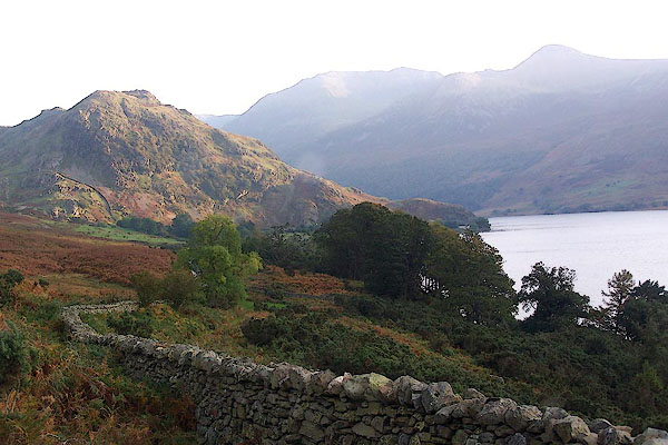 BJY20.jpg From the north. (taken 14.10.2005)  CAY07.jpg (taken 11.6.2014) 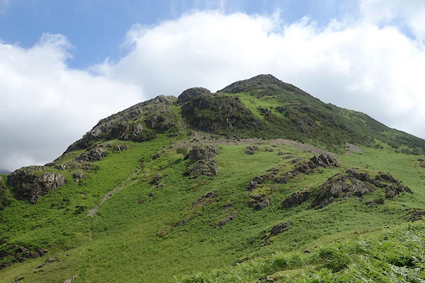 CAY08.jpg (taken 11.6.2014) 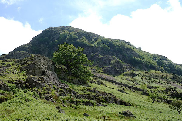 CAY09.jpg (taken 11.6.2014) 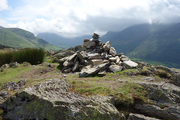 CAY11.jpg Cairn, (taken 11.6.2014) |
||
|
|
||
| hearsay:- |
The col between this and Blake Rigg is a viewpoint called Surprise View. |
|
|
|
||
 Lakes Guides menu.