 Old Cumbria Gazetteer
 |
 |
|
| Park House, Heversham | ||
| Park House | ||
| civil parish:- | Heversham (formerly Westmorland) | |
| county:- | Cumbria | |
| locality type:- | buildings | |
| coordinates:- | SD49518264 | |
| 1Km square:- | SD4982 | |
| 10Km square:- | SD48 | |
|
|
||
| evidence:- | old map:- OS County Series (Wmd 42 15) placename:- Park House |
|
| source data:- | Maps, County Series maps of Great Britain, scales 6 and 25
inches to 1 mile, published by the Ordnance Survey, Southampton,
Hampshire, from about 1863 to 1948. |
|
|
|
||
| evidence:- | old map:- Jefferys 1770 (Wmd) placename:- Park House |
|
| source data:- | Map, 4 sheets, The County of Westmoreland, scale 1 inch to 1
mile, surveyed 1768, and engraved and published by Thomas
Jefferys, London, 1770.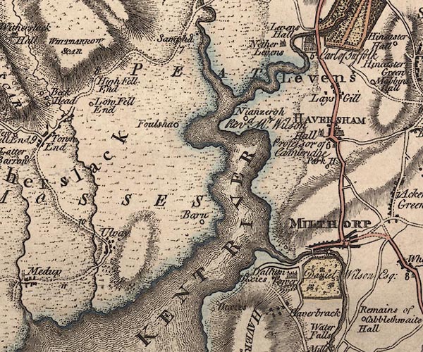 J5SD48SE.jpg "Park H." circle, labelled in italic lowercase text; settlement, farm, house, or hamlet? item:- National Library of Scotland : EME.s.47 Image © National Library of Scotland |
|
|
|
||
| evidence:- | database:- Listed Buildings 2010 |
|
| source data:- | courtesy of English Heritage "BARN TO EAST OF PARK HOUSE FARMHOUSE WITH ATTACHED SHIPPONS TO NORTH AND EAST / / / HEVERSHAM / SOUTH LAKELAND / CUMBRIA / II[star] / 76512 / SD4951982640" |
|
|
|
||
 Lakes Guides menu.