 Old Cumbria Gazetteer
 |
 |
|
| packhorse bridge, Crook | ||
| site name:- | Winster, River | |
| civil parish:- | Crook (formerly Westmorland) | |
| county:- | Cumbria | |
| locality type:- | packhorse bridge | |
| locality type:- | bridge | |
| coordinates:- | SD41259429 | |
| 1Km square:- | SD4194 | |
| 10Km square:- | SD49 | |
| references:- | Hinchcliffe, Ernest: 1994: Packhorse Bridges of England: Cicerone Press (Milnthorpe,
Cumbria) |
|
|
|
||
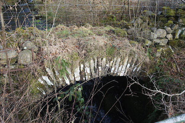 CCH52.jpg (taken 4.2.2015) 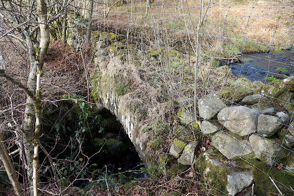 CCH53.jpg (taken 4.2.2015) |
||
|
|
||
| evidence:- | old map:- Jefferys 1770 (Wmd) |
|
| source data:- | Map, 4 sheets, The County of Westmoreland, scale 1 inch to 1
mile, surveyed 1768, and engraved and published by Thomas
Jefferys, London, 1770.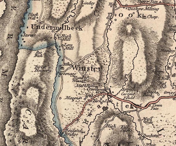 J5SD49SW.jpg double line, road, across a stream; bridge item:- National Library of Scotland : EME.s.47 Image © National Library of Scotland |
|
|
|
||
| evidence:- | database:- Listed Buildings 2010 |
|
| source data:- | courtesy of English Heritage "PACK HORSE BRIDGE BESIDE A5074 A QUARTER OF A MILE NORTH WEST OF HIGH MILL HOUSE / / / CROOK / SOUTH LAKELAND / CUMBRIA / II / 76397 / SD4125494296" |
|
| source data:- | courtesy of English Heritage "Pack Horse bridge. Probably C17. Approx. 4' wide with rough slate stone voussoirs and rubble core. No parapets. Now partly derelict and leads nowhere." |
|
|
|
||
| :- |
8 ft span, 72 ins wide, no parapets. |
|
| Hinchcliffe, Ernest: 1994: Packhorse Bridges of England: Cicerone Press (Milnthorpe,
Cumbria) |
||
|
|
||
 Lakes Guides menu.