 Old Cumbria Gazetteer
 |
 |
|
| Low Borrowbridge, Tebay | ||
| Low Borrowbridge | ||
| locality:- | Low Borrow Bridge | |
| civil parish:- | Tebay (formerly Westmorland) | |
| county:- | Cumbria | |
| locality type:- | buildings | |
| locality type:- | locality | |
| coordinates:- | NY60940148 | |
| 1Km square:- | NY6001 | |
| 10Km square:- | NY60 | |
|
|
||
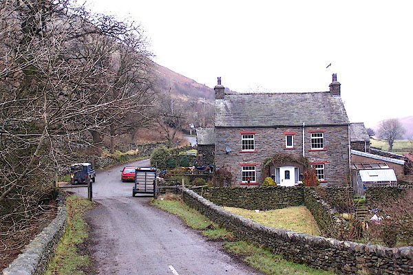 BLL27.jpg (taken 9.12.2005) |
||
|
|
||
| evidence:- | hearth tax returns:- Hearth Tax 1675 placename:- Borradale |
|
| source data:- | Records, hearth tax survey returns, Westmorland, 1674/75. "Borradale" in "Teaby" |
|
|
|
||
| evidence:- | old map:- Morden 1695 (Wmd) placename:- Burrow Bridg |
|
| source data:- | Map, hand coloured engraving, Westmorland, scale about 2.5 miles to 1 inch, by Robert
Morden, published by Abel Swale, the Unicorn, St Paul's Churchyard, Awnsham, and John
Churchill, the Black Swan, Paternoster Row, London, 1695.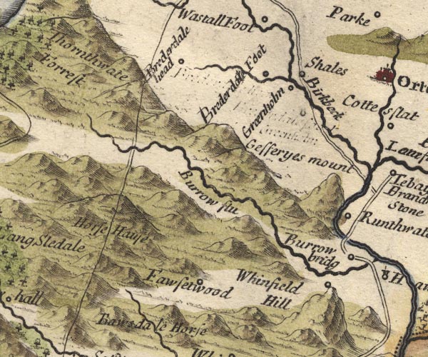 MD10NY50.jpg "Burrow bridg" Circle. item:- JandMN : 24 Image © see bottom of page |
|
|
|
||
| evidence:- | old map:- Simpson 1746 map (Wmd) placename:- Burrow Bridge |
|
| source data:- | Map, uncoloured engraving, Westmorland, scale about 8 miles to 1
inch, printed by R Walker, Fleet Lane, London, 1746.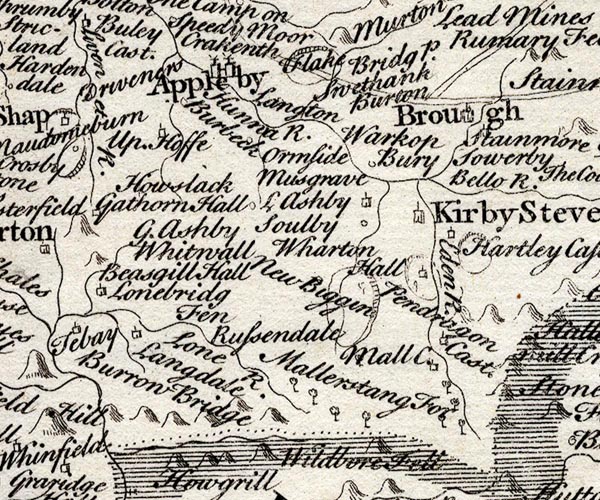 SMP2NYQ.jpg "Burrow Bridge" item:- Dove Cottage : 2007.38.59 Image © see bottom of page |
|
|
|
||
| evidence:- | old map:- Jefferys 1770 (Wmd) placename:- Low Burrow Bridge placename:- Burrow Bridge, Low |
|
| source data:- | Map, 4 sheets, The County of Westmoreland, scale 1 inch to 1
mile, surveyed 1768, and engraved and published by Thomas
Jefferys, London, 1770.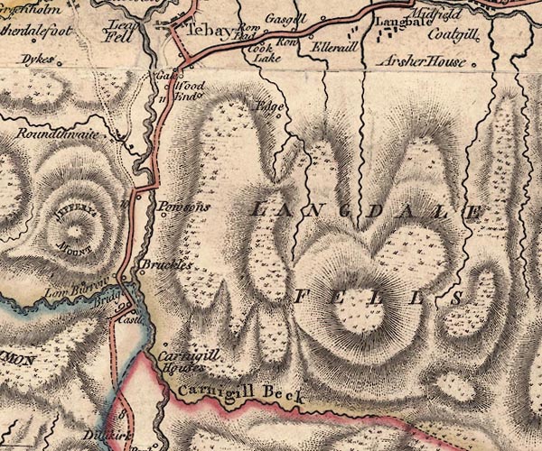 J5NY60SW.jpg "Low Burrow Bridge" circle, labelled in italic lowercase text; settlement, farm, house, or hamlet? item:- National Library of Scotland : EME.s.47 Image © National Library of Scotland |
|
|
|
||
| evidence:- | descriptive text:- West 1778 (11th edn 1821) placename:- Borrowbridge |
|
| source data:- | Guide book, A Guide to the Lakes, by Thomas West, published by
William Pennington, Kendal, Cumbria once Westmorland, and in
London, 1778 to 1821. goto source goto sourceTour to the Caves in the West Riding of Yorkshire, late 18th century Page 243:- "..." "... The Roman road is easily traced from Ribchester ... to Overborough; afterwards the Roman road goes through Casterton and Middleton, and, as some think, by Borrow-bridge and Orton, to Apulby. ..." |
|
|
|
||
| evidence:- | old map:- Cary 1789 (edn 1805) placename:- Low Burrow Bridge placename:- Burrow Bridge, Low |
|
| source data:- | Map, uncoloured engraving, Westmoreland, scale about 2.5 miles
to 1 inch, by John Cary, London, 1789; edition 1805.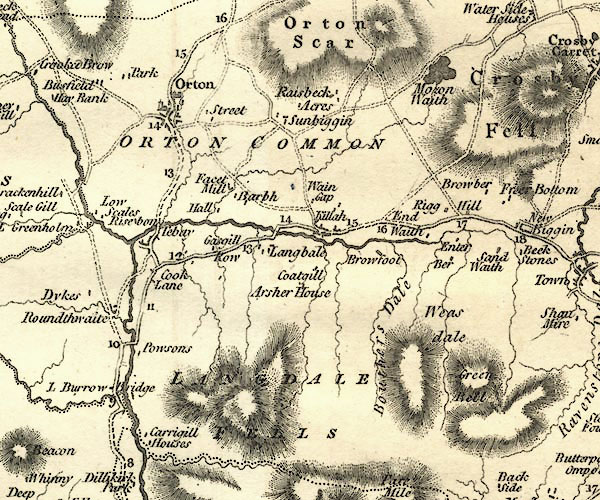 CY24NY60.jpg "L Burrow Bridge" block/s, labelled in italic lowercase; house, or hamlet item:- JandMN : 129 Image © see bottom of page |
|
|
|
||
| evidence:- | old map:- Laurie and Whittle 1806 placename:- Low Barrow Bridge |
|
| source data:- | Road map, Continuation of the Roads to Glasgow and Edinburgh,
scale about 10 miles to 1 inch, by Nathaniel Coltman? 1806,
published by Robert H Laurie, 53 Fleet Street, London, 1834. click to enlarge click to enlargeLw21.jpg "Low Barrow Bridge 271¾" place; distance from London item:- private collection : 18.21 Image © see bottom of page |
|
|
|
||
| evidence:- | descriptive text:- Otley 1823 (8th edn 1849) placename:- Low Borrow Bridge |
|
| source data:- | Guide book, A Concise Description of the English Lakes, the
mountains in their vicinity, and the roads by which they may be
visited, with remarks on the mineralogy and geology of the
district, by Jonathan Otley, published by the author, Keswick,
Cumberland now Cumbria, by J Richardson, London, and by Arthur
Foster, Kirkby Lonsdale, Cumbria, 1823; published 1823-49,
latterly as the Descriptive Guide to the English Lakes. goto source Page 188:- "..." "... we come to LOW BORROW BRIDGE. It is situated in the northern pass of" goto sourcePage 189:- "the valley [Lune], at its junction with Little Borrowdale. There is a good inn here, where parties may form head quarters, while visiting the vicinity. Behind the house is a Roman Station, ..." |
|
|
|
||
Lakes Guides menu.