 Old Cumbria Gazetteer
 |
 |
|
| Little Man, Underskiddaw | ||
| Little Man | ||
| Skiddaw Little Man | ||
| site name:- | Skiddaw | |
| civil parish:- | Underskiddaw (formerly Cumberland) | |
| county:- | Cumbria | |
| locality type:- | hill | |
| coordinates:- | NY26672779 | |
| 1Km square:- | NY2627 | |
| 10Km square:- | NY22 | |
| altitude:- | 2837 feet | |
| altitude:- | 865m | |
|
|
||
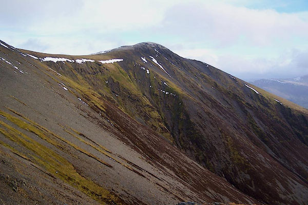
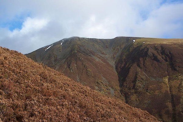 BPW01.jpg (taken 17.12.2008) 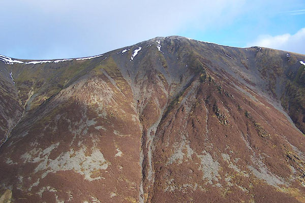 BPW02.jpg (taken 17.12.2008) |
||
|
|
||
| evidence:- | old map:- OS County Series (Cmd 56 10) placename:- Little Man placename:- Man, Little |
|
| source data:- | Maps, County Series maps of Great Britain, scales 6 and 25
inches to 1 mile, published by the Ordnance Survey, Southampton,
Hampshire, from about 1863 to 1948. |
|
|
|
||
| evidence:- | probably descriptive text:- West 1778 (11th edn 1821) |
|
| source data:- | Guide book, A Guide to the Lakes, by Thomas West, published by
William Pennington, Kendal, Cumbria once Westmorland, and in
London, 1778 to 1821. goto source goto sourceMrs Radcliffe's Ride over Skiddaw, 1794 Page 307:- "..." "At length, passing the skirts of the two points of Skiddaw which are nearest to Derwent water, we approached the third and loftiest, and then perceived that their steep sides, together with the ridges which connect them, were entirely covered near the summits with a whitish shivered slate, which threatens to slide down them with every gust of wind. The broken state of this slate makes the present summits seem like ruins of others - a circumstance as extraordinary in appearance as difficult to be accounted for." "The ridge on which we passed from the neighbourhood of the second summit to the third, was narrow, and the eye reached, on each side, down the whole extent of the mountain following, on the left, the rocky precipices that impend over the lake of Bassenthwaite, and looking on the right, into the glens of Saddleback, far, far below." |
|
|
|
||
| evidence:- | outline view:- Otley 1823 (4th edn 1830) placename:- Little Man |
|
| source data:- | Print, engraving, Outline View of Skiddaw, and Saddleback, as seen on approaching
Keswick from the South, published by Jonathan Otley, Keswick, Cumberland et al, 1830.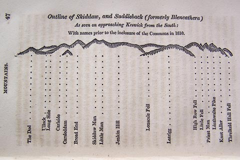 click to enlarge click to enlargeO75E01.jpg p.47 in A Concise Description of the English Lakes, by Jonathan Otley, 4th edition, 1830. "Outline View of Skiddaw, and Saddleback (formerly Blencathera) As seen on approaching Keswick from the South: With names prior to the inclosure of the Commons in 1810." "The Dod / Ullock / Long Side / Carleside / Carsleddam / Broad End / Skiddaw Man / Little Man / Jenkin Hill / Lonscale Fell / Latrigg / High Row Fell / Little Fell / Priest Man / Linthwaite Pike / Knot Aller / Threlkeld Hall Fell" item:- Armitt Library : A1175.2 Image © see bottom of page |
|
|
|
||
| evidence:- | outline view:- Otley 1823 (8th edn 1849) placename:- Little Man |
|
| source data:- | Engraving, outline view of mountains, Skiddaw, and Saddleback ... as seen on entering
Keswick from the South, drawn by T Binns, engraved by O Jewitt, opposite p.46 of A
Descriptive Guide of the English Lakes, by Jonathan Otley, 8th edition, 1849.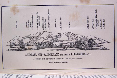 click to enlarge click to enlargeO80E16.jpg item:- Armitt Library : A1180.17 Image © see bottom of page |
|
|
|
||
| evidence:- | outline view:- Otley 1823 (5th edn 1834) |
|
| source data:- | Print, woodcut outline view, Skiddaw and Saddleback, by Jonathan Otley, Keswick, Cumberland,
1830.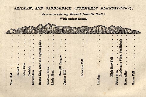 click to enlarge click to enlargeOT2E08.jpg Printed on p.49 of A Concise Description of the English Lakes, by Jonathan Otley, 5th edition, 1834. "SKIDDAW, AND SADDLEBACK (FORMERLY BLENCATHRA): As seen entering Keswick from the South: With ancient names." "The Dod / Hullock / Long Side / Carlside / Carsleddam / Broad End, near the highest point / Skiddaw Man / Little Man / Howgill Tongue / Jenkin Hill / Lonscale Fell / Latrigg / High Row Fell / Priest Man / Linthwaite Pike, Saddleback / Knot Aller / Scales Fell" item:- JandMN : 48.9 Image © see bottom of page |
|
|
|
||
| evidence:- | outline view:- Matthew 1866 placename:- Low Man |
|
| source data:- | Print, engraving, outline view, View from Watendlath Road of Derwent Water and Bassenthwaite,
Cumberland, published by J Richardson, Highgate, Kendal, Westmorland, 1866.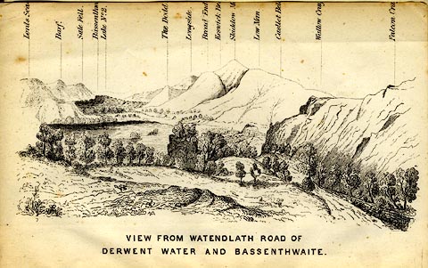 click to enlarge click to enlargeMW1E05.jpg Tipped in before p.1 of The English Lakes, Peaks and Passes, from Kendal to Keswick, by George King Matthew. printed at bottom:- "VIEW FROM WATENDLATH ROAD OF / DERWENT WATER AND BASSENTHWAITE." printed at caption to mountains:- "... Low Man. ..." item:- Armitt Library : A1168.5 Image © see bottom of page |
|
|
|
||
| evidence:- | outline view:- Black 1856 (23rd edn 1900) placename:- Skiddaw Low Man |
|
| source data:- | Print, lithograph, Outline Views, Skiddaw and Derwent Water - Mountains as seen at
Lodore Hotel, and Mountains as seen at the Third Gate on Ascending Latrigg on the
Way to Skiddaw, by J Flintoft, Keswick, Cumberland, engraved by R Mason, Edinburgh,
Lothian, about 1900.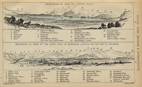 click to enlarge click to enlargeBC08E4.jpg "... 10 Skiddaw Low Man ..." item:- JandMN : 37.14 Image © see bottom of page |
|
|
|
||
| evidence:- | outline view:- Black 1841 (3rd edn 1846) placename:- Skiddaw Low Man |
|
| source data:- | Print, engraving, outline view, Mountains as seen at Lowdore Inn, and Mountains as
seen at the Third Gate on Ascending Latrigg on the Way to Skiddaw, by J Flintoft,
Keswick, Cumberland, engraved by R Mason, Edinburgh, Lothian, about 1846.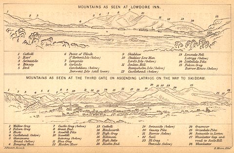 click to enlarge click to enlargeBC02E4.jpg "... 10 Skiddaw Low Man ..." item:- JandMN : 32.7 Image © see bottom of page |
|
|
|
||
 BPW03.jpg (taken 17.12.2008) 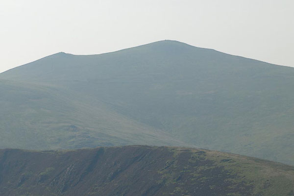 BPR46.jpg Skiddaw and Little Man from the east. (taken 26.9.2008) 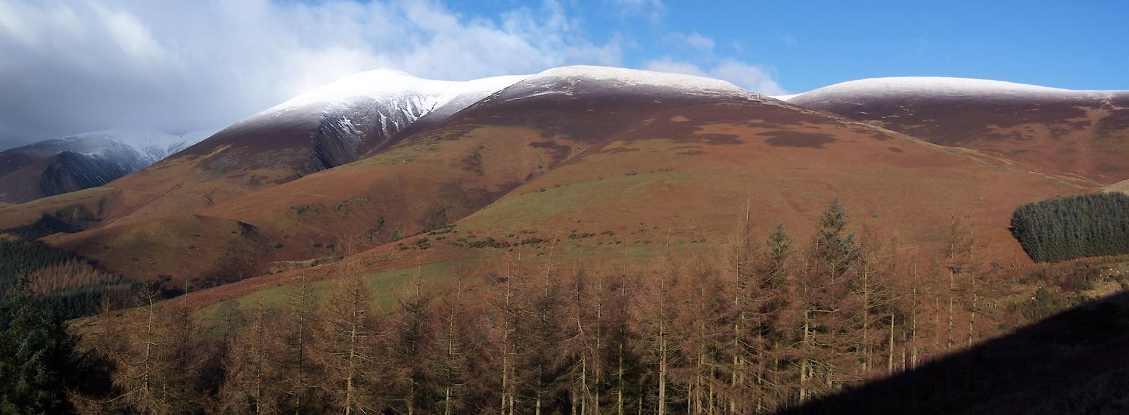 Click to enlarge BXT25.jpg From Latrigg. (taken 5.12.2012) 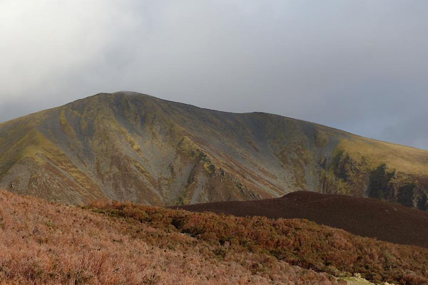 BZT60.jpg (taken 28.12.2013) |
||
|
|
||
Lakes Guides menu.