 Old Cumbria Gazetteer
 |
 |
|
||
| Kingsdale Beck | ||||
| county:- | North Yorkshire | |||
| locality type:- | river | |||
| 1Km square:- | SD6976 | |||
| 10Km square:- | SD67 | |||
|
|
||||
| evidence:- | old map:- Saxton 1579 |
|||
| source data:- | Map, hand coloured engraving, Westmorlandiae et Cumberlandiae Comitatus ie Westmorland
and Cumberland, scale about 5 miles to 1 inch, by Christopher Saxton, London, engraved
by Augustinus Ryther, 1576, published 1579-1645.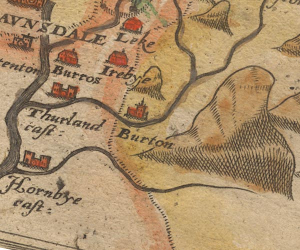 Sax9SD67.jpg item:- private collection : 2 Image © see bottom of page |
|||
|
|
||||
| evidence:- | old map:- Speed 1611 (Wmd) |
|||
| source data:- | Map, hand coloured engraving, The Countie Westmorland and
Kendale the Cheif Towne, scale about 2.5 miles to 1 inch, by
John Speed, 1610, published by George Humble, Popes Head Alley,
London, 1611-12.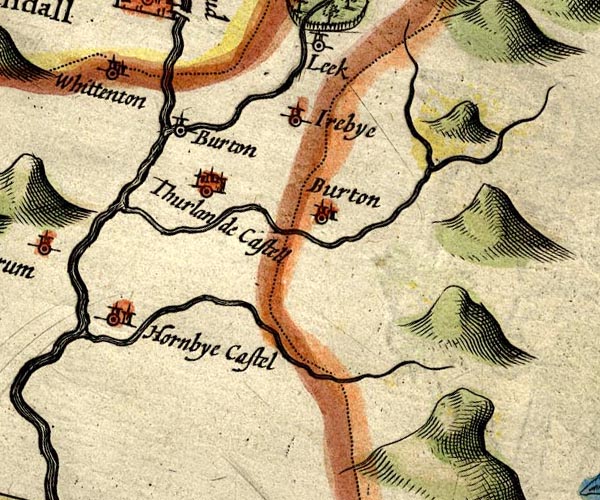 SP14SD67.jpg double line, into the Greta item:- Armitt Library : 2008.14.5 Image © see bottom of page |
|||
|
|
||||
| evidence:- | descriptive text:- West 1778 (11th edn 1821) |
|||
| source data:- | Guide book, A Guide to the Lakes, by Thomas West, published by
William Pennington, Kendal, Cumbria once Westmorland, and in
London, 1778 to 1821. goto source goto sourceTour to the Caves in the West Riding of Yorkshire, late 18th century Page 251:- "..." "[1] After we had regaled and rested ourselves comfortably at the Bay-horse, we took an evening walk, about a mile above the town [Ingleton], to the slate quarries by the side of the river Wease, or Greta, which comes down out of Chapel-in-the-Dale, and joins the Kingsdale river at Ingleton." goto sourcePage 252:- "... take a second view of Thornton-force, on the south side of the Kingsdale river, and followed its murmuring stream down a deep glen, fortified with high precipices on each side, to Ingleton; nor did we think ourselves ill repaid, for all the difficulties we had to encounter in our road amongst rocks and streams, as something new and amusing presented itself almost every step we took. ..." "Ingleton is a pretty village, pleasantly situated on a natural mount, yet at the bottom of a vale, near the conflux of two" goto sourcePage 253:- "rivers, over which are thrown two handsome arches. If the streams are sometimes small, the huge stones and fragments of rocks which are rolled down the beds of these rivers, will serve to show that at other times they are remarkably full and impetuous. ..." |
|||
|
|
||||
| evidence:- | old map:- Balderston c1890 map |
|||
| source data:- | Map, the hills in the Ingleton area, probably by Robert R
Balderston, engraved by Goodall and Suddick, Leeds, West
Yorkshire, about 1890.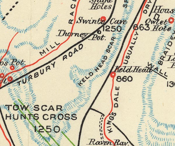 BS1SD67Y.jpg The valley is lebelled as 'usually dry'. item:- private collection : 27.1 Image © see bottom of page |
|||
|
|
||||
| places:- |
|
|||
|
||||
Lakes Guides menu.