 Old Cumbria Gazetteer
 |
 |
|
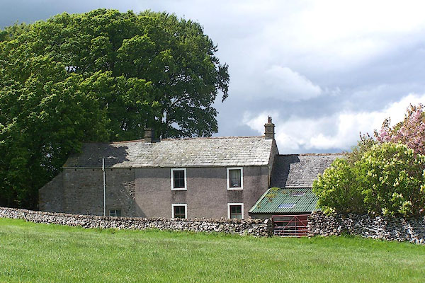
| High Murber, Newby | ||
| High Murber | ||
| civil parish:- | Newby (formerly Westmorland) | |
| county:- | Cumbria | |
| locality type:- | buildings | |
| coordinates:- | NY58201810 | |
| 1Km square:- | NY5818 | |
| 10Km square:- | NY51 | |
|
|
||
 BMD13.jpg (taken 29.5.2006) 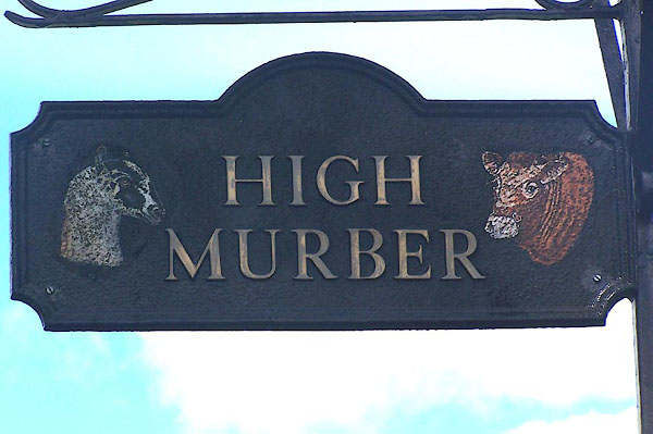 BMD14.jpg (taken 29.5.2006) |
||
|
|
||
| evidence:- | old map:- OS County Series (Wmd 14 7) placename:- High Sides placename:- Sides, High |
|
| source data:- | Maps, County Series maps of Great Britain, scales 6 and 25
inches to 1 mile, published by the Ordnance Survey, Southampton,
Hampshire, from about 1863 to 1948. |
|
|
|
||
 Lakes Guides menu.