 Old Cumbria Gazetteer
 |
 |
|
| Heald Brow Pasture, Satterthwaite | ||
| Heald Brow Pasture | ||
| civil parish:- | Satterthwaite (formerly Lancashire) | |
| county:- | Cumbria | |
| coordinates:- | SD314942 | |
| 1Km square:- | SD3194 | |
| 10Km square:- | SD39 | |
|
|
||
| evidence:- | old map:- Crosthwaite 1783-94 (Con) placename:- Hield Brow |
|
| source data:- | Map, uncoloured engraving, An Accurate Map of Coniston Lake,
scale about 3 inches to 1 mile, by Peter Crosthwaite, Keswick,
Cumberland, 1788, version published 1809.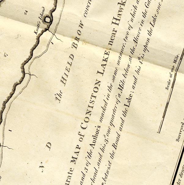 CTESD39B.jpg "The HIELD BROW covered with WOOD ..." item:- JandMN : 182.5 Image © see bottom of page |
|
|
|
||
| person:- | : National Trust |
|
|
|
||
 Lakes Guides menu.