 Old Cumbria Gazetteer
 |
 |
|
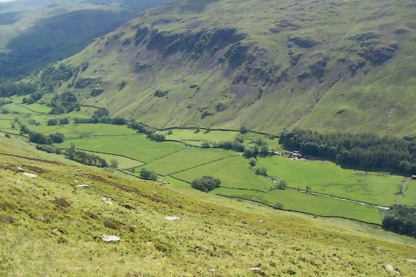
| Grisedale, Patterdale | ||
| Grisedale | ||
| civil parish:- | Patterdale (formerly Westmorland) | |
| county:- | Cumbria | |
| locality type:- | valley | |
| coordinates:- | NY371151 (etc) | |
| 1Km square:- | NY3715 | |
| 10Km square:- | NY31 | |
|
|
||
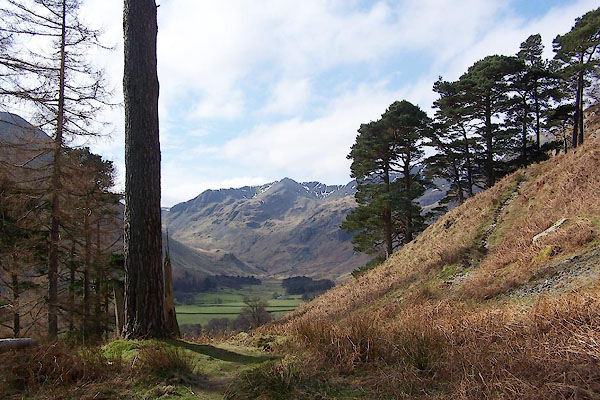 BQG87.jpg (taken 17.3.2009) 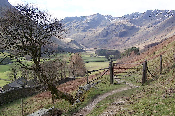 BQG90.jpg (taken 17.3.2009) |
||
|
|
||
| evidence:- | old map:- Jefferys 1770 (Wmd) placename:- Grysdale |
|
| source data:- | Map, 4 sheets, The County of Westmoreland, scale 1 inch to 1
mile, surveyed 1768, and engraved and published by Thomas
Jefferys, London, 1770.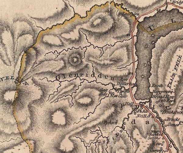 J5NY31NE.jpg "Grysdale" hill hachuring; valley item:- National Library of Scotland : EME.s.47 Image © National Library of Scotland |
|
|
|
||
| evidence:- | old text:- Clarke 1787 placename:- Griesdale |
|
| source data:- | Guide book, A Survey of the Lakes of Cumberland, Westmorland,
and Lancashire, written and published by James Clarke, Penrith,
Cumberland, and in London etc, 1787; published 1787-93. goto source goto sourcePage 32:- "... The whole Dale [Patterdale] consists at present of five small manors; Hartsop, the property of the Earl of Lonsdale; Deep-Dale, of the Duke of Norfolk; Griesdale and Pless-Fell, of William Hassel, Esq; of Dalemain; and Glenridding, of John Mounsey, Esquire." |
|
|
|
||
| evidence:- | old map:- Cary 1789 (edn 1805) placename:- Grysdale |
|
| source data:- | Map, uncoloured engraving, Westmoreland, scale about 2.5 miles
to 1 inch, by John Cary, London, 1789; edition 1805.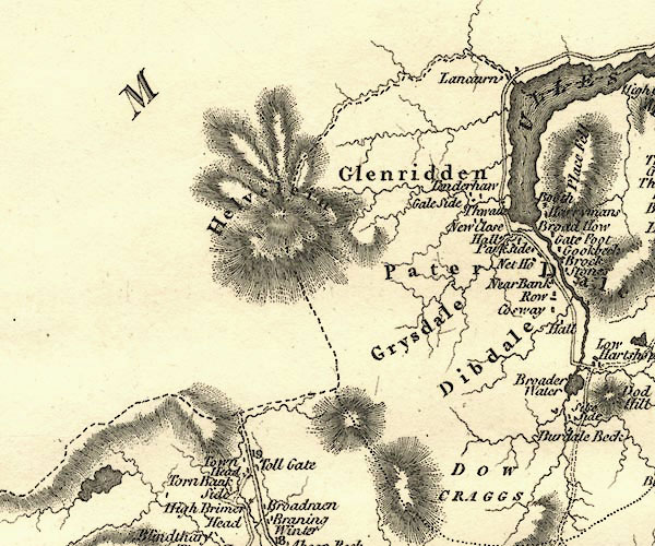 CY24NY31.jpg "Grysdale" area item:- JandMN : 129 Image © see bottom of page |
|
|
|
||
| evidence:- | old map:- Otley 1818 placename:- Grisedale |
|
| source data:- | Map, uncoloured engraving, The District of the Lakes,
Cumberland, Westmorland, and Lancashire, scale about 4 miles to
1 inch, by Jonathan Otley, 1818, engraved by J and G Menzies,
Edinburgh, Scotland, published by Jonathan Otley, Keswick,
Cumberland, et al, 1833.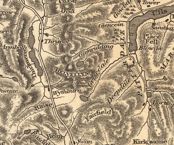 OT02NY31.jpg item:- JandMN : 48.1 Image © see bottom of page |
|
|
|
||
| evidence:- | old map:- Ford 1839 map placename:- Grisdale |
|
| source data:- | Map, uncoloured engraving, Map of the Lake District of
Cumberland, Westmoreland and Lancashire, scale about 3.5 miles
to 1 inch, published by Charles Thurnam, Carlisle, and by R
Groombridge, 5 Paternoster Row, London, 3rd edn 1843.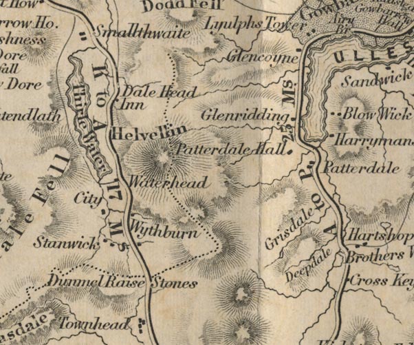 FD02NY31.jpg "Grisdale" Between hill hachures. item:- JandMN : 100.1 Image © see bottom of page |
|
|
|
||
| evidence:- | old map:- Garnett 1850s-60s H placename:- Grisedale |
|
| source data:- | Map of the English Lakes, in Cumberland, Westmorland and
Lancashire, scale about 3.5 miles to 1 inch, published by John
Garnett, Windermere, Westmorland, 1850s-60s.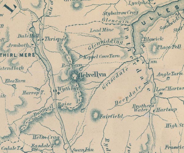 GAR2NY31.jpg "Grisedale" river valley item:- JandMN : 82.1 Image © see bottom of page |
|
|
|
||
| evidence:- | old text:- Martineau 1855 item:- placename, Grisedale; wild boar |
|
| source data:- | Guide book, A Complete Guide to the English Lakes, by Harriet
Martineau, published by John Garnett, Windermere, Westmorland,
and by Whittaker and Co, London, 1855; published 1855-76. goto source Page 163:- "... Grasmere and Grisedale have the same derivation,- Gris being the old Saxon for wild swine: and these are therefore the lake and the valley of the wild boar. A deep and still retreat must both have been in the days of wild boars." |
|
|
|
||
| evidence:- | outline view:- Black 1856 (23rd edn 1900) placename:- Grizedale |
|
| source data:- | Print, lithograph, Outline Views, Ullswater - Mountains as seen a little on the Matterdale
Road near Lyulph's Tower on Ullswater, and Mountains as seen at the Slate Quarry at
Blowick on Ullswater, by J Flintoft, Keswick, Cumberland, engraved by R Mason, Edinburgh,
Lothian, about 1900.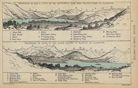 click to enlarge click to enlargeBC08E2.jpg "... Grizedale ... Grizedale ..." item:- JandMN : 37.8 Image © see bottom of page |
|
|
|
||
| evidence:- | outline view:- Black 1841 (3rd edn 1846) placename:- Grizedale |
|
| source data:- | Print, engraving, outline view, Mountains as seen a little on the Matterdale Road
near Lyulph's Tower on Ulleswater, and Mountains as seen at the Slate Quarry at Blowick
on Ulleswater, by J Flintoft, Keswick, Cumberland, engraved by R Mason, Edinburgh,
Lothian, about 1846.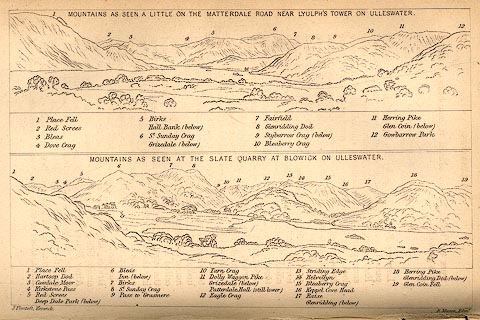 click to enlarge click to enlargeBC02E9.jpg "... Grizedale ... Grizedale ..." item:- JandMN : 32.15 Image © see bottom of page |
|
|
|
||
| evidence:- | old print:- Rose 1832-35 |
|
| source data:- | Print, engraving, Grisdale, near Ulleswater, by Thomas Allom, engraved by H Adlard,
1835.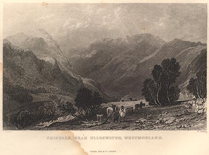 click to enlarge click to enlargeR355.jpg item:- JandMN : 66.52 Image © see bottom of page |
|
|
|
||
 BUU91.jpg (taken 20.6.2011) 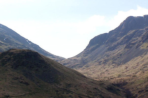 BQG99.jpg (taken 17.3.2009) 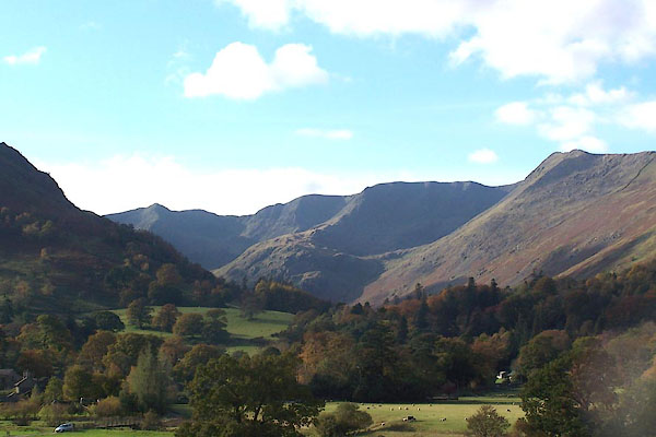 BMY08.jpg (taken 2.11.2006) 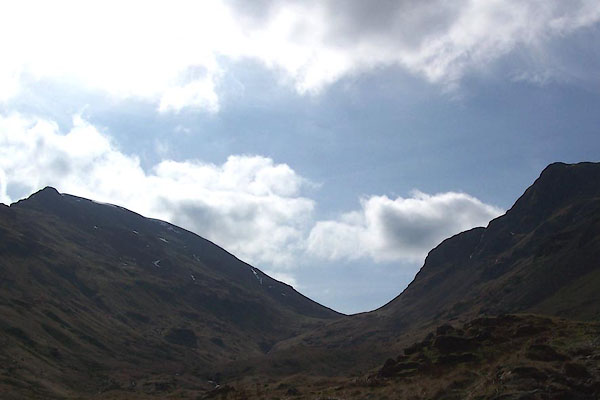 BQG98.jpg (taken 17.3.2009) |
||
|
|
||
Lakes Guides menu.