 Old Cumbria Gazetteer
 |
 |
|
| Grisedale Bridge bridge, Patterdale | ||
| Grisedale Bridge | ||
| site name:- | Grisedale Beck | |
| locality:- | Grisedale Bridge | |
| civil parish:- | Patterdale (formerly Westmorland) | |
| county:- | Cumbria | |
| locality type:- | bridge | |
| coordinates:- | NY39031614 | |
| 1Km square:- | NY3916 | |
| 10Km square:- | NY31 | |
|
|
||
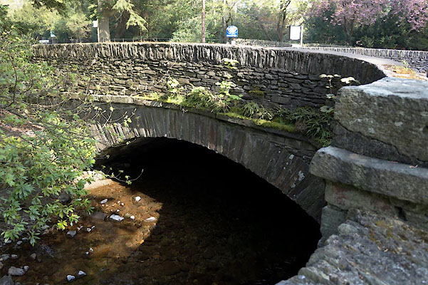 CAM08.jpg (taken 29.4.2014) 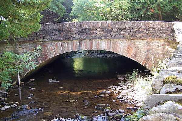 BJS67.jpg (taken 17.8.2005) |
||
|
|
||
| evidence:- | old map:- Morden 1695 (Wmd) |
|
| source data:- | Map, hand coloured engraving, Westmorland, scale about 2.5 miles to 1 inch, by Robert
Morden, published by Abel Swale, the Unicorn, St Paul's Churchyard, Awnsham, and John
Churchill, the Black Swan, Paternoster Row, London, 1695.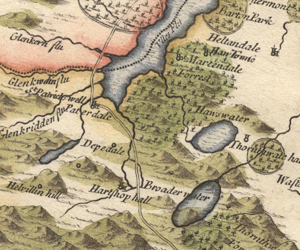 MD10NY41.jpg Double line over a stream, over the Grisedale Beck. item:- JandMN : 24 Image © see bottom of page |
|
|
|
||
| evidence:- | possibly old map:- Donald 1774 (Cmd) |
|
| source data:- | Map, hand coloured engraving, 3x2 sheets, The County of Cumberland, scale about 1
inch to 1 mile, by Thomas Donald, engraved and published by Joseph Hodskinson, 29
Arundel Street, Strand, London, 1774.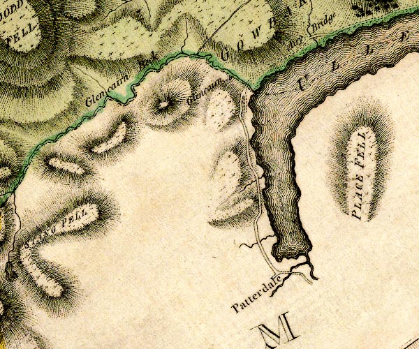 D4NY31NE.jpg double line across a river; a bridge item:- Carlisle Library : Map 2 Image © Carlisle Library |
|
|
|
||
| evidence:- | old map:- Crosthwaite 1783-94 (Ull) |
|
| source data:- | Map, uncoloured engraving, Accurate Map of the Beautiful Lake of
Ullswater, scale about 3 inches to 1 mile, by Peter Crosthwaite,
Keswick, Cumberland, 1783, version published 1800.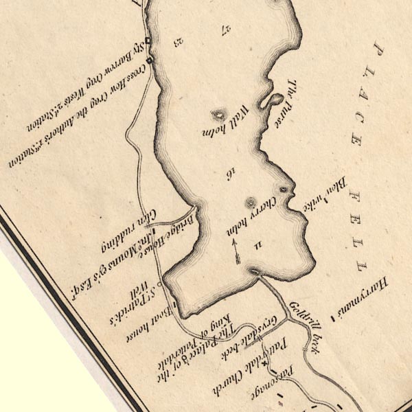 CT5NY31Y.jpg Clearly marked over the Grisedale Beck. item:- Armitt Library : 1959.191.7 Image © see bottom of page |
|
|
|
||
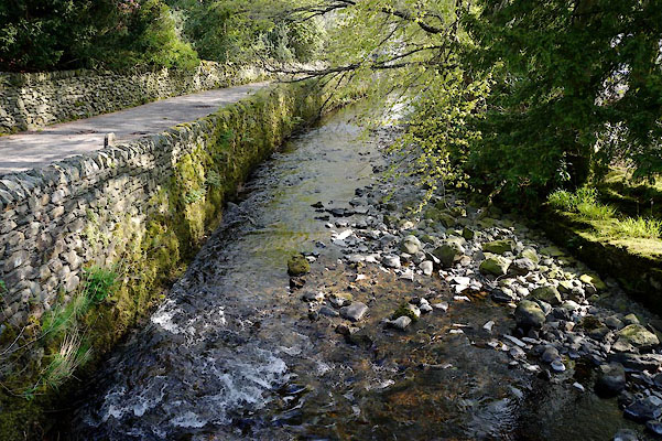 CAM09.jpg View of river. (taken 29.4.2014) |
||
|
|
||
 Lakes Guides menu.