 Old Cumbria Gazetteer
 |
 |
|
| Greencastle Tarn, Alston Moor | ||
| runs into:- |  Middle Gill Middle Gill |
|
|
|
||
| Greencastle Tarn | ||
| civil parish:- | Alston Moor (formerly Cumberland) | |
| county:- | Cumbria | |
| locality type:- | tarn | |
| coordinates:- | NY69743989 (etc) | |
| 1Km square:- | NY6939 | |
| 10Km square:- | NY63 | |
|
|
||
| evidence:- | old text:- Gents Mag placename:- Green Castle Loch |
|
| source data:- | Magazine, The Gentleman's Magazine or Monthly Intelligencer or
Historical Chronicle, published by Edward Cave under the
pseudonym Sylvanus Urban, and by other publishers, London,
monthly from 1731 to 1922. goto source Gentleman's Magazine 1747 p.385 "...We pass'd the river Tine near its confluence with Blackaburn, beyond which this immense waste begins, and could plainly perceive the alteration of air in riding a few miles. On the top of Roderic heights is a pretty large lake, call'd Green-castle-loch, which recieves no visible feeder, but emits a small stream northward to the said burn; ..." |
|
|
|
||
| evidence:- | old map:- Donald 1774 (Cmd) placename:- Greencastle Tarn |
|
| source data:- | Map, hand coloured engraving, 3x2 sheets, The County of Cumberland, scale about 1
inch to 1 mile, by Thomas Donald, engraved and published by Joseph Hodskinson, 29
Arundel Street, Strand, London, 1774.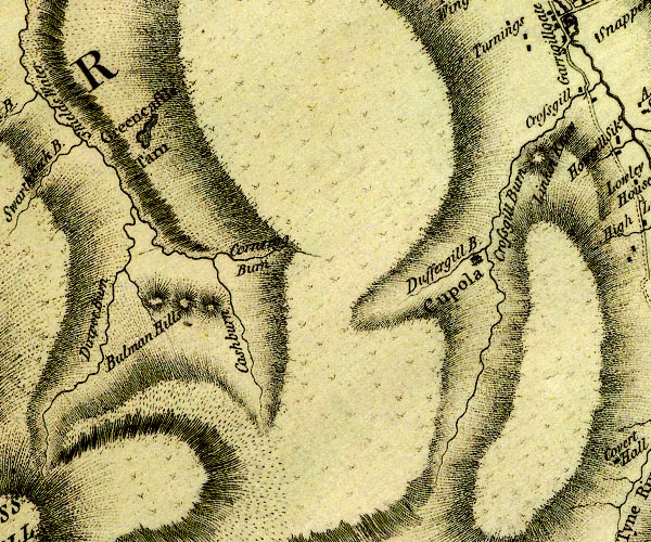 D4NY73NW.jpg "Greencastle Tarn" lake item:- Carlisle Library : Map 2 Image © Carlisle Library |
|
|
|
||
Lakes Guides menu.