 Old Cumbria Gazetteer
 |
 |
|
||
| Grassgarth, Hugill | ||||
| Grassgarth | ||||
| civil parish:- | Hugill (formerly Westmorland) | |||
| county:- | Cumbria | |||
| locality type:- | locality | |||
| locality type:- | buildings | |||
| coordinates:- | SD44169947 (etc) | |||
| 1Km square:- | SD4499 | |||
| 10Km square:- | SD49 | |||
|
|
||||
| evidence:- | old map:- OS County Series (Wmd 33 5) placename:- Grassgarth |
|||
| source data:- | Maps, County Series maps of Great Britain, scales 6 and 25
inches to 1 mile, published by the Ordnance Survey, Southampton,
Hampshire, from about 1863 to 1948. |
|||
|
|
||||
| evidence:- | hearth tax returns:- Hearth Tax 1675 placename:- Grassgarth |
|||
| source data:- | Records, hearth tax survey returns, Westmorland, 1674/75. "Grassgarth" in "Hugill" |
|||
|
|
||||
| evidence:- | old map:- Ogilby 1675 (plate 96) placename:- Grosgate |
|||
| source data:- | Road strip map, hand coloured engraving, the Road from Kendal to
Cockermouth, and the Road from Egremond to Carlisle, scale about
1 inch to 1 mile, by John Ogilby, London, 1675.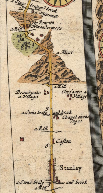 OG96m005.jpg In mile 7, Westmoreland. "Grosgate a Village" Houses off the road to the right. item:- JandMN : 22 Image © see bottom of page |
|||
|
|
||||
| evidence:- | old map:- Bowen 1720 (plate 260) placename:- Grass Gate |
|||
| source data:- | Road strip map, uncoloured engraving, pl.260, The Road from
Kendal to Cockermouth, scale about 2 miles to 1 inch, with
sections in Westmorland and Cumberland, published by Emanuel
Bowen, St Katherines, London, 1720.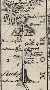 B260m05.jpg At mile 7+. item:- private collection : 1.260 Image © see bottom of page |
|||
|
|
||||
| evidence:- | old map:- Jefferys 1770 (Wmd) placename:- Grass Garth |
|||
| source data:- | Map, 4 sheets, The County of Westmoreland, scale 1 inch to 1
mile, surveyed 1768, and engraved and published by Thomas
Jefferys, London, 1770.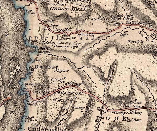 J5SD49NW.jpg "Grass Garth" circle, labelled in italic lowercase text; settlement, farm, house, or hamlet? item:- National Library of Scotland : EME.s.47 Image © National Library of Scotland |
|||
|
|
||||
| evidence:- | old map:- Rowe 1816 |
|||
| source data:- | Map, hand coloured engraving, Westmorland, scale about 3 miles
to 1 inch, by Robert Rowe, published by Henry Teesdale and Co,
302 Holborn, London, 1830s. "Grass Ings" 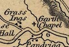 TSD6P1.jpg item:- Dove Cottage : 2014.7.10 Image © see bottom of page |
|||
|
|
||||
| hearsay:- |
A grass is a norse unit of land, about 8 acres, enough for 1 horse, 3 cows, 17 sheep
and 20 geese through winter. In summer the animals pastured on adjoining land while
the grass grew for hay. |
|||
|
|
||||
| places:- |
|
|||
|
||||
|
||||
|
||||
 Lakes Guides menu.