 Old Cumbria Gazetteer
 |
 |
|
| Golden Oak, Storrs | ||
| locality:- | Storrs | |
| civil parish:- | Windermere (formerly Westmorland) | |
| county:- | Cumbria | |
| locality type:- | tree | |
| locality type:- | oak | |
| coordinates:- | SD40009514 | |
| 1Km square:- | SD4095 | |
| 10Km square:- | SD49 | |
| references:- | OS County Series |
|
|
|
||
| evidence:- | old map:- OS County Series (Wmd 32 15) placename:- Golden Oak, The |
|
| source data:- | Maps, County Series maps of Great Britain, scales 6 and 25
inches to 1 mile, published by the Ordnance Survey, Southampton,
Hampshire, from about 1863 to 1948. "The Golden Oak" |
|
|
|
||
| evidence:- | old map:- Crosthwaite 1783-94 (Win/Ble) placename:- Golden Oak |
|
| source data:- | Map, uncoloured engraving, An Accurate Map of the Grand Lake of
Windermere, scale about 2 inches to 1 mile, by Peter
Crosthwaite, Keswick, Cumberland, 1783, version published 1819.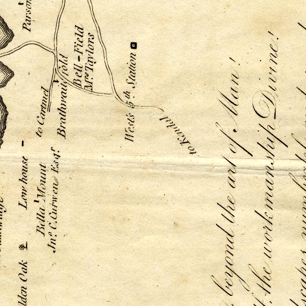 CT9SD49C.jpg "Golden Oak" tree item:- Armitt Library : 2008.14.102 Image © see bottom of page |
|
|
|
||
| notes:- |
Oak, Quercus sp. |
|
|
|
||
 Lakes Guides menu.