 Old Cumbria Gazetteer
 |
 |
|
| Gatebeck Bridge, Preston Richard | ||
| Gatebeck Bridge | ||
| site name:- | Peasey Beck | |
| civil parish:- | Preston Richard (formerly Westmorland) | |
| civil parish:- | Preston Patrick (formerly Westmorland) | |
| county:- | Cumbria | |
| locality type:- | bridge | |
| locality type:- | boundary stone | |
| locality type:- | parish boundary mark | |
| coordinates:- | SD54748566 | |
| 1Km square:- | SD5485 | |
| 10Km square:- | SD58 | |
|
|
||
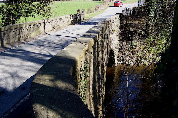 BLV08.jpg (taken 9.4.2006) 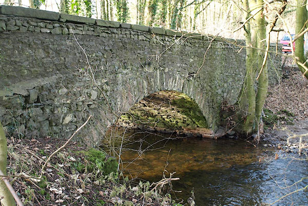 BPW31.jpg (taken 2.1.2009) |
||
|
|
||
| evidence:- | old map:- OS County Series (Wmd 43 5) placename:- Gatebeck Bridge |
|
| source data:- | Maps, County Series maps of Great Britain, scales 6 and 25
inches to 1 mile, published by the Ordnance Survey, Southampton,
Hampshire, from about 1863 to 1948. |
|
|
|
||
| evidence:- | old map:- Jefferys 1770 (Wmd) |
|
| source data:- | Map, 4 sheets, The County of Westmoreland, scale 1 inch to 1
mile, surveyed 1768, and engraved and published by Thomas
Jefferys, London, 1770.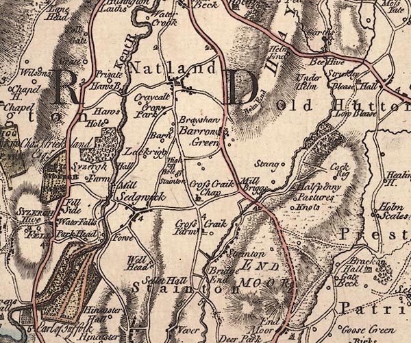 J5SD58NW.jpg double line, road, across a stream; bridge item:- National Library of Scotland : EME.s.47 Image © National Library of Scotland |
|
|
|
||
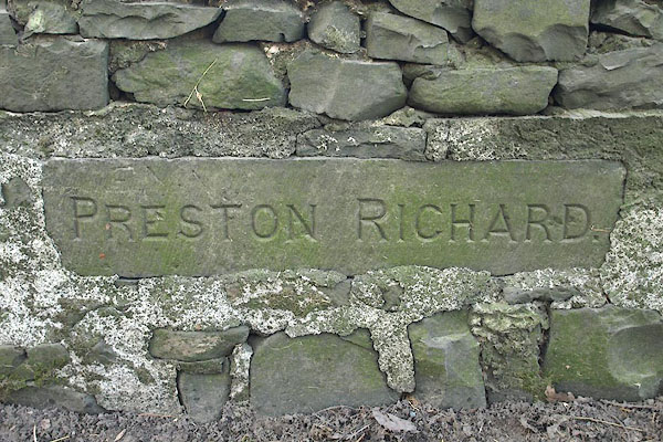 BPW32.jpg Boundary stone on parapet:- "PRESTON RICHARD." (taken 2.1.2009) |
||
|
|
||
 Lakes Guides menu.