 Old Cumbria Gazetteer
 |
 |
|
| Far Sawrey, Claife | ||
| Far Sawrey | ||
| civil parish:- | Claife (formerly Lancashire) | |
| county:- | Cumbria | |
| locality type:- | buildings | |
| coordinates:- | SD37839543 (etc) | |
| 1Km square:- | SD3795 | |
| 10Km square:- | SD39 | |
|
|
||
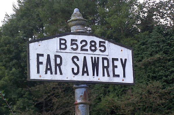 BJV11.jpg Signpost, south of village. (taken 16.9.2005) |
||
|
|
||
| evidence:- | old map:- OS County Series (Lan 5 7) placename:- Far Sawrey placename:- Sawrey, Far |
|
| source data:- | Maps, County Series maps of Great Britain, scales 6 and 25
inches to 1 mile, published by the Ordnance Survey, Southampton,
Hampshire, from about 1863 to 1948. |
|
|
|
||
| evidence:- | old map:- Otley 1818 placename:- Sawrey |
|
| source data:- | Map, uncoloured engraving, The District of the Lakes,
Cumberland, Westmorland, and Lancashire, scale about 4 miles to
1 inch, by Jonathan Otley, 1818, engraved by J and G Menzies,
Edinburgh, Scotland, published by Jonathan Otley, Keswick,
Cumberland, et al, 1833.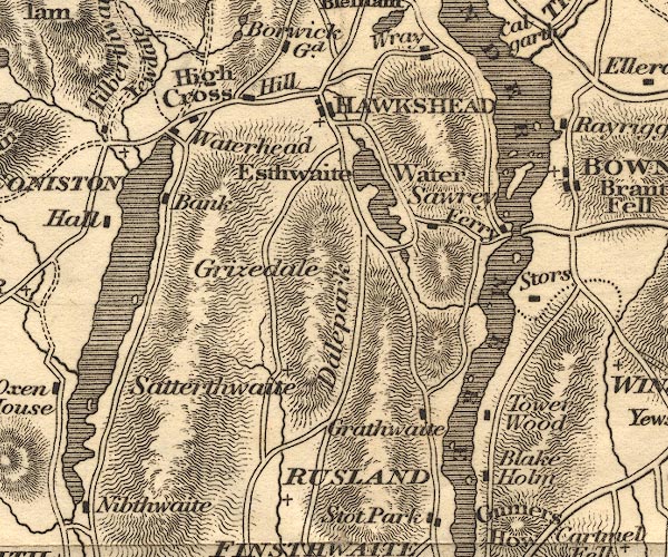 OT02SD39.jpg item:- JandMN : 48.1 Image © see bottom of page |
|
|
|
||
| evidence:- | old map:- Ford 1839 map placename:- Sowrey |
|
| source data:- | Map, uncoloured engraving, Map of the Lake District of
Cumberland, Westmoreland and Lancashire, scale about 3.5 miles
to 1 inch, published by Charles Thurnam, Carlisle, and by R
Groombridge, 5 Paternoster Row, London, 3rd edn 1843.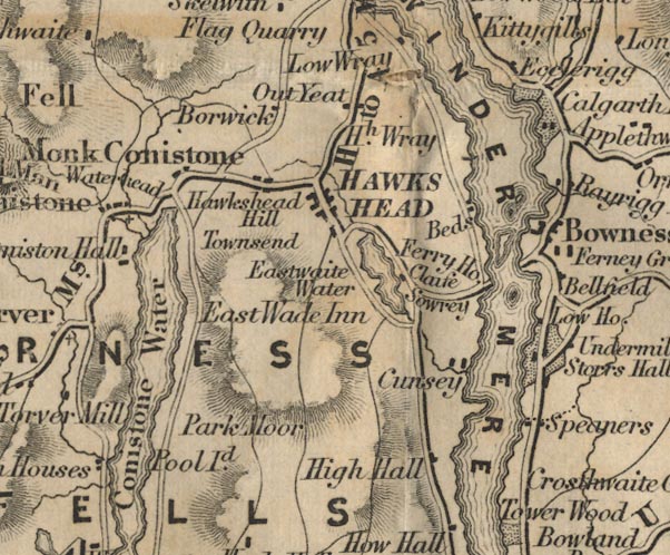 FD02SD39.jpg "Sowrey" item:- JandMN : 100.1 Image © see bottom of page |
|
|
|
||
| evidence:- | old drawing:- Aspland 1840s-60s placename:- Sawrey |
|
| source data:- | Drawing, pencil, a lane at Sawrey, Claife, Lancashire, by Theophilus Lindsey Aspland,
August 1867.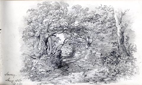 click to enlarge click to enlargeAS0416.jpg "Sawrey. / Aug 1867 / H [P]" page number "19" item:- Armitt Library : 2008.60.16 Image © see bottom of page |
|
|
|
||
| evidence:- | perhaps old drawing:- Aspland 1840s-60s |
|
| source data:- | Drawing, pencil, a hay cart, Claife, Lancashire? by Theophilus Lindsey Aspland, 27
August 1867.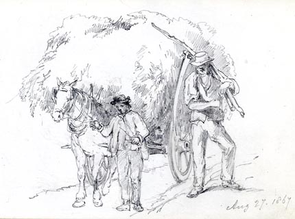 click to enlarge click to enlargeAS0417.jpg "Aug 27. 1867" item:- Armitt Library : 2008.60.17 Image © see bottom of page |
|
|
|
||
| evidence:- | perhaps old drawing:- Aspland 1840s-60s |
|
| source data:- | Drawing, pencil, a hay cart, Claife, Lancashire? by Theophilus Lindsey Aspland, 27
August 1867.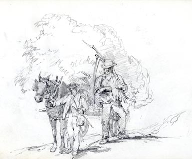 click to enlarge click to enlargeAS0418.jpg page number "20" item:- Armitt Library : 2008.60.18 Image © see bottom of page |
|
|
|
||
| evidence:- | old map:- Garnett 1850s-60s H placename:- Sawrey |
|
| source data:- | Map of the English Lakes, in Cumberland, Westmorland and
Lancashire, scale about 3.5 miles to 1 inch, published by John
Garnett, Windermere, Westmorland, 1850s-60s.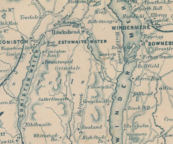 GAR2SD39.jpg "Sawrey" blocks, settlement item:- JandMN : 82.1 Image © see bottom of page |
|
|
|
||
 Martineau Directory 1855 Martineau Directory 1855 |
||
|
|
||
| evidence:- | old text:- Martineau 1855 |
|
| source data:- | Guide book, A Complete Guide to the English Lakes, by Harriet
Martineau, published by John Garnett, Windermere, Westmorland,
and by Whittaker and Co, London, 1855; published 1855-76. goto source goto sourcePage 30:- "... a trace of the rebellion of 1745 in the name of a lane, called "Scotch Gate" (way.) It was here that the fearful Highlanders were looked for, on their march to Derby; and here they might have had all their own way if they had come; for Sawrey had no idea of showing fight. All the inhabitants, carrying all their valuables, hied away, and took refuge together in a solitary building which was called Cook's braw bog-house. And braw it must have been, to hold all the Sawreyans. ..." |
|
|
|
||
| evidence:- | old map:- Prior 1874 map 1 placename:- Sawrey |
|
| source data:- | Map, uncoloured engraving or lithograph? Winander Mere, scale
about 2.5 miles to 1 inch, published by John Garnett,
Windermere, Westmorland, 1874. click to enlarge click to enlargePI03M1.jpg "Sawrey" block/s; building/s item:- private collection : 133.1 Image © see bottom of page |
|
|
|
||
| evidence:- | old map:- Post Office 1850s-1900s placename:- Far Sawrey |
|
| source data:- | Post road maps, General Post Office Circulation Map for England
and Wales, for the General Post Office, London, 1850s-1900s. click to enlarge click to enlargePOF7Cm.jpg "Far Sawrey" map date 1909 |
|
|
|
||
| evidence:- | old map:- Post Office 1850s-1900s placename:- Far Sawrey |
|
| source data:- | Post road maps, General Post Office Circulation Map for England
and Wales, for the General Post Office, London, 1850s-1900s. click to enlarge click to enlargePF10Cm.jpg "Far Sawrey" map date 1892 |
|
|
|
||
| :- |
images courtesy of the British Postal Museum and Hampshire CC Museums |
|
|
|
||
Lakes Guides menu.