 Old Cumbria Gazetteer
 |
 |
|
| Deepdale Hall, Patterdale | ||
| Deepdale Hall | ||
| locality:- | Deepdale | |
| civil parish:- | Patterdale (formerly Westmorland) | |
| county:- | Cumbria | |
| locality type:- | buildings | |
| coordinates:- | NY39561412 | |
| 1Km square:- | NY3914 | |
| 10Km square:- | NY31 | |
|
|
||
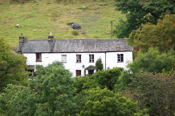 BOE31.jpg (taken 11.9.2007) 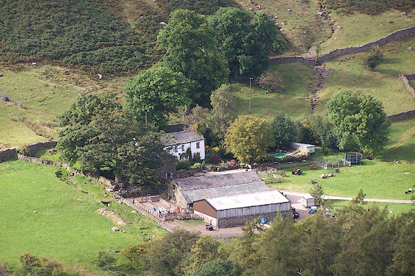 BOE32.jpg (taken 11.9.2007) |
||
|
|
||
| evidence:- | old map:- OS County Series (Wmd 19 3) placename:- Deepdale Hall |
|
| source data:- | Maps, County Series maps of Great Britain, scales 6 and 25
inches to 1 mile, published by the Ordnance Survey, Southampton,
Hampshire, from about 1863 to 1948. |
|
|
|
||
| evidence:- | old map:- Saxton 1579 placename:- Depedale |
|
| source data:- | Map, hand coloured engraving, Westmorlandiae et Cumberlandiae Comitatus ie Westmorland
and Cumberland, scale about 5 miles to 1 inch, by Christopher Saxton, London, engraved
by Augustinus Ryther, 1576, published 1579-1645.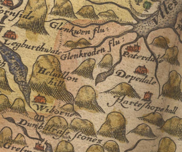 Sax9NY31.jpg Building, symbol for a hamlet, which may or may not have a nucleus. "Depedale" item:- private collection : 2 Image © see bottom of page |
|
|
|
||
| evidence:- | old map:- Jansson 1646 placename:- Depedale |
|
| source data:- | Map, hand coloured engraving, Cumbria and Westmoria, ie
Cumberland and Westmorland, scale about 3.5 miles to 1 inch, by
John Jansson, Amsterdam, Netherlands, 1646.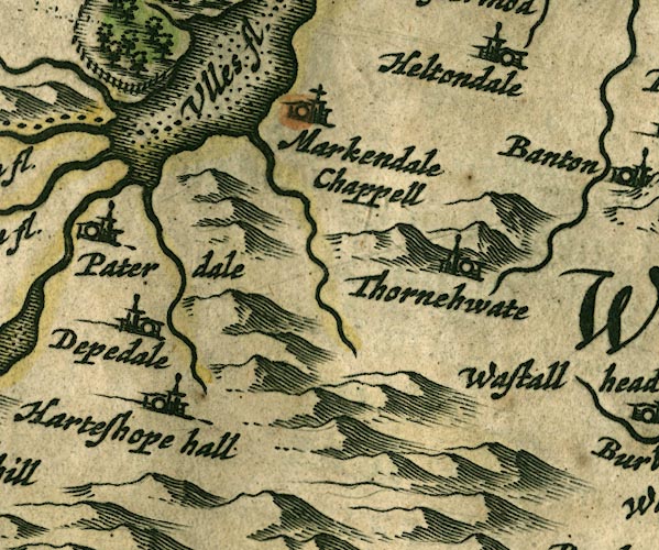 JAN3NY41.jpg "Depedale" Buildings and tower. item:- JandMN : 88 Image © see bottom of page |
|
|
|
||
| evidence:- | old map:- Morden 1695 (Wmd) placename:- Depedale |
|
| source data:- | Map, hand coloured engraving, Westmorland, scale about 2.5 miles to 1 inch, by Robert
Morden, published by Abel Swale, the Unicorn, St Paul's Churchyard, Awnsham, and John
Churchill, the Black Swan, Paternoster Row, London, 1695.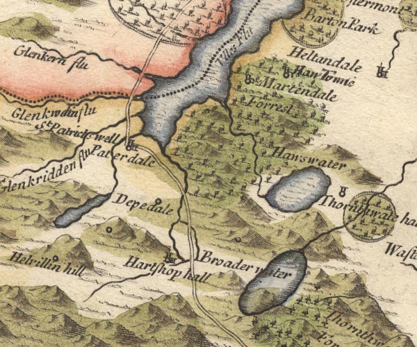 MD10NY41.jpg "Depedale" Circle. item:- JandMN : 24 Image © see bottom of page |
|
|
|
||
| evidence:- | old map:- Jefferys 1770 (Wmd) |
|
| source data:- | Map, 4 sheets, The County of Westmoreland, scale 1 inch to 1
mile, surveyed 1768, and engraved and published by Thomas
Jefferys, London, 1770.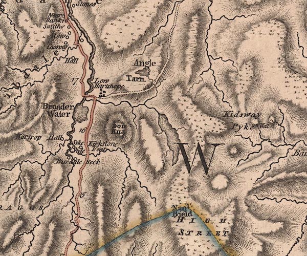 J5NY41SW.jpg "Hall" circle, labelled in italic lowercase text; settlement, farm, house, or hamlet? item:- National Library of Scotland : EME.s.47 Image © National Library of Scotland |
|
|
|
||
| evidence:- | old map:- Cary 1789 (edn 1805) |
|
| source data:- | Map, uncoloured engraving, Westmoreland, scale about 2.5 miles
to 1 inch, by John Cary, London, 1789; edition 1805.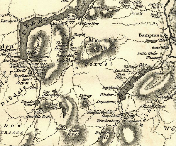 CY24NY41.jpg "Hall" block/s, labelled in italic lowercase; house, or hamlet item:- JandMN : 129 Image © see bottom of page |
|
|
|
||
| evidence:- | possibly old map:- Hall 1820 (Wmd) placename:- Dindale Hall |
|
| source data:- | Map, hand coloured engraving, Westmoreland ie Westmorland, scale
about 14.5 miles to 1 inch, by Sidney Hall, London, 1820,
published by Samuel Leigh, 18 Strand, London, 1820-31. click to enlarge click to enlargeHA18.jpg "Dindale Hall" circle; house item:- Armitt Library : 2008.14.58 Image © see bottom of page |
|
|
|
||
| evidence:- | database:- Listed Buildings 2010 placename:- Deepdale Hall |
|
| source data:- | courtesy of English Heritage "DEEPDALE HALL / / / PATTERDALE / EDEN / CUMBRIA / II / 452380 / NY3956014128" |
|
|
|
||
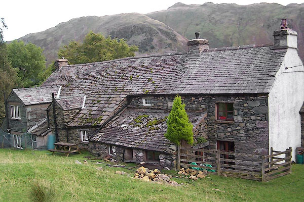 BXI69.jpg (taken 18.9.2012) 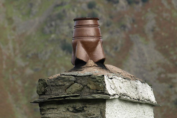 BVK46.jpg Chimney. (taken 26.9.2011) |
||
|
|
||
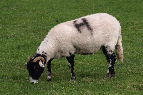 BVK47.jpg Swaledale sheep, smit mark a black H on the near side. (taken 26.9.2011) |
||
| The smit mark for Deepdale stock on Deepdale Hall farm is a red open on the crupper
and a black H on the near side, ewes from clipping to dipping a black H only. |
||
|
|
||
 Lakes Guides menu.