 Old Cumbria Gazetteer
 |
 |
|
| City, St John's Castlerigg etc | ||
| City | ||
| locality:- | Wythburn | |
| civil parish:- | St John's Castlerigg and Wythburn (formerly Cumberland) | |
| county:- | Cumbria | |
| locality type:- | buildings | |
| coordinates:- | NY319142 (approx) | |
| 1Km square:- | NY3114 | |
| 10Km square:- | NY31 | |
| SummaryText:- | Now submerged. | |
| references:- | OS County Series |
|
|
|
||
| evidence:- | old map:- Donald 1774 (Cmd) placename:- City |
|
| source data:- | Map, hand coloured engraving, 3x2 sheets, The County of Cumberland, scale about 1
inch to 1 mile, by Thomas Donald, engraved and published by Joseph Hodskinson, 29
Arundel Street, Strand, London, 1774.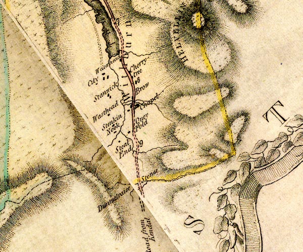 D4NY31SW.jpg "City" block or blocks, labelled in lowercase; a hamlet or just a house item:- Carlisle Library : Map 2 Image © Carlisle Library |
|
|
|
||
| evidence:- | old map:- Clarke 1787 map (Ambleside to Keswick) placename:- City |
|
| source data:- | Map, A Map of the Roads Lakes etc between Keswick and Ambleside,
scale about 2.5 ins to 1 mile, by James Clarke, engraved by S J
Neele, 352 Strand, published by James Clarke, Penrith,
Cumberland and in London etc, 1787.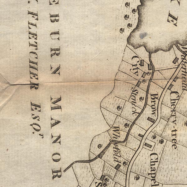 CL9NY31B.jpg "City" item:- private collection : 10.9 Image © see bottom of page |
|
|
|
||
| evidence:- | descriptive text:- Ford 1839 (3rd edn 1843) placename:- City |
|
| source data:- | Guide book, A Description of Scenery in the Lake District, by
Rev William Ford, published by Charles Thurnam, Carlisle, by W
Edwards, 12 Ave Maria Lane, Charles Tilt, Fleet Street, William
Smith, 113 Fleet Street, London, by Currie and Bowman,
Newcastle, by Bancks and Co, Manchester, by Oliver and Boyd,
Edinburgh, and by Sinclair, Dumfries, 1839. goto source goto sourcePage 48:- "..." "In order to see this vale [Thirlmere] from its western side, cross the meadows from the inn to a few white cottages, enlivened by the green leaves of the cheerful hollin tree, called the City, a corruption undoubtedly from some more homely epithet; ..." |
|
|
|
||
| evidence:- | old map:- Ford 1839 map placename:- City |
|
| source data:- | Map, uncoloured engraving, Map of the Lake District of
Cumberland, Westmoreland and Lancashire, scale about 3.5 miles
to 1 inch, published by Charles Thurnam, Carlisle, and by R
Groombridge, 5 Paternoster Row, London, 3rd edn 1843.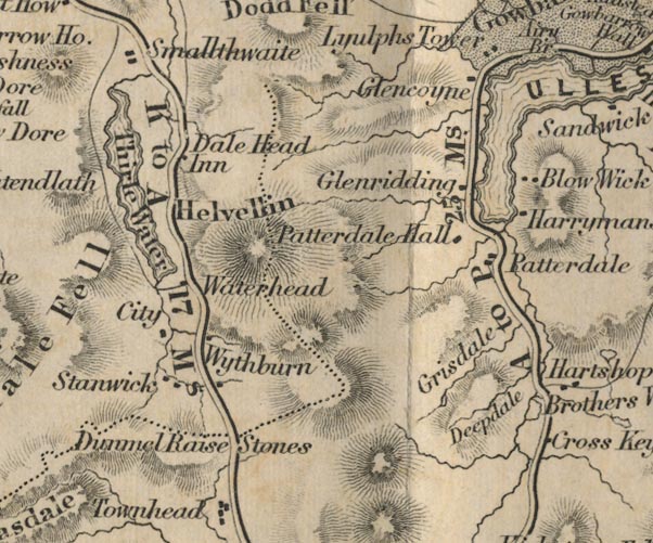 FD02NY31.jpg "City" item:- JandMN : 100.1 Image © see bottom of page |
|
|
|
||
| evidence:- | old text:- Martineau 1855 placename:- City of Wythburn |
|
| source data:- | Guide book, A Complete Guide to the English Lakes, by Harriet
Martineau, published by John Garnett, Windermere, Westmorland,
and by Whittaker and Co, London, 1855; published 1855-76. goto source Page 69:- "... The stranger leaves the mail road within a mile of the Nag's Head, passes the cottages called by the boastful name of the City of Wythburn," |
|
|
|
||
Lakes Guides menu.