 Old Cumbria Gazetteer
 |
 |
|
| Chapel Island, Morecambe Bay | ||
| Chapel Island | ||
| locality:- | Morecambe Bay | |
| civil parish:- | Lower Allithwaite (formerly Lancashire) | |
| county:- | Cumbria | |
| locality type:- | island | |
| coordinates:- | SD32127587 (etc) | |
| 1Km square:- | SD3275 | |
| 10Km square:- | SD37 | |
|
|
||
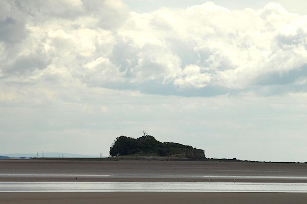 BPO55.jpg (taken 8.8.2008) 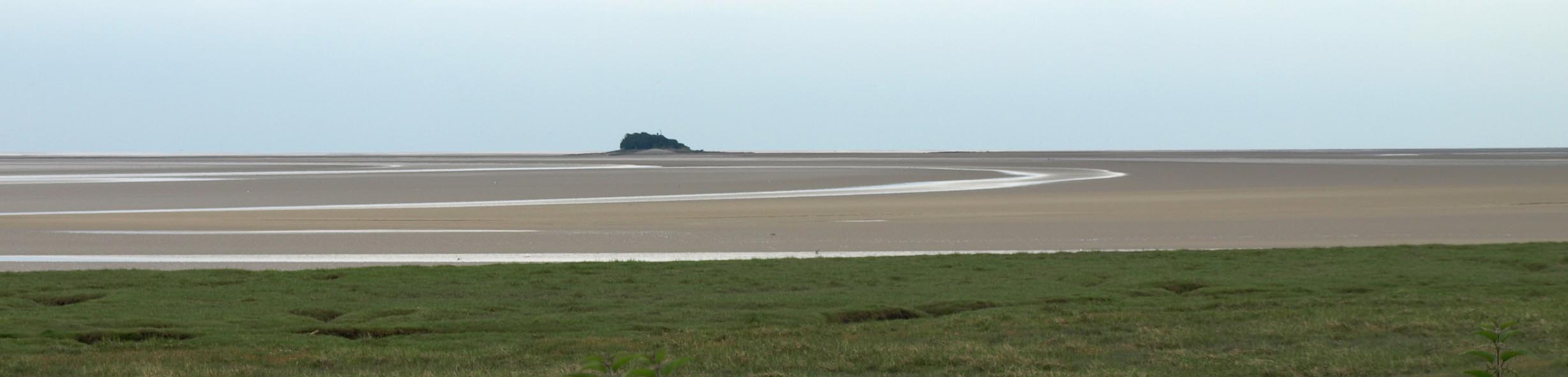 Click to enlarge BWV52.jpg (taken 13.7.2012) |
||
|
|
||
| evidence:- | old map:- West 1784 map placename:- Chapel Isle |
|
| source data:- | Map, hand coloured engraving, A Map of the Lakes in Cumberland,
Westmorland and Lancashire, scale about 3.5 miles to 1 inch,
engraved by Paas, 53 Holborn, London, about 1784.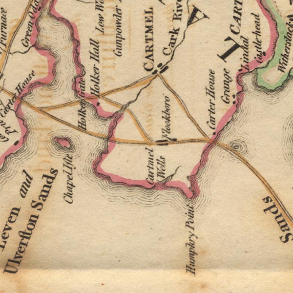 Ws02SD37.jpg item:- Armitt Library : A1221.1 Image © see bottom of page |
|
|
|
||
| evidence:- | old map:- Otley 1818 |
|
| source data:- | Map, uncoloured engraving, The District of the Lakes,
Cumberland, Westmorland, and Lancashire, scale about 4 miles to
1 inch, by Jonathan Otley, 1818, engraved by J and G Menzies,
Edinburgh, Scotland, published by Jonathan Otley, Keswick,
Cumberland, et al, 1833.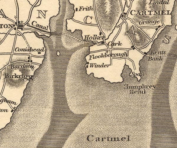 OT02SD37.jpg item:- JandMN : 48.1 Image © see bottom of page |
|
|
|
||
| evidence:- | old map:- Ford 1839 map placename:- Chapel Island |
|
| source data:- | Map, uncoloured engraving, Map of the Lake District of
Cumberland, Westmoreland and Lancashire, scale about 3.5 miles
to 1 inch, published by Charles Thurnam, Carlisle, and by R
Groombridge, 5 Paternoster Row, London, 3rd edn 1843.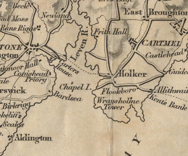 FD02SD37.jpg "Chapel I." Island. item:- JandMN : 100.1 Image © see bottom of page |
|
|
|
||
 Lakes Guides menu.