


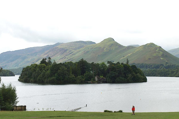
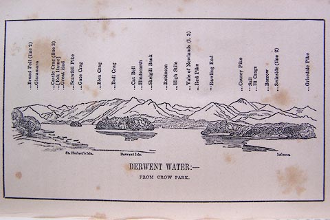
BPP94.jpg Across Derwent Isle from Crow Park.
(taken 24.8.2008)
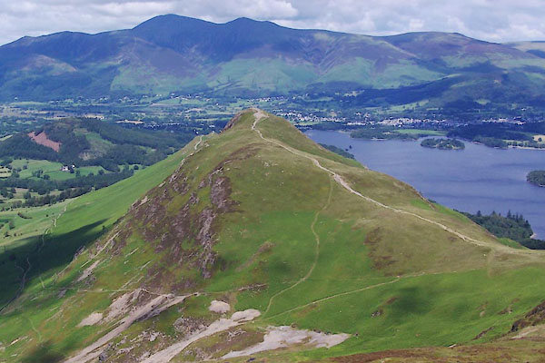
BUW30.jpg (taken 29.6.2011)
placename:- Cat Bells
placename:- Newlands Common
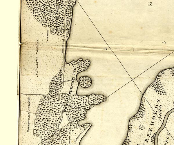
CL152519.jpg
"NEWLANDS COMMON"
area
item:- private collection : 169
Image © see bottom of page
placename:- Catt Bells
item:- shiver
 goto source
page 16:- "..."
"Catt Bells, on the opposite side of the lake, advance boldly from it; but their surfaces being of green turf and loose shiver, are tamer in appearance than the rugged rocks of Barrow."
placename:- Cat Bell
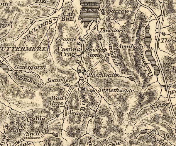
OT02NY21.jpg
item:- JandMN : 48.1
Image © see bottom of page
placename:- Cat Bell
 click to enlarge
O75E06.jpg
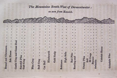
p.115 in A Concise Description of the English Lakes, by Jonathan Otley, 4th edition, 1830. "The Mountains South-West of Derwentwater: / as seen from Keswick."
"Brund and Glaramara / Esk Hause / Castle Crag and Great End / Scawfell Pike / Gait Crag / Blea Crag / Bull Crag / Cat Bell / Hindscarth / Gold Scalp / Robinson / High Stile / Red Pike / Rawling end / Causey Pike / Sail / Ill Crags / Barrow / Swinside / Coledale Hause / Grisedale Pike"
item:- Armitt Library : A1175.6
Image © see bottom of page
placename:- Cat Bell
 click to enlarge
O80E06.jpg
item:- Armitt Library : A1180.7
Image © see bottom of page
placename:- Cat Bell
 click to enlarge
OT2E04.jpg
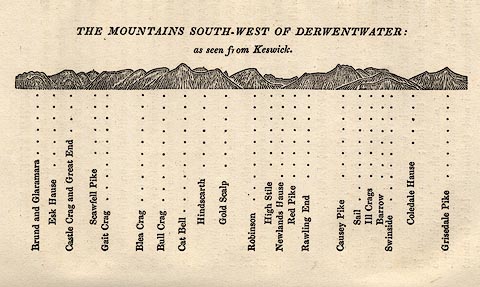
Printed on p.21 of A Concise Description of the English Lakes, by Jonathan Otley, 5th edition, 1834. "THE MOUNTAINS SOUTH-WEST OF DERWENTWATER: as seen from Keswick"
"Brund and Glaramara / Esk Hause / Castle Crag and Great End / Scawfell Pike / Gait Crag / Blea Crag / Bull Crag / Cat Bell / Hindscarth / Gold Scalp / Robinson / High Stile / Newlands Hause / Red Pike / Rawling End / Causey Pike / Sail / Ill Crags / Barrow / Swinside / Coledale Hause / Grisedale Pike"
item:- JandMN : 48.5
Image © see bottom of page
placename:- Catbells
 goto source
Page 121:- "... Catbells with front of brighter green, shelve into the lake; which is chiefly bordered on that side by the woods of the late Lord William Gordon."
placename:- Cat Bell
item:- altitude, Cat Bells
 goto source
Page 178:- "ELEVATION OF THE MOUNTAINS,"
"ACCORDING TO DIFFERENT AUTHORITIES."
| No. | Names of Mountains. | Dalton. | Otley. | Trig. S. | Jamieson |
| 28 | Cat Bell | 1448 |
placename:- Cat Bell
FD02NY22.jpg
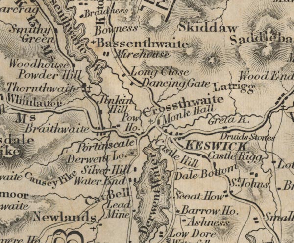
"Cat Bell"
No hachures.
item:- JandMN : 100.1
Image © see bottom of page
placename:- Cat Bells
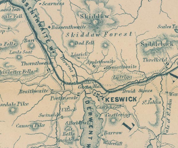
GAR2NY22.jpg
"Cat Bells"
hill hachuring
item:- JandMN : 82.1
Image © see bottom of page
placename:- Catbell
 click to enlarge
MNU114.jpg
Plate, folded in opposite p.93 in A Complete Guide to the English Lakes, by Harriet Martineau. "MOUNTAINS SEEN FROM APPLETHWAITE NEAR KESWICK."
"L Aspland Delt. / W Banks Sc Edinr."
The view is captioned, numbers referring to mountains in the image:- "1 Wallow Crag, 2 Falcon Crag, 3 Shepherd's Crag / Lowdore below, 4 Glaramara, 5 Brund, 6 Castle Crag, 7 Great End, 8 Scawfell Pike, 9 Catbell, 10, High Stile, 11 Red Pike, 12 Grasmoor, 13 Causey Pike, 14 Melbreak, 15 Grisdale Pike"
item:- Armitt Library : A1159.14
Image © see bottom of page
placename:- Cat Bell
item:- altitude, Cat Bells
 goto source
Page 179:- "A TABLE OF THE HEIGHTS OF MOUNTAINS IN THE COUNTIES OF CUMBERLAND, WESTMORLAND, AND LANCASHIRE."
"No. : Names of Mountains. : Counties. : Height in Feet above the Sea Level."
"25 : Cat Bell, Newlands : Cumberland : 1448"
placename:- Cat Bells
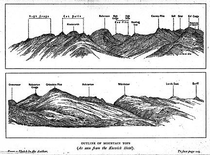 click to enlarge
BRW1.jpg
"... Cat Bells ..."
item:- Kendal Library : 10.3
Image © see bottom of page
placename:- Cat Bells
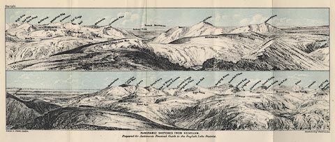 click to enlarge
Jk01E1.jpg
"... Cat Bells ..."
item:- JandMN : 28.5
Image © see bottom of page
placename:- Cat Bells
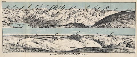 click to enlarge
Jk01E2.jpg
"... Cat Bells ..."
item:- JandMN : 28.8
Image © see bottom of page
placename:- Catbell
 click to enlarge
BC08E4.jpg
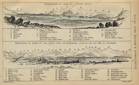
"... 1 Catbell ... 13 Catbell ..."
item:- JandMN : 37.14
Image © see bottom of page
placename:- Cat Bells
 click to enlarge
PR0918.jpg
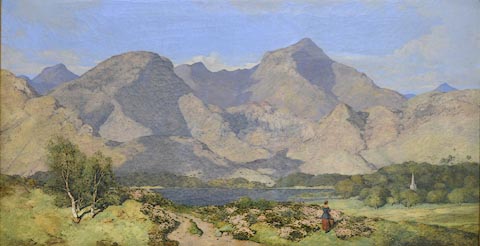
This is a view of Catbells and Causey Pike beyond Derwent Water in the Lake District on a fine summer's day. Bright sunshine throws the shadows of the fells beyond the lake into sharp relief. In the middle distance to right of composition the church spire of St John's Church, Keswick can be seen rising from thick woodland in front of which sheep are grazing. In the foreground a sandy track leads towards the lake in the centre of the composition. A woman stands amongst clumps of flowering heather, her back towards the viewer, looking towards the church spire. This painting was exhibited at the Royal Academy in 1854. Blacklock is one of Cumbria's most important landscape painters. He painted the scenery of Cumbria, the Lake District and the Borders and particularly favoured remote areas. He painted these landscapes in his own uniquely precise style.
The composition shows considerable artistic licence. Blacklock has altered components of the picture by bringing St John's Church in Keswick into view to make a more pleasing composition. Blacklock's unique painting style is very precise and has an almost three dimensional effect.
labelled at reverse on stretcher:- "Cat Bells and Causey Pike, Derwentwater W J Blacklock Cumwhitton No 3 Carlisle"
item:- Tullie House Museum : 1935.91.1
Image © Tullie House Museum
placename:- Catbell
 click to enlarge
BC02E4.jpg
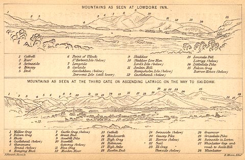
"... 1 Catbell ... 13 Catbell ..."
item:- JandMN : 32.7
Image © see bottom of page
placename:- Catbells
 click to enlarge
TAT129.jpg
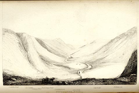
The print is captioned with mountain names and acts as an outline view.
Tipped in opposite p.75 of The Lakes of England, by George Tattersall.
printed at bottom:- "NEWLANDS VALE, / from Robinson Fall."
printed at bottom left to right:- "Saddle End. / Caskettle. / Causey Pike. / Rawling End. / Saddleback. / Cross Fell. / Cat-bells. / Robinson."
item:- Armitt Library : A1204.30
Image © see bottom of page
