 Old Cumbria Gazetteer
  Old Cumbria Gazetteer|  |  |    | 
| Carsleddam, Underskiddaw | ||
| Carsleddam | ||
| civil parish:- | Underskiddaw (formerly Cumberland) | |
| county:- | Cumbria | |
| locality type:- | hill | |
| coordinates:- | NY258270 | |
| 1Km square:- | NY2527 | |
| 10Km square:- | NY22 | |
|  | ||
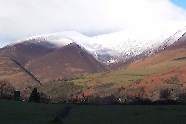
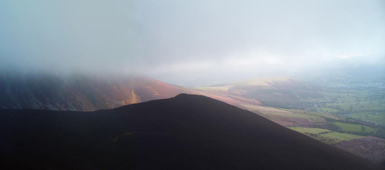
|  BXT26.jpg (taken 5.12.2012)  Click to enlarge BOJ56.jpg (taken 29.11.2007) | ||
|  | ||
| evidence:- | outline view:- Otley 1823 (4th edn 1830) placename:- Carsleddam | |
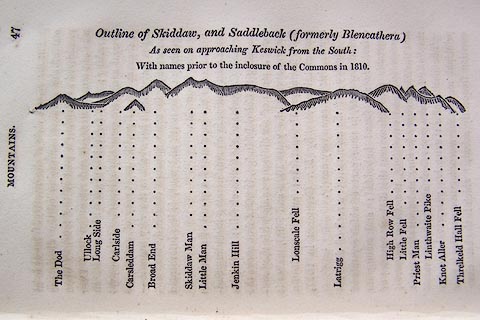
| source data:- | Print, engraving, Outline View of Skiddaw, and Saddleback, as seen on approaching
                  Keswick from the South, published by Jonathan Otley, Keswick, Cumberland et al, 1830.  click to enlarge O75E01.jpg p.47 in A Concise Description of the English Lakes, by Jonathan Otley, 4th edition, 1830. "Outline View of Skiddaw, and Saddleback (formerly Blencathera) As seen on approaching Keswick from the South: With names prior to the inclosure of the Commons in 1810." "The Dod / Ullock / Long Side / Carleside / Carsleddam / Broad End / Skiddaw Man / Little Man / Jenkin Hill / Lonscale Fell / Latrigg / High Row Fell / Little Fell / Priest Man / Linthwaite Pike / Knot Aller / Threlkeld Hall Fell" item:- Armitt Library : A1175.2 Image © see bottom of page | |
|  | ||
| evidence:- | outline view:- Otley 1823 (8th edn 1849) placename:- Carsleddam | |
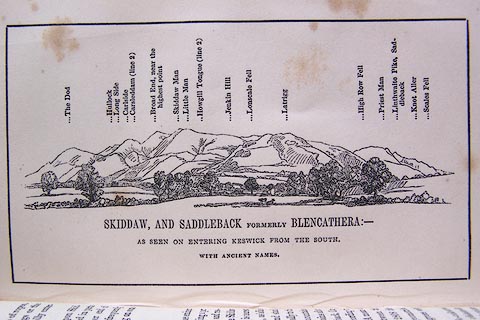
| source data:- | Engraving, outline view of mountains, Skiddaw, and Saddleback ... as seen on entering
                  Keswick from the South, drawn by T Binns, engraved by O Jewitt, opposite p.46 of A
                  Descriptive Guide of the English Lakes, by Jonathan Otley, 8th edition, 1849.  click to enlarge O80E16.jpg item:- Armitt Library : A1180.17 Image © see bottom of page | |
|  | ||
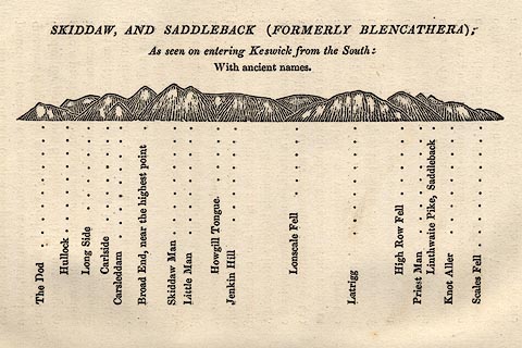
| evidence:- | outline view:- Otley 1823 (5th edn 1834) | |
| source data:- | Print, woodcut outline view, Skiddaw and Saddleback, by Jonathan Otley, Keswick, Cumberland,
                  1830.  click to enlarge OT2E08.jpg Printed on p.49 of A Concise Description of the English Lakes, by Jonathan Otley, 5th edition, 1834. "SKIDDAW, AND SADDLEBACK (FORMERLY BLENCATHRA): As seen entering Keswick from the South: With ancient names." "The Dod / Hullock / Long Side / Carlside / Carsleddam / Broad End, near the highest point / Skiddaw Man / Little Man / Howgill Tongue / Jenkin Hill / Lonscale Fell / Latrigg / High Row Fell / Priest Man / Linthwaite Pike, Saddleback / Knot Aller / Scales Fell" item:- JandMN : 48.9 Image © see bottom of page | |
|  | ||
| evidence:- | outline view:- Black 1856 (23rd edn 1900) placename:- Carsleddam | |
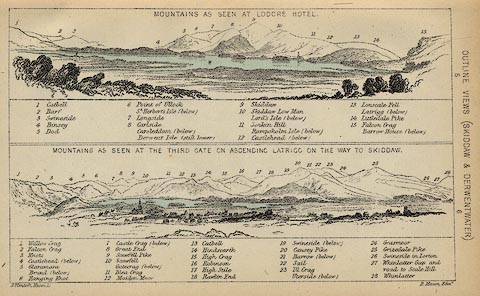
| source data:- | Print, lithograph, Outline Views, Skiddaw and Derwent Water - Mountains as seen at
                  Lodore Hotel, and Mountains as seen at the Third Gate on Ascending Latrigg on the
                  Way to Skiddaw, by J Flintoft, Keswick, Cumberland, engraved by R Mason, Edinburgh,
                  Lothian, about 1900.  click to enlarge BC08E4.jpg "... Carsleddam ..." item:- JandMN : 37.14 Image © see bottom of page | |
|  | ||
| evidence:- | outline view:- Black 1841 (3rd edn 1846) placename:- Carsleddam | |
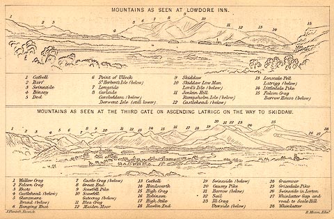
| source data:- | Print, engraving, outline view, Mountains as seen at Lowdore Inn, and Mountains as
                  seen at the Third Gate on Ascending Latrigg on the Way to Skiddaw, by J Flintoft,
                  Keswick, Cumberland, engraved by R Mason, Edinburgh, Lothian, about 1846.  click to enlarge BC02E4.jpg "... Carsleddam ..." item:- JandMN : 32.7 Image © see bottom of page | |
|  | ||
|  Click to enlarge BZT51.jpg Skiddaw Little Man behind. (taken 28.12.2013) | ||
|  | ||
 Lakes Guides menu.
  Lakes Guides menu.