 Old Cumbria Gazetteer
 |
 |
|
| Carnforth, Lancashire | ||
| Carnforth | ||
| county:- | Lancashire | |
| locality type:- | buildings | |
| coordinates:- | SD499705 | |
| 1Km square:- | SD4970 | |
| 10Km square:- | SD47 | |
|
|
||
| evidence:- | old map:- Ogilby 1675 (plate 38) placename:- Carnford |
|
| source data:- | Road strip map, hand coloured engraving, continuation of the
Road from London to Carlisle, scale about 1 inch to 1 mile, by
John Ogilby, London, 1675.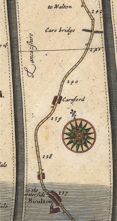 OG38m237.jpg In mile 239, Lancashire. "Carnford" row of houses each side of the road. item:- JandMN : 21 Image © see bottom of page |
|
|
|
||
| evidence:- | old map:- West 1784 map placename:- Carnforth |
|
| source data:- | Map, hand coloured engraving, A Map of the Lakes in Cumberland,
Westmorland and Lancashire, scale about 3.5 miles to 1 inch,
engraved by Paas, 53 Holborn, London, about 1784.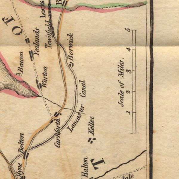 Ws02SD56.jpg item:- Armitt Library : A1221.1 Image © see bottom of page |
|
|
|
||
| evidence:- | road book:- Cary 1798 (2nd edn 1802) placename:- Carnford |
|
| source data:- | Road book, itineraries, Cary's New Itinerary, by John Cary, 181
Strand, London, 2nd edn 1802. goto source goto source click to enlarge click to enlargeC38267.jpg page 267-268 "Carnford" item:- JandMN : 228.1 Image © see bottom of page |
|
|
|
||
| evidence:- | descriptive text:- Baker 1802 placename:- Carnforth |
|
| source data:- | Perspective road map with sections in Lancashire, Westmorland,
and Cumberland, by J Baker, London 1802. pp.25-26:- "Burton and Carnforth are the first villages on the great road at leaving Lancaster, ..." |
|
|
|
||
| evidence:- | old map:- Baker 1802 placename:- Carnforth |
|
| source data:- | Perspective road maps with sections in Lancashire, Westmorland
and Cumberland, by J Baker, London 1802.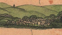 Bk03Vg21.jpg "Carnforth" item:- private collection : 3 Image © see bottom of page |
|
|
|
||
| evidence:- | old map:- Otley 1818 placename:- Carnforth |
|
| source data:- | Map, uncoloured engraving, The District of the Lakes,
Cumberland, Westmorland, and Lancashire, scale about 4 miles to
1 inch, by Jonathan Otley, 1818, engraved by J and G Menzies,
Edinburgh, Scotland, published by Jonathan Otley, Keswick,
Cumberland, et al, 1833.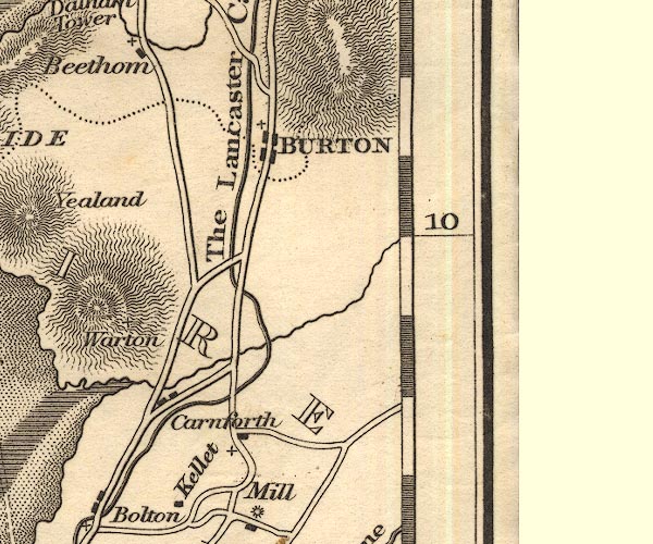 OT02SD57.jpg item:- JandMN : 48.1 Image © see bottom of page |
|
|
|
||
| evidence:- | old map:- Ford 1839 map placename:- Carnforth |
|
| source data:- | Map, uncoloured engraving, Map of the Lake District of
Cumberland, Westmoreland and Lancashire, scale about 3.5 miles
to 1 inch, published by Charles Thurnam, Carlisle, and by R
Groombridge, 5 Paternoster Row, London, 3rd edn 1843.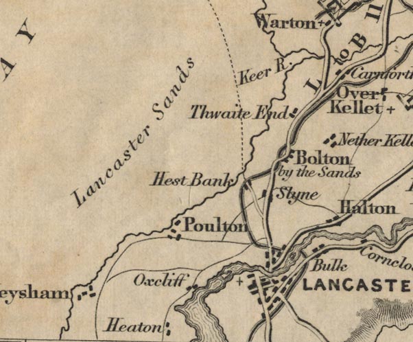 FD02SD46.jpg "Carnforth" item:- JandMN : 100.1 Image © see bottom of page |
|
|
|
||
| evidence:- | old text:- Burrow 1920s |
|
| source data:- | Road book, strip maps with parts in Westmorland, Cumberland etc,
irregular scales about 1.5 miles to 1 inch, by E J Burrow and
Co, Cheltenham, Gloucestershire, 1920s. "... where the ironworks of Carnforth impose themselves boldly upon the landscape." |
|
|
|
||
| evidence:- | old map:- Burrow 1920s |
|
| source data:- | Road book, On the Road, Dunlop Pictorial Road Plans, volume V,
strip maps with parts in Westmorland, Cumberland etc, irregular
scale about 1.5 miles to 1 inch, by E J Burrow and Co,
Cheltenham, Gloucestershire, 1920s.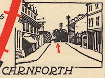 EJB3Vg03.jpg item:- private collection : 17 Image © see bottom of page |
|
|
|
||
Lakes Guides menu.