 Old Cumbria Gazetteer
 |
 |
|
| Cam, North Yorkshire | ||
| Cam | ||
| county:- | North Yorkshire | |
| locality type:- | hill | |
| 1Km square:- | SD8182 | |
| 10Km square:- | SD88 | |
|
|
||
| evidence:- | probably descriptive text:- West 1778 (11th edn 1821) |
|
| source data:- | Guide book, A Guide to the Lakes, by Thomas West, published by
William Pennington, Kendal, Cumbria once Westmorland, and in
London, 1778 to 1821. goto source goto sourceTour to the Caves in the West Riding of Yorkshire, late 18th century Page 270:- "..." "We now [after climbing Whernside] shaped our course back to Winterscales, and from thence to a public-house called Gearstones, by the side of the turnpike road, at the bottom of the mountain Cam. Here we refreshed ourselves, and left our horses, while we went about half a mile to the south, to explore another subterranean wonder of nature called Catknot-hole. ..." |
|
|
|
||
| evidence:- | old map:- Balderston c1890 map placename:- Cam Fell |
|
| source data:- | Map, the hills in the Ingleton area, probably by Robert R
Balderston, engraved by Goodall and Suddick, Leeds, West
Yorkshire, about 1890.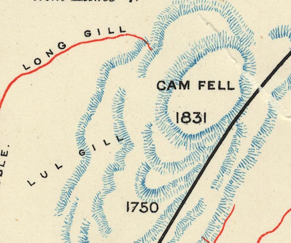 BS1SD88B.jpg "CAM FELL / 1831" item:- private collection : 27.1 Image © see bottom of page |
|
|
|
||
Lakes Guides menu.