 Old Cumbria Gazetteer
 |
 |
|
| Broadgate, Millom Without | ||
| Broadgate | ||
| civil parish:- | Millom Without (formerly Cumberland) | |
| county:- | Cumbria | |
| locality type:- | buildings | |
| coordinates:- | SD18108669 | |
| 1Km square:- | SD1886 | |
| 10Km square:- | SD18 | |
|
|
||
| evidence:- | old map:- OS County Series (Cmd 88 3) placename:- Broadgate |
|
| source data:- | Maps, County Series maps of Great Britain, scales 6 and 25
inches to 1 mile, published by the Ordnance Survey, Southampton,
Hampshire, from about 1863 to 1948. |
|
|
|
||
| evidence:- | possibly old map:- Donald 1774 (Cmd) placename:- High Broadgate placename:- Broadgate, High |
|
| source data:- | Map, hand coloured engraving, 3x2 sheets, The County of Cumberland, scale about 1
inch to 1 mile, by Thomas Donald, engraved and published by Joseph Hodskinson, 29
Arundel Street, Strand, London, 1774.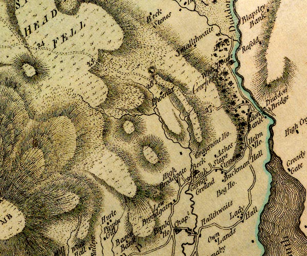 D4SD18NE.jpg "High Broadgate" block or blocks, labelled in lowercase; a hamlet or just a house item:- Carlisle Library : Map 2 Image © Carlisle Library |
|
|
|
||
| evidence:- | old map:- Ford 1839 map placename:- Broadgate |
|
| source data:- | Map, uncoloured engraving, Map of the Lake District of
Cumberland, Westmoreland and Lancashire, scale about 3.5 miles
to 1 inch, published by Charles Thurnam, Carlisle, and by R
Groombridge, 5 Paternoster Row, London, 3rd edn 1843.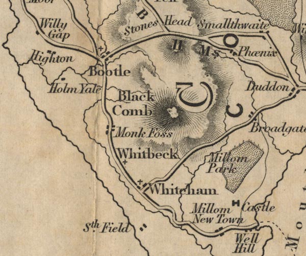 FD02SD18.jpg "Broadgate" item:- JandMN : 100.1 Image © see bottom of page |
|
|
|
||
| evidence:- | database:- Listed Buildings 2010 placename:- Broadgate |
|
| source data:- | courtesy of English Heritage "BROADGATE / / / MILLOM WITHOUT / COPELAND / CUMBRIA / II / 76341 / SD1810786696" |
|
|
|
||
| evidence:- | old map:- Post Office 1850s-1900s placename:- Broadgate |
|
| source data:- | Post road maps, General Post Office Circulation Map for England
and Wales, for the General Post Office, London, 1850s-1900s. click to enlarge click to enlargePOF7Cm.jpg "Broadgate" map date 1909 |
|
|
|
||
| :- |
images courtesy of the British Postal Museum and Hampshire CC Museums |
|
|
|
||
 Lakes Guides menu.