 Old Cumbria Gazetteer
 |
 |
|
| bridge, Brough | ||
| site name:- | Augill Beck | |
| locality:- | Church Brough | |
| locality:- | Brough | |
| civil parish:- | Brough (formerly Westmorland) | |
| county:- | Cumbria | |
| locality type:- | bridge | |
| coordinates:- | NY79411417 | |
| 1Km square:- | NY7914 | |
| 10Km square:- | NY71 | |
|
|
||
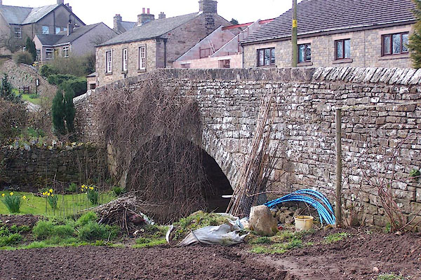 BLX03.jpg (taken 21.4.2006) |
||
|
|
||
| evidence:- | old map:- Jefferys 1770 (Wmd) |
|
| source data:- | Map, 4 sheets, The County of Westmoreland, scale 1 inch to 1
mile, surveyed 1768, and engraved and published by Thomas
Jefferys, London, 1770.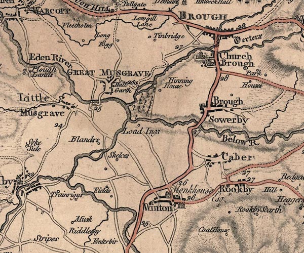 J5NY71SE.jpg double line, road, across a stream; bridge item:- National Library of Scotland : EME.s.47 Image © National Library of Scotland |
|
|
|
||
| evidence:- | old map:- Cary 1789 (edn 1805) |
|
| source data:- | Map, uncoloured engraving, Westmoreland, scale about 2.5 miles
to 1 inch, by John Cary, London, 1789; edition 1805.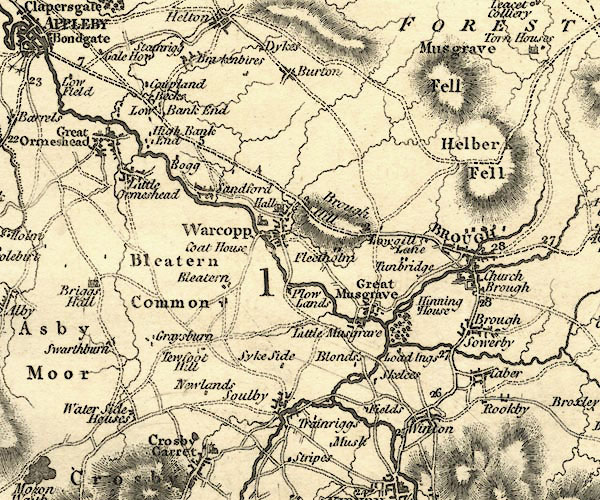 CY24NY71.jpg road across a stream; bridge over the Augill Beck item:- JandMN : 129 Image © see bottom of page |
|
|
|
||
 Lakes Guides menu.