 Old Cumbria Gazetteer
 |
 |
|
| Blowick, Patterdale | ||
| Blowick | ||
| civil parish:- | Patterdale (formerly Westmorland) | |
| county:- | Cumbria | |
| locality type:- | buildings | |
| locality type:- | locality | |
| coordinates:- | NY39481738 | |
| 1Km square:- | NY3917 | |
| 10Km square:- | NY31 | |
|
|
||
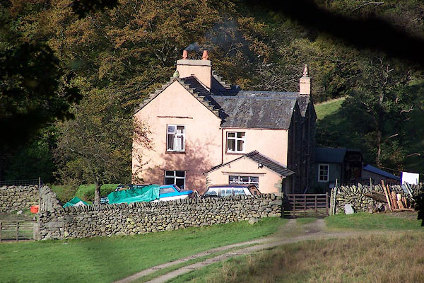 BMY11.jpg (taken 2.11.2006) 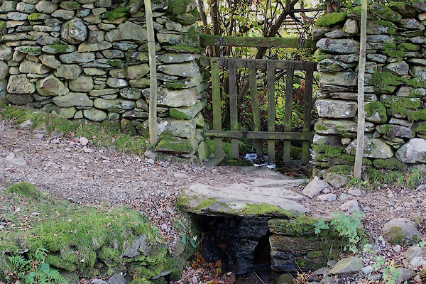 BMY12.jpg Footbridge over one of the becks running into Blowick, notice the swinging fence placed to cope with flood water. (taken 2.11.2006) |
||
|
|
||
| evidence:- | old map:- OS County Series (Wmd 12 7) placename:- Bleawick |
|
| source data:- | Maps, County Series maps of Great Britain, scales 6 and 25
inches to 1 mile, published by the Ordnance Survey, Southampton,
Hampshire, from about 1863 to 1948. |
|
|
|
||
| evidence:- | old map:- Crosthwaite 1783-94 (Ull) placename:- Blow Wike |
|
| source data:- | Map, uncoloured engraving, Accurate Map of the Beautiful Lake of
Ullswater, scale about 3 inches to 1 mile, by Peter Crosthwaite,
Keswick, Cumberland, 1783, version published 1800.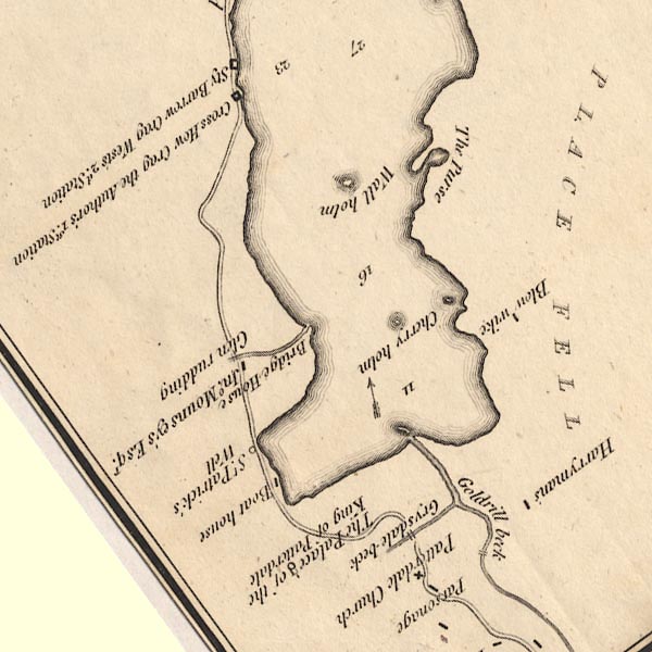 CT5NY31Y.jpg "Blow wike" item:- Armitt Library : 1959.191.7 Image © see bottom of page |
|
|
|
||
| evidence:- | old map:- Clarke 1787 map (Ullswater) placename:- Low Blawike |
|
| source data:- | Map, A Map of the Lake Ullswater and its Environs, scale about
6.5 ins to 1 mile, by James Clarke, engraved by S J Neele, 352
Strand, published by James Clarke, Penrith, Cumberland and in
London etc, 1787.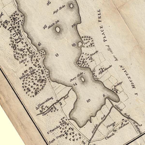 CL4NY31Y.jpg "Low Blawike" "High Blawike" item:- private collection : 10.4 Image © see bottom of page |
|
|
|
||
| evidence:- | old text:- Wordsworth 1810 placename:- Blowick item:- oak trees; birch trees; juniper bushes |
|
| source data:- | Guide book, A Description of the Scenery of the Lakes, later A
Guide through the District of The Lakes, by William Wordsworth,
1810-35. goto source goto sourcepage xxii "... No persons but such as come to Patterdale, merely to pass through it, should fail to walk as far as Blowick, the only enclosed land which on this side borders the higher part of the Lake. The axe has here indiscriminately levelled a rich wood of birches and oaks, that divided this favoured spot into a hundred pictures. It has yet its land-locked bays, and rocky promontories; but those beautiful woods are gone, which perfected its seclusion; and scenes, that might formerly have been compared to an inexhaustible volume, are now spread before the eye in a sin-" goto sourcepage xxiii "[sin]gle sheet, - magnificent indeed, but seemingly perused in a moment! From Blowick a narrow track conducts along the craggy side of Place-fell, richly adorned with juniper, and sprinkled over with birches, ..." |
|
|
|
||
| evidence:- | old map:- Otley 1818 placename:- Blowike |
|
| source data:- | Map, uncoloured engraving, The District of the Lakes,
Cumberland, Westmorland, and Lancashire, scale about 4 miles to
1 inch, by Jonathan Otley, 1818, engraved by J and G Menzies,
Edinburgh, Scotland, published by Jonathan Otley, Keswick,
Cumberland, et al, 1833.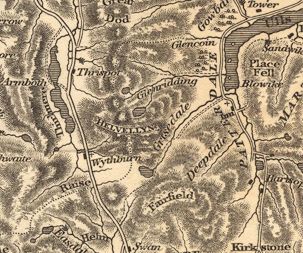 OT02NY31.jpg item:- JandMN : 48.1 Image © see bottom of page |
|
|
|
||
| evidence:- | old map:- Ford 1839 map placename:- Blow Wick |
|
| source data:- | Map, uncoloured engraving, Map of the Lake District of
Cumberland, Westmoreland and Lancashire, scale about 3.5 miles
to 1 inch, published by Charles Thurnam, Carlisle, and by R
Groombridge, 5 Paternoster Row, London, 3rd edn 1843.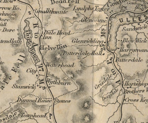 FD02NY31.jpg "Blow Wick" item:- JandMN : 100.1 Image © see bottom of page |
|
|
|
||
| evidence:- | old map:- Garnett 1850s-60s H placename:- Blowick |
|
| source data:- | Map of the English Lakes, in Cumberland, Westmorland and
Lancashire, scale about 3.5 miles to 1 inch, published by John
Garnett, Windermere, Westmorland, 1850s-60s.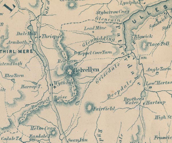 GAR2NY31.jpg "Blowick" blocks, settlement item:- JandMN : 82.1 Image © see bottom of page |
|
|
|
||
| evidence:- | outline view:- Red Guide 1892 |
|
| source data:- | Print, engraving, pair of outline views, Mountains as seen from the Matterdale Road
in Gowbarrow Park, and Mountains as seen from Milking Hill, between the Inn and Blowick,
in Patterdale, published by Ward, Lock and Co, Warwick House, Salisbury Square, London,
etc, 1892.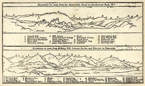 click to enlarge click to enlargeRG0106.jpg "1 Hartsop Dod 2 Cawdale Moor 3 Woundale Head 4 Kirkstone Pass 5 Red Screes / Deepdale Park (below) 6 Blease 7 Birks 8 Dolly Waggon Pike 9 Eagle Crag 10 Striding Edge 11 Path to Helvellyn (below) 12 Helvellyn 13 Bleaberry Fell &Crag 14 Raise 15 Greenside 16 Herring Pike 17 Glenridding Dod 18 Glencoin Fell 19 Stinted Common Fell 20 Gowbarrow Park" On p.190 in the Red Guide guide book, Guide to the English Lakes. item:- JandMN : 102.7 Image © see bottom of page |
|
|
|
||
Lakes Guides menu.